

- Usage in publication:
-
- A-L Peak Rhyolite
- Modifications:
-
- Original reference
- Dominant lithology:
-
- Rhyolite
- Tuff
- AAPG geologic province:
-
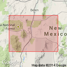
- Orogrande basin
Summary:
Pg. 54. A-L Peak Rhyolite. Gray to purple, foliated, welded rhyolite ash-flow tuff. Thickness 50-700 m. Intruded by quartz monzonite stocks (28.0 to 28.3 Ma, Weber and Bassett, 1963) near Magdalena. Unconformably overlies Hells Mesa Rhyolite or Vicks Peak Rhyolite; underlies Potato Canyon Rhyolite. Erupted from Mount Withington cauldron. Age is Oligocene; fission-track age of 31.8 +/-1.7 Ma (Smith and others, 1976).
Type locality: on northeast flank of A-L Peak, in secs. 33, 34, and 35, T. 4 S., R. 6 W., northern San Mateo Mountains, Socorro Co., central NM.
Source: US geologic names lexicon (USGS Bull. 1564, p. 3).
- Usage in publication:
-
- A-L Peak Rhyolite
- Modifications:
-
- Geochronologic dating
- AAPG geologic province:
-
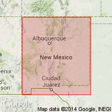
- Orogrande basin
Summary:
This report presents new fission-track ages for Tertiary volcanic rocks in the Mogollon plateau, southwestern NM. Potato Canyon Rhyolite and A-L Peak Rhyolite probably erupted from the Mount Withington cauldron, San Mateo Mountains, Socorro Co, NM, Orogrande basin (Deal, Rhodes, 1976). Within the cauldron, Potato Canyon overlies A-L Peak and both formations lie stratigraphically above Hells Mesa Quartz Latite dated at 32.1 and 32.4 m.y. by Burke and others (1963). A sample of Potato Canyon taken from sec 6, T5S, R5W, Socorro Co produced a fission-track date on sphene of 30.3 +/-1.6 m.y.; a sample of A-L Peak taken from SE1/4 sec 27, T4S, R6W, Socorro Co produced a fission-track date on sphene of 31.8 +/-1.7 m.y. These dates are in complete accord with stratigraphic relations and available dates, and date the time of formation of the Mount Withington cauldron.
Source: GNU records (USGS DDS-6; Denver GNULEX).
- Usage in publication:
-
- A-L Peak Tuff†
- Modifications:
-
- Abandoned
Summary:
Abandoned as a name in Orogrande basin. Was miscorrelated away from its type with an older unit named La Jencia Tuff in this report. Rocks on A-L Peak correlated with South Canyon Tuff, named in this report, the third regional tuff above the La Jencia.
Source: GNU records (USGS DDS-6; Denver GNULEX).
For more information, please contact Nancy Stamm, Geologic Names Committee Secretary.
Asterisk (*) indicates published by U.S. Geological Survey authors.
"No current usage" (†) implies that a name has been abandoned or has fallen into disuse. Former usage and, if known, replacement name given in parentheses ( ).
Slash (/) indicates name conflicts with nomenclatural guidelines (CSN, 1933; ACSN, 1961, 1970; NACSN, 1983, 2005, 2021). May be explained within brackets ([ ]).