The National Geologic Map Database is migrating to a new infrastructure. We apologize for any service disruptions during this process.
|
|---|


- Usage in publication:
-
- Elephant Canyon Formation
- Modifications:
-
- Named
- Dominant lithology:
-
- Limestone
- Siltstone
- Sandstone
- Dolomite
- Shale
- Mudstone
- AAPG geologic province:
-
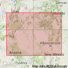
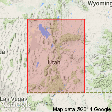
- Paradox basin
Summary:
Marine rocks formerly assigned to Rico Formation in area between upper Cataract Canyon to San Rafael Swell named. Type section, 1,050 ft thick, only complete accessible section, measured in Elephant Canyon, secs 4 and 9, T30S, R19E, San Juan Co, UT, Paradox basin. Thickens west from 500 ft in north San Juan Co to 1,500 ft along Green River; present as far west as Emery Co. Lies unconformably above Honaker Trail Formation. Overlies progressively older Pennsylvanian to west and Mississippian? on Emery uplift. Underlies Cedar Mesa Sandstone. Consists of interbedded: 1) sandstone that may be red-brown, gray, white, purple, tan, or green, very fine- to coarse-grained, micaceous, calcareous, arkosic, friable, argillaceous, thin-bedded to massive; 2) siltstone that may be red-brown or gray, gypsiferous, calcareous, micaceous, thin- to thick-bedded; 3) limestone that may be cream, gray, tan, red, brown, or purple, medium- to coarse-grained, dense, sucrosic, glauconitic, oolitic, thin- to thick-bedded; 4) dolomite that may be red to tan mottled red, silty, sucrosic, thin- to thick-bedded; 5) shale that may be gray to red-brown, very micaceous; 6) mudstone that may be red, purple, or dark-gray, micaceous, gypsiferous, calcareous, massive. Fossils: brachiopods, bryozoans, crinoids, horn corals, forams, algae, fusulinids, productids. Of early to middle Wolfcampian age. Isopach map; cross section; fence diagram; nomenclature chart.
Source: GNU records (USGS DDS-6; Denver GNULEX).
- Usage in publication:
-
- Elephant Canyon Formation
- Modifications:
-
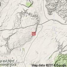
- Areal extent
- AAPG geologic province:
-
- Paradox basin
Summary:
Identified in an isolated section measured in Straight Wash Canyon, a deep canyon that is not entirely accessible, in sec 19, T23S, R13E, Emery Co, UT in the Paradox basin. Disconformably overlies buff dolomite assigned to Hermosa? Formation. Underlies Coconino Sandstone. Is 290 ft thick in the measured section where it consists mostly of dolomite interbedded with sandstone, shale, siltstone, limestone, and quartzite. Dolomite ranges from red-brown, green, yellow, gray, buff; is thin to thick bedded to massive, coarse to finely crystalline. The shale is red, brown and green and very finely micaceous. The sandstone beds vary from white, buff, gray, yellow or red, thin to medium bedded; they may be fine grained, micaceous, dolomitic. Siltstone is gray or red brown, calcareous, thin to medium bedded. One yellow and gray quartzite bed and one gray micaceous limestone in lower part. Gray dolomite makes up lowest bed. Red-brown shale is uppermost bed. No fossils found. Regarded as Early Permian?.
Source: GNU records (USGS DDS-6; Denver GNULEX).
- Usage in publication:
-
- Elephant Canyon Formation†
- Modifications:
-
- Abandoned
Summary:
Type section of Elephant Canyon Formation near confluence of Green and Colorado Rivers, San Juan Co, UT in the Paradox basin, restudied. Basal Elephant Canyon contact previously considered to be an angular unconformity that separated it from the underlying Honaker Trail Formation [upper formation of Hermosa Group]. Authors of this report traced individual beds in both formations and collected fossils (fusulinids) from both. They conclude: 1) there is no major break--no angular unconformity--within the sequence; 2) scour-surfaces are present in both formations; 3) the lower 450 ft of the original Elephant Canyon is Virgilian, not Wolfcampian, and thus no great time gap present between the Honaker Trail Formation of Missourian age and Wolfcampian rocks of the original upper Elephant Canyon. Fossils listed. Columnar sections. Name Elephant Canyon abandoned. Upper contact for upper member of Honaker Trail raised to top of a limestone 25+ ft thick about 560 ft above former top of Honaker Trail. Upper 590+ ft of former Elephant Canyon is reassigned as the informal "lower Cutler beds," rather than Rico Formation, because of distance between type Elephant Canyon and Rico. Cedar Mesa Sandstone overlies the "lower Cutler beds."
Source: GNU records (USGS DDS-6; Denver GNULEX).
- Usage in publication:
-
- Elephant Canyon Formation
- Modifications:
-
- Age modified
- AAPG geologic province:
-
- Paradox basin
Summary:
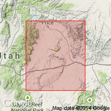
Fusulinids from General Petroleum No. 45-5-G core (alternative subsurface type section for Elephant Canyon), located in sec 5, T24S, R15W, Emery Co, UT, Paradox basin, indicate Virgilian (Late Pennsylvanian) and Wolfcampian (Early Permian) age for Elephant Canyon Formation. Core above 3950 ft is characterized by SCHWAGERINA of early Wolfcampian age; 4450-3950 ft interval contains TRITICITES and new species of KANSANELLA of Virgilian age. Presence of at least some Virgilian strata in Elephant Canyon suggests that major hiatus at base of Elephant Canyon is unlikely.
Source: GNU records (USGS DDS-6; Denver GNULEX).

- Usage in publication:
-
- Elephant Canyon Formation
- Modifications:
-
- Overview
- AAPG geologic province:
-
- Paradox basin
Summary:
Report is a reply to the Loope and others (1990) report. Rocks assigned to Elephant Canyon Formation in the Paradox basin of UT truncate Missourian through Mississippian rocks regionally towards the northwest. Author believes basal contact is an angular unconformity. Virgilian and Wolfcampian fusulinids have been identified in the formation. The unconformity is, therefore, older than previously thought. The basal part of the formation is Virgilian, the middle part is Bursum [Wolfcampian], and the upper part Neal Ranch or early Wolfcampian. Upper part interfingers with the overlying Cedar Mesa Sandstone [of authors' Cutler Group]. Author believes that if some want to call these rocks "Rico" Formation, it's all right with him; his definition of Elephant Canyon stands.
Source: GNU records (USGS DDS-6; Denver GNULEX).
For more information, please contact Nancy Stamm, Geologic Names Committee Secretary.
Asterisk (*) indicates published by U.S. Geological Survey authors.
"No current usage" (†) implies that a name has been abandoned or has fallen into disuse. Former usage and, if known, replacement name given in parentheses ( ).
Slash (/) indicates name conflicts with nomenclatural guidelines (CSN, 1933; ACSN, 1961, 1970; NACSN, 1983, 2005, 2021). May be explained within brackets ([ ]).