- Usage in publication:
-
- Buffalo Canyon Formation
- Modifications:
-
- Named
- Geochronologic dating
- Dominant lithology:
-
- Fanglomerate
- Mudstone
- Sandstone
- Diatomite
- Tuff
- Volcaniclastics
- AAPG geologic province:
-
- Great Basin province
Summary:
Buffalo Canyon Formation. Occurs in Buffalo basin; thins in northern part of basin. Carved into badlands due to large complement of weakly indurated sedimentary rocks. Divided into five informal members: basal ashflow tuff, diatomite, brown mudstone, salmon mudstone, and uppermost fanglomerate-mudflow (the last of which occurs as a wedge-shaped deposit exposed only to the northeast). Total thickness is about 475 m (1560 feet). Underlies Pleistocene deposits; unconformably overlies early Miocene volcanic formations (descending) Erb, Tortoise Peak, Desatoya, Skull, and Carroll [all first used]. Interfingers with Miocene Buffalo Hill Volcanics [first used]. Age is early Miocene, based on K-Ar age of 18.0 Ma (from Barrows, 1971, recalculated using constants of Dalrymple, 1979) from basal ashflow member. More recent work yielded the following ages: 18.03 +/-1.1 Ma, 17.5 +/-0.4 Ma, and 19.3 +/-0.8 Ma. Report includes geologic map and fossil lists of 69 species of flora collected from formation.
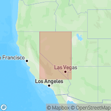
Type not designated, but described as occurring in lowland area between southern Desatoya Mountains and Eastgate Hills, chiefly south of State Highway 2 (old U.S. 50), Buffalo Summit 7.5-min quadrangle, Churchill Co. and adjacent Lander Co., west-central NV. Probably named from Buffalo Canyon (K.J. Barrows, 1971, unpub. PhD thesis). [Intent to name not stated. Report selected as naming paper because of complete, detailed description.]
Source: Modified from GNU records (USGS DDS-6; Denver GNULEX).
For more information, please contact Nancy Stamm, Geologic Names Committee Secretary.
Asterisk (*) indicates published by U.S. Geological Survey authors.
"No current usage" (†) implies that a name has been abandoned or has fallen into disuse. Former usage and, if known, replacement name given in parentheses ( ).
Slash (/) indicates name conflicts with nomenclatural guidelines (CSN, 1933; ACSN, 1961, 1970; NACSN, 1983, 2005, 2021). May be explained within brackets ([ ]).

