

- Usage in publication:
-
- Samaria Limestone Member
- Modifications:
-
- Original reference
- Dominant lithology:
-
- Limestone
- Dolomite
- Sandstone
- AAPG geologic province:
-
- Great Basin province
Summary:
Pg. 789. Samaria Limestone Member of Jefferson Formation. Limestone with minor orthoquartzite, sandstone, and siltstone. Thickness at type 597 feet. Unconformably overlies Grassy Flat Member of Water Canyon Formation; conformably underlies Hyrum Member of Jefferson. Correlates with Devils Gate Limestone and Guilmette Formation of Nevada, and with lower Jefferson of Utah. Fossiliferous. Devonian, probably Middle where AMBOTHYRIS and EMANUELLA occur, and Late where ALLANELLA and ATRYPA occur. Recognized in Utah and Idaho.
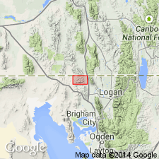
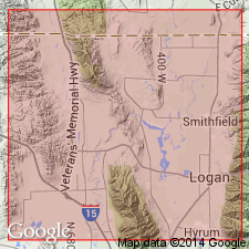
Type section: measured along east-west ridge crest, beginning 3.7 mi (6 km) west-northwest of Portage, in sec. 34, T. 15 N., R. 4 W., Box Elder Co., northeastern UT. Named from Samaria Mountain, Oneida Co., ID.
Source: US geologic names lexicon (USGS Bull. 1520, p. 268-269); supplemental information from GNU records (USGS DDS-6; Denver GNULEX).
- Usage in publication:
-
- Samaria Limestone Member
- Modifications:
-
- Revised
- AAPG geologic province:
-
- Wasatch uplift
- Great Basin province
Summary:
Revised from Samaria Limestone Member of Jefferson Formation to basal member of Hyrum Formation [no explanation included]. Author believes the section below the lowest limestone ledge (of the type Samaria)--which consists of alternating dolomite, and sandy and silty dolomite beds--should be removed from Samaria and reassigned to underlying Water Canyon Formation of Early Devonian age. The Samaria is restricted to beds 6 to 15 of Beus' type locality near Portage, Box Elder Co, UT in the Great Basin province. Units 1 to 5 of Beus' type Samaria are 276 ft thick and are reassigned to the Water Canyon. The thickness of the Samaria at its type as revised is 321 ft. RENSSELANDIA, a Middle Devonian fossil conodont, found about 25 ft above base of Samaria in bed 4. The Middle-Upper Devonian boundary is about 100 ft above the base of the revised Samaria at Portage, UT and about 45 to 80 ft above the base of the Samaria at Logan Canyon, Cache CO, UT on the Wasatch uplift. Columnar sections.
Source: GNU records (USGS DDS-6; Denver GNULEX).
For more information, please contact Nancy Stamm, Geologic Names Committee Secretary.
Asterisk (*) indicates published by U.S. Geological Survey authors.
"No current usage" (†) implies that a name has been abandoned or has fallen into disuse. Former usage and, if known, replacement name given in parentheses ( ).
Slash (/) indicates name conflicts with nomenclatural guidelines (CSN, 1933; ACSN, 1961, 1970; NACSN, 1983, 2005, 2021). May be explained within brackets ([ ]).