The National Geologic Map Database is migrating to a new infrastructure. We apologize for any service disruptions during this process.
|
|---|


- Usage in publication:
-
- Big Sandy Formation*
- Modifications:
-
- Named
- Reference
- Dominant lithology:
-
- Mudstone
- AAPG geologic province:
-
- Plateau sedimentary province
Summary:
Extends over an area of about 30 sq mi. Consists chiefly of green and brown mudstone or a calcareous silty or sandy variant. Grades into coarse-grained rocks. Tuffs are conspicuous and continuous; 13 were recognized, making up 2 to 3 percent of the formation. Is 197 feet thick at type. At reference localites, R1, R2, and R3, is 58 feet, 78 feet and 134 feet thick respectively. Unconformably overlies unnamed Tertiary sedimentary and volcanic rocks to the east, and Tertiary volcanic rocks and Precambrian granitic rocks to the south. Contains a rich vertebrate fauna; age is considered Pliocene, probably late Pliocene.
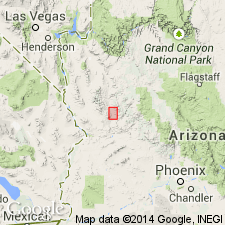
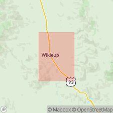
Type section: 2 mi east of Wikieup, along line between secs. 24 and 25, T. 16 N., R. 13 W., Wikieup quadrangle, Mohave Co., AZ. Named from Big Sandy River, a tributary to Bill Williams River, Mohave Co., AZ.
Reference sections: (1) R-1 measured along bluffs east of Big Sandy River, in SW/4 SW/4 sec. 18, T. 15 N., R. 12 W.; (2) R-2 measured about 1 mi east of Big Sandy River, in NW/4 NE/4 NE/4 sec. 30, T. 15 N., R. 12 W.; (3) R-3 along a wash, in NW/4 NW/4 SW/4 sec. 29 to NE/4 SE/4 NW/4 sec. 29, T. 15 N., R. 12 W.
Source: Modified from GNU records (USGS DDS-6; Denver GNULEX).
- Usage in publication:
-
- Big Sandy Formation
- Modifications:
-
- Age modified
- Geochronologic dating
- Paleomagnetics
- Biostratigraphic dating
- AAPG geologic province:
-
- Plateau sedimentary province
Summary:
Fossil mammals from Big Sandy belong to Wikieup local fauna of late Hemphillian age. Zircons from three tuff samples of unit have a mean age of 5.5 +/-0.2 m.y. B.P. Magnetic polarity data indicate Big Sandy extends from late Epoch 6 to early Gilbert time. Above evidence indicates late Miocene to early Pliocene age.
Source: GNU records (USGS DDS-6; Denver GNULEX).
For more information, please contact Nancy Stamm, Geologic Names Committee Secretary.
Asterisk (*) indicates published by U.S. Geological Survey authors.
"No current usage" (†) implies that a name has been abandoned or has fallen into disuse. Former usage and, if known, replacement name given in parentheses ( ).
Slash (/) indicates name conflicts with nomenclatural guidelines (CSN, 1933; ACSN, 1961, 1970; NACSN, 1983, 2005, 2021). May be explained within brackets ([ ]).