- Usage in publication:
-
- Slate Creek Complex
- Modifications:
-
- Named
- Dominant lithology:
-
- Serpentinite
- Amphibolite
- Greenstone
- Tonalite
- AAPG geologic province:
-
- Sierra Nevada province
Summary:
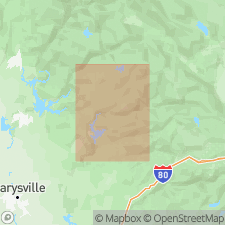
Named for Slate Creek, Sierra Co., northern CA. Previously called, in part, Paleozoic and Triassic Franklin Canyon Formation (Hietanen, 1981). Type locality assigned to east limb of Cascade anticline along [southeast bank] of Slate Creek. [Creek marks portion of political boundary between northwestern Plumas and southeastern Sierra Cos.]. Extends beyond type to all physically continuous and lithologically similar rocks west of Dogwood Peak fault. Also seen as band just east of Gillis Hill fault, as well as west-facing section in Lost Creek syncline and small outliers east of Dogwood Peak fault. Exposed in cores of Lost Creek and Camptonville synclines, in northern part of Scales anticline, and in isolated masses within late Paleozoic and early Mesozoic Calaveras Complex (revised), particularly near Gillis Hill fault. Described as west-to-east succession of serpentinized ultramafic, plutonic, and volcanic rocks best preserved in two continuous bands on either limb of Cascade anticline. Includes (ascending) 1) a serpentinite unit consisting of serpentinite-matrix melange with blocks of amphibolite, plutonic, and volcanic rocks; quartzite; and rare blocks of serpentinized harzburgite tectonite; 2) a plutonic unit consisting chiefly of gabbroic, diabasic, and tonalitic rocks; and 3) a volcanic unit (most areally extensive and thickest of Slate Creek's divisions) consisting of greenstone derived from volcanic breccia, tuff, volcaniclastic sediment, pillow lava, and rare "cherty" tuff. Total thickness of Slate Creek Complex at least 3 km; base is faulted and top is not preserved. Emplacement age (200 Ma) of the plutonic unit and evidence that Slate Creek's other units are broadly comagmatic, date entire complex as Early Jurassic (+/-200 Ma). One 200-Ma Slate Creek tonalite pod is known to be intruded by Jurassic (160-Ma) dikes of the Smartville Complex [informal] based on U-Pb zircon (M. E. Bickford, personal communication, 1988). Slate Creek Complex is interpreted as an immature intra-oceanic arc (Garcia, 1978). Report includes stratigraphic columns, geologic maps, and cross sections.
Source: GNU records (USGS DDS-6; Menlo GNULEX).
For more information, please contact Nancy Stamm, Geologic Names Committee Secretary.
Asterisk (*) indicates published by U.S. Geological Survey authors.
"No current usage" (†) implies that a name has been abandoned or has fallen into disuse. Former usage and, if known, replacement name given in parentheses ( ).
Slash (/) indicates name conflicts with nomenclatural guidelines (CSN, 1933; ACSN, 1961, 1970; NACSN, 1983, 2005, 2021). May be explained within brackets ([ ]).

