

- Usage in publication:
-
- Simtustus formation
- Modifications:
-
- First used
- AAPG geologic province:
-
- Columbia basin
Summary:
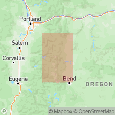
Volcaniclastic rocks informally referred to as "Simtustus formation" (Swanson, personal commun., 1983). Interbedded with and overlies Columbia River Basalt Group. Assigned middle Miocene age.
Source: GNU records (USGS DDS-6; Menlo GNULEX).
- Usage in publication:
-
- Simtustus Formation
- Modifications:
-
- Named
- Dominant lithology:
-
- Mudstone
- Sandstone
- Volcanics
- AAPG geologic province:
-
- Cascades province
- Columbia basin
Summary:
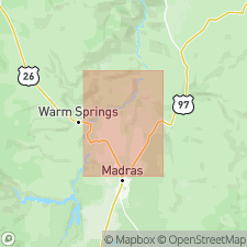
Named for Lake Simtustus reservoir behind Pelton Dam on Deschutes River west of Madras [Jefferson Co] OR. Type section is composite of three exposures on eastern canyon wall near reservoir and two references designated near Gateway, OR. Volcanic sediments below unconformity once assigned to lower Deschutes Formation here renamed Simustus Formation. Informally called "Lake Simtustus formation" (Smith and Hayman, 1983). Name informally shortened to "Simtustus formation" (Smith and Priest, 1983). Composed of tan, massive and laminated tuffaceous mudstone to fine-grained sandstone, light-gray to tan cross-bedded sandstone, conglomerate, tuff breccia and ignimbrite. Is 1 to 65 m thick. Unconformably underlies Deschutes Formation. Interfingers and overlies Columbia River Basalt Group. Age is middle Miocene (15.5 to 12 Ma) inferred from isotopic dating (L.W. Snee, pers. commun.) of lowest Prineville chemical type basalt flow at Pelton Dam and occurrence of middle Miocene Pelton flora of Ashwill (1983) in lower Simtustus Formation.
Source: GNU records (USGS DDS-6; Menlo GNULEX).
For more information, please contact Nancy Stamm, Geologic Names Committee Secretary.
Asterisk (*) indicates published by U.S. Geological Survey authors.
"No current usage" (†) implies that a name has been abandoned or has fallen into disuse. Former usage and, if known, replacement name given in parentheses ( ).
Slash (/) indicates name conflicts with nomenclatural guidelines (CSN, 1933; ACSN, 1961, 1970; NACSN, 1983, 2005, 2021). May be explained within brackets ([ ]).