

- Usage in publication:
-
- Noatak sandstone*
- Modifications:
-
- Named
- Biostratigraphic dating
- Dominant lithology:
-
- Sandstone
- Shale
- AAPG geologic province:
-
- Alaska Northern region
Summary:
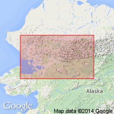
Named for Noatak basin. [No type evaluated.] Occurs in central and western parts of Noatak basin, AK. Composed of dominantly sandstones, medium fine grained and rather massive; contains layers of limestone, and layers of shale that accentuate bedding. Color on fresh surface is dark gray or greenish. Underlies Lisburne limestone. Overlies unnamed Late Devonian limestone. Age is possibly Late Devonian and Early Mississippian based on biostratigraphic dating of large fauna of Mississippian age.
Source: GNU records (USGS DDS-6; Menlo GNULEX).
- Usage in publication:
-
- Noatak formation*
- Modifications:
-
- Mapped
- Revised
- AAPG geologic province:
-
- Alaska Northern region
Summary:
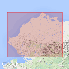
Noatak sandstone of Smith (1913) redesignated Noatak formation. Type locality designated as exposures in western part of Noatak Valley, between Nimiuktuk and Kugururok Rivers, AK. "Previous work did not yield a complete section across strike. For this reason and also because other Mississippian rocks have been assembled and treated collectively with original Noatak sandstone, it has seemed desirable to create a new and more comprehensive, cartographic unit." Underlies Lisburne limestone and includes all pre-Lisburne Mississippian rocks in northern region.
Source: GNU records (USGS DDS-6; Menlo GNULEX).
- Usage in publication:
-
- Noatak formation*
- Modifications:
-
- Mapped
- AAPG geologic province:
-
- Alaska Northern region
Summary:
Noatak formation mapped as one cartographic unit with Sadlerochit sandstone and Lisburne limestone. Occurs in Brooks Range, and may be present at great depth in northern and southern foothills, northern and northwestern AK. Top 900 ft composed of black marine shale with ferruginous limestone at top, argillaceous limestone 150 ft below top, and 160 ft of ferruginous quartz sandstone at base. Also consists of intervals of clay and silt shale, shale with pebble quartz sandstone, and massive quartzitic chert-pebble conglomerate and sandstone. Noted fossils are brachiopods, bryozoans, blastoids, trilobites, fish fragments, and poorly preserved plant fossils. Age is Mississippian (unit may include some Devonian).
Source: GNU records (USGS DDS-6; Menlo GNULEX).
- Usage in publication:
-
- Noatak formation*
- Modifications:
-
- Revised
- AAPG geologic province:
-
- Alaska Northern region
Summary:
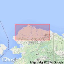
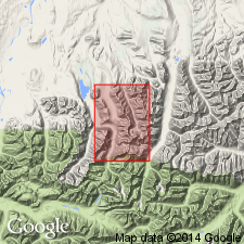
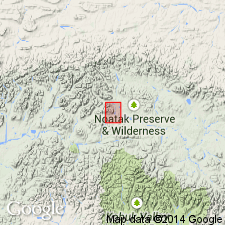
Type section designated as exposures on mountain side 4.5 mi N15W of junction of Nimiuktuk and Noatak Rivers, [68 deg 11'N, 159 deg 58'W], Type area is mountains immediately west of Nimiuktuk River [Kingasivik Mountains, south of DeLong Mountains, Misheguk Mountain quad, western Brooks Range, AK]. Thickness at type section is 263 m and range of 214 to 305 m. Composed chiefly of sandstone, with minor amounts of clay shale and conglomerate. Stratigraphically restricted to rocks above a siltstone-slate-phyllite sequence previously included in Noatak formation [Smith, 1913, 1930]; these rocks designated as Hunt Fork(?) formation. Upper contact placed arbitrarily at top of highest massive sandstone and clay shale of Utukok formation. Is partly equivalent to Kanayut formation located along crest of Brooks Range 200 mi to east. Lower part is probably Late Devonian age (based on fossils) and upper part is Early Mississippian age.
Source: GNU records (USGS DDS-6; Menlo GNULEX).
- Usage in publication:
-
- Noatak formation*
- Modifications:
-
- Areal extent
- Revised
- AAPG geologic province:
-
- Alaska Northern region
Summary:
Rocks previously referred to as Noatak formation (Smith and Mertie, 1930; and Payne and others, 1952), are assigned to Kanayut conglomerate (new) and Kayak shale (new). [Noatak formation restricted to include only dominantly nonmarine sandstone and conglomerate in type area in western Noatak district]. "Dutro suggest, on basis of field work in type area of the Noatak formation in 1950, that name for this nonmarine sandstone is not appropriate for use in Shainin Lake area" [150 deg W to 153 deg W by 68 deg N to 69 deg N].
Source: GNU records (USGS DDS-6; Menlo GNULEX).

- Usage in publication:
-
- Noatak Sandstone*
- Modifications:
-
- Revised
- Age modified
- AAPG geologic province:
-
- Alaska Northern region
Summary:
Noatak Sandstone assigned to Endicott Group (new) as next to lowest formation in southern DeLong Mountains. Gradationally overlies Hunt Fork Shale (Endicott Group). Underlies Utukok Formation (Lisburne Group) at type area; in Baird Mountains underlies Kayak Shale (Endicott Group). Chart shows correlation with Kanayut Conglomerate and lower part of Kayak Shale (both of Endicott Group). Deposited in paralic environment. Is believed to be Late Devonian and Early Mississippian in age (Dutro, 1953).
Source: GNU records (USGS DDS-6; Menlo GNULEX).
- Usage in publication:
-
- Noatak Sandstone*
- Modifications:
-
- Areal extent
- Revised
- AAPG geologic province:
-
- Alaska Northern region
Summary:
Noatak Sandstone is revised and geographically extended to include lowermost informal marine (basal) sandstone member of Kanayut Conglomerate (Endicott Group) in central and eastern Brooks Range, because of present definition of Kanayut as wholly nonmarine (Brosge and others, in press. U.S. Geological Survey Professional Paper 1399 [on National Petroleum Reserve]).
Source: GNU records (USGS DDS-6; Menlo GNULEX).
- Usage in publication:
-
- Noatak Sandstone*
- Modifications:
-
- Reference
- Overview
- AAPG geologic province:
-
- Alaska Northern region
Summary:
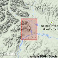
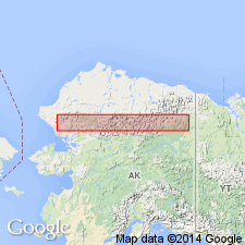
Reference section designated as exposures in type area, approximately 68 deg 13'N, 150 deg 00'W, 2 km northwest of type section, 6 km northwest of junction of Nimiuktuk and Noatak Rivers, Misheguk Mountain quad, western Brooks Range, AK. In central Brooks Range, composed of medium-bedded, fine- to medium-grained, quartzose sandstone that locally contains pebble conglomerate and thin shale intervals. Conformably overlies Hunt Fork Shale (Endicott Group). Conformably underlies Ear Peak Member (Kanayut Conglomerate). Thickness ranges 0 to 560 m. Contains late Late Devonian (middle Famennian) marine megafossils, including brachiopods, gastropods, pelecypods, and echinoderms, and trace fossils such as SKOLITHOS. Age remains Late Devonian and Early Mississippian.
Source: GNU records (USGS DDS-6; Menlo GNULEX).
For more information, please contact Nancy Stamm, Geologic Names Committee Secretary.
Asterisk (*) indicates published by U.S. Geological Survey authors.
"No current usage" (†) implies that a name has been abandoned or has fallen into disuse. Former usage and, if known, replacement name given in parentheses ( ).
Slash (/) indicates name conflicts with nomenclatural guidelines (CSN, 1933; ACSN, 1961, 1970; NACSN, 1983, 2005, 2021). May be explained within brackets ([ ]).