- Usage in publication:
-
- Bridger group*
- Modifications:
-
- Original reference
- Dominant lithology:
-
- Sandstone
- AAPG geologic province:
-
- Green River basin
Summary:
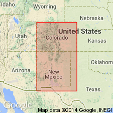
Pg. 191 of 1873 ed. The next group commences not far west of Bryan and is doubtless a prolongation upward of Green River shales. The sediments are composed of more or less fine sands and sandstones, mostly indurated, sometimes forming compact beds, but usually weathering into those castellated and dome-like forms which have given such celebrity to the "Bad Lands" of White River. Church Buttes, near Fort Bridger [Uinta County, southwestern Wyoming], is an example of this group, and shows the style of weathering to which I refer, I have called this group the Bridger group, from fact it is best developed in this region. Assigned to upper Tertiary.
Source: US geologic names lexicon (USGS Bull. 896, p. 263-264).
- Usage in publication:
-
- Bridger formation
- Modifications:
-
- Revised
- AAPG geologic province:
-
- Green River basin
Summary:
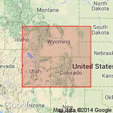
Divided into five horizons, A-E, in ascending order, which are further divided into levels 1-5, in ascending order. Purpose of divisions was to accurately record levels of fossil materials found. Divisions made on basis of widespread calcareous layers and benches. Upper Bridger consists of (descending) Horizon E, 500 ft thick, Horizon D, 350 ft thick, and Horizon C, 300 ft thick, which occur in southern and central part of basin; Lower Bridger consists of (descending) Horizon B, 450 ft thick, and Horizon A, 200 ft thick, which occur in northern and central part of basin (map). Horizon A has few mammals, although reptiles, fish, and fresh-water mollusks are abundant; Horizon E is nearly barren of fossils, though a few fragmentary mammal remains are of Bridger age. Greatest number of fossil vertebrates found in lower part of Horizon B and its fauna is mostly distinct from Horizons C and D. Horizons consists of: A--calcareous shales alternating with tuffs; B--tuffs and two principal benches separated by Cottonwood White Layer; C--tuffs and persistent calcareous Sage Creek White Layer; D--harder gray and greenish gray sandy and clayey tuffs with one or more ash beds and persistent calcareous Lone Tree White Layer and Upper White Layer; and E--soft banded tuffs with heavy volcanic ash layers. Underlies Pleistocene Wyoming Conglomerate; overlies Green River formation. Fossil lists, descriptions and plates. Middle Eocene age.
Source: GNU records (USGS DDS-6; Denver GNULEX).
- Usage in publication:
-
- Bridger formation
- Modifications:
-
- Contact revised
- AAPG geologic province:
-
- Wind River basin
- Green River basin
Summary:
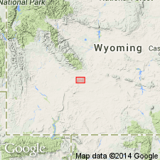
Divided into a lower part 455 to 495 ft thick that is separated from the upper part 215 to 270 ft thick by a disconformity. Overlies Morrow Creek member of Green River formation. Upper contact revised in that Bridger unconformably underlies the newly named Continental Peak formation. Stratigraphic table; cross sections; geologic map; measured sections. Mapped in southern part of area from west of Oregon Buttes, Sweetwater Co, Wind River basin, to Continental Peak in Fremont Co, Greater Green River basin. Middle Eocene age. Fossils (gastropods, pelecypods) from lower Bridger listed. Upper Bridger yielded a single gastropod, fish scales, tooth, spines, and a mammal vertebra.
Source: GNU records (USGS DDS-6; Denver GNULEX).
- Usage in publication:
-
- Bridger Formation*
- Modifications:
-
- Areal extent
- AAPG geologic province:
-
- Green River basin
Summary:
Is a unit of Eocene age that is replaced in Washakie basin within Greater Green River basin by the Washakie Formation of Eocene age.
Source: GNU records (USGS DDS-6; Denver GNULEX).
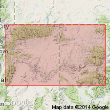
- Usage in publication:
-
- Bridger Formation*
- Modifications:
-
- Areal extent
- AAPG geologic province:
-
- Green River basin
Summary:
Restricted from Uinta and Piceance Creek basins. Rocks formerly thought to be part of the Eocene Bridger in the Uinta basin, UT are reassigned to Uinta Formation; rocks formerly assigned to Bridger in the Piceance basin, northwest CO are reassigned to upper part of Uinta Formation. Still used in Greater Green River basin (Moffat Co., CO and north into WY).
Source: GNU records (USGS DDS-6; Denver GNULEX).
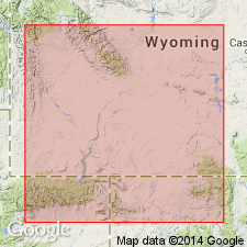
- Usage in publication:
-
- Bridger Formation
- Modifications:
-
- Revised
- Overview
- AAPG geologic province:
-
- Green River basin
Summary:
Divided into newly named Whiskey Butte Bed at base and main body. Whiskey Butte overlies, underlies, and intertongues with Laney Member of Green River Formation. Estimated to be 2,000 ft thick in Greater Green River Formation. Is the non-red fluviatile sandstone and mudstone that can be separated as designated above on the margins of the basin and can be distinguished from Wasatch Formation by intervening Laney Member of Green River. Source areas were Paleozoic and Mesozoic rocks of Wind River Mountains and Precambrian quartzites and metaquartzites of Uinta Mountains. Thought to have been deposited in an intermontane basin in a subtropical, humid climate. Of Bridgerian, Eocene age. Cross sections.
Source: GNU records (USGS DDS-6; Denver GNULEX).
For more information, please contact Nancy Stamm, Geologic Names Committee Secretary.
Asterisk (*) indicates published by U.S. Geological Survey authors.
"No current usage" (†) implies that a name has been abandoned or has fallen into disuse. Former usage and, if known, replacement name given in parentheses ( ).
Slash (/) indicates name conflicts with nomenclatural guidelines (CSN, 1933; ACSN, 1961, 1970; NACSN, 1983, 2005, 2021). May be explained within brackets ([ ]).

