

- Usage in publication:
-
- Yenruogis Member
- Modifications:
-
- Named
- Dominant lithology:
-
- Sandstone
- AAPG geologic province:
-
- Iowa shelf
Summary:
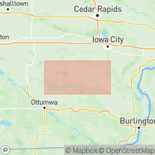
Named as Member of Mississippian "St. Louis" Formation. The "St. Louis" comprises (ascending) Croton (revised), Yenruogis (new), Verdi (revised), and Waugh (revised) Members. Named for nearby Lake Yenruogis, a water-filled quarry in Lake Yenruogis Park, Keokuk County. Was assigned by Van Tuyl (1925) to Mississippian Verdi Member; now thought to warrant separate identity by virtue of thickness and lateral extent. Type section designated along south valley wall of Bridge Creek next to Co Hwy V45 in SE1/4 NE1/4 NE1/4 sec 22, T76N, R12W (Van Buren Township), Keswick 7.5 min quad, Keokuk Co, southeastern IA. Reference secs are found along other Bridge Creek valley walls; upper bounding contact exposed in sections north of Hedrick, Keokuk Co. This mappable sandstone unit contains minor carbonate interbeds. At type, consists of well-stratified, very fine-to fine-grained, quartzose sandstone that is weakly calcite-cemented, friable, porous, and lightly case-hardened. Sedimentary structures are dominated by tabular to wedge shaped sets of large-scale horizontal to low-angle planar strata cut by major low-angle planar truncation surfaces. Sandstone texture uniform; thin laminae range from 1 to 10 mm; trace fossils in form of sand-filled, cemented marine burrows are visible on weathered outcrop. Some facies variation; minor hummocky to swaley stratification; small-scale ripples, some draped by sandy lime mudstone, are observed on quarry floors near Verdi, Washington Co and in Waugh Branch area, Keokuk Co. Deposits in lower part of unit may be nonmarine. Thickness at type is 5.5 m (18 ft); subsurface, outcrop, and quarry data show range from 1-14 m (3-45 ft) over at least six-county area in southeastern and south-central IA, namely Keokuk, Mahaska, Marion, Poweshiek, Wapello, and Washington Cos. Overlies Mississippian Croton Member, locally deemed an erosional surface because of sandy dolostone breccia and conglomerate at top of the Croton. Sharply, but conformably, underlies Mississippian Verdi Member. Age is considered broadly Mississippian, pending further work on the "St. Louis" Formation. Most geologists working in IA presently use that name, referring to upper and lower "St. Louis" as needed. Current belief holds that, at least in IA, the "St. Louis" is only partly time correlative with type St. Louis in MO. Quotes serve as a warning that correlational and nomenclatural problems associated with the term continue. Report includes measured sections, cross sections and geologic sketch maps.
Source: GNU records (USGS DDS-6; Denver GNULEX).
For more information, please contact Nancy Stamm, Geologic Names Committee Secretary.
Asterisk (*) indicates published by U.S. Geological Survey authors.
"No current usage" (†) implies that a name has been abandoned or has fallen into disuse. Former usage and, if known, replacement name given in parentheses ( ).
Slash (/) indicates name conflicts with nomenclatural guidelines (CSN, 1933; ACSN, 1961, 1970; NACSN, 1983, 2005, 2021). May be explained within brackets ([ ]).