

- Usage in publication:
-
- Railroad Canyon Formation*
- Modifications:
-
- Named
- Dominant lithology:
-
- Conglomerate
- Siltstone
- Shale
- Limestone
- AAPG geologic province:
-
- Montana folded belt
- Idaho Mountains province
Summary:
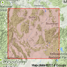
Named for Railroad Canyon, Lemhi Co, ID in Montana folded belt and Idaho Mountains provinces. Type section measured in NE1/4 sec 31 and SE1/4 sec 30, T14S, R27E, Bannock Pass quad, Lemhi Co, ID. Known in east-central ID and southwest MT. Composed of gray to black shale; brown-gray to black-gray, thin- to thick-bedded, flaggy, silty lime-mudstone; thin-bedded calcareous siltstone; olive-gray, flaggy claystone; poorly-sorted conglomerate of mudchips, phosphatic and brachiopod fragments; yellow and gray, thin- to medium-bedded packstone; and dark-gray, thin-bedded, occasionally silty wackestone at type. Is 676+ ft (205+ m) thick at type. Overlies Scott Peak Formation. Underlies Bluebird Mountain Formation. Is found only in the Beaverhead Range. Is of Chesterian or Late Mississippian age. Brachiopod and conodont faunas indicate a Sando and Bamber Coral Zone V or younger age. Is equivalent to upper unit of Lombard Limestone (new) and Conover Ranch Formation (new) of Snowcrest Range Group (new). Is equivalent to Surrett Canyon and Arco Hills Formation of the carbonate bank sequence of ID. Correlation chart.
Source: GNU records (USGS DDS-6; Denver GNULEX).
- Usage in publication:
-
- Railroad Canyon Formation*
- Modifications:
-
- Areal extent
- AAPG geologic province:
-
- Idaho Mountains province
Summary:
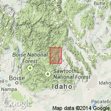
Known only in Beaverhead Mountains where it crops out in thrust slices on south face of Grizzly Hill. Is so cut by faults that no section is complete. Is 260 m thick in north part of Mountains and 200 m thick in south part. Measured section 260 m thick northeast corner of sec 31, T17N, R27E described where it overlies Scott Peak Formation and underlies Bluebird Mountain Formation. Upper contact placed at base of distinctive fine-grained calcitic to quartzitic sandstone. Composed of grayish-red to brown-gray or brown-black shaly to flaggy, partly calcareous shale and mudstone in lower part and black papery shale in upper part. Fossils (corals, conodonts, pelecypods, brachiopods, productids) listed. Of Late Mississippian, Chesterian age. Generalized columnar sections diagram.
Source: GNU records (USGS DDS-6; Denver GNULEX).
For more information, please contact Nancy Stamm, Geologic Names Committee Secretary.
Asterisk (*) indicates published by U.S. Geological Survey authors.
"No current usage" (†) implies that a name has been abandoned or has fallen into disuse. Former usage and, if known, replacement name given in parentheses ( ).
Slash (/) indicates name conflicts with nomenclatural guidelines (CSN, 1933; ACSN, 1961, 1970; NACSN, 1983, 2005, 2021). May be explained within brackets ([ ]).