Science Language Technical Team
MEMORANDUM
To: Geologic Division Employees
From: P. Patrick Leahy
Associate Director for Geology
Subject: Science-Language Technical Team for geologic-map data model
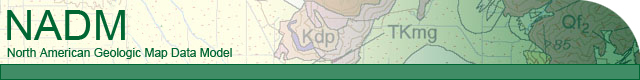
I invite and encourage your input to the Science-language Technical Team, which is developing standardized nomenclature for digital geologic-map databases. As many of you are aware, a standardized data model for the input, storage, manipulation, retrieval, and analysis of digital geologic-map information is being developed by the U.S. Geological Survey (USGS), the Association of American State Geologists (AASG), the Geological Survey of Canada (GSC), and the Canadian Provincial Surveys. USGS's role stems from the National Geologic Mapping Act, which requires USGS to develop a national geologic map database and related map standards; and OMB Circular A16, which established the Federal Geographic Data Committee (FGDC). A geologic data model developed cooperatively by the USGS, the FGDC, and the AASG is currently being evaluated as a candidate for becoming the FGDC and North America standard. This model has been revised and refined over a period of time through a series of workshops and presentations at National GSA meetings. The data model can be found on the World Wide Web at http://nadm-geo.org/dmdt/Model43a.pdf (version 4.3).
A multi-constituency North American Data Model Steering Committee (NADMSC, http://nadm-geo.org/about.html) is overseeing continued development of a data-model standard and has commissioned several technical teams to develop various aspects of the data model. One of these teams is the Science Language Technical Team (SLTT), which is charged with developing a common language for describing and interpreting the following: (1) geologic-map units, geologic lines, and geologic points; (2) spatial and geologic relations among these features; and (3) their genesis and geologic history. Participants on the SLTT are now being nominated from all NADMSC constituencies. The Regional Geologists and Geologic Division Program Coordinators identified 20 scientists to participate on the SLTT. The appointment procedure has ensured both (1) diversified technical representation, and (2) programmatic representation that acknowledges the interests and requirements of USGS geologic-map customers and their constituents.
I encourage you to participate in the development of the geoscience concepts and attendant geoscience terminology that eventually will be proposed as part of the North American data-model standard. Geologic maps long have been a traditional science product of the Geologic Division, and now their digital data-base equivalents provide even greater opportunities to communicate science and to support applied research. But the benefits of digital data-base delivery can be achieved only if the right kind of science (and supportive nomenclature) is embraced by the data bases. I ask that you support this process and participate in its development.
Several mechanisms exist for you to participate directly in the Science-Language process:
- Contribute to the Science Language Web-Conference site (now archived);
- Talk to or email any of the SLTT members (listed below), or SLTT chair (Jon Matti);
Please take the time to visit the various web sites and to contribute to the development of science language that will be incorporated into the North American standard.