For many societal and scientific applications, detailed geologic map information of local areas is essential, and the National Geologic Map Database (NGMDB) will provide access to that information where available. Regional maps that cover larger areas in less detail also are essential for many purposes -- such maps provide a regional geologic context for detailed map information and support regional planning decisions. This page describes our efforts to develop regional or national geologic map coverage, in digital format.
Currently, the best available geologic map of the United States is the "Geologic Map of the United States (exclusive of Alaska and Hawaii"), by P.B. King and H.M. Beikman (USGS, 1974, scale 1:2,500,000). A digital version of the map was released in 1994 (Schruben and others, USGS Digital Data Series DDS-11). Click here to view an image of the map.
As described below, the NGMDB has begun a limited effort to create selected small-scale digital geologic maps, to provide a surficial and bedrock geologic framework for the Nation that is more modern and detailed. If you have suggestions for maps that should be included in the NGMDB's collection of on-line regional earth-science maps (including map themes other than geologic maps), please advise the project chief.
The USGS has essentially finished compiling a relatively detailed map of bedrock geology and marine deposits for North America and extending to South America, Ireland, Siberia, and the north polar region. Commissioned by the Geological Society of America's Decade of North American Geology Project (DNAG), this will be published circa 2003 as a paper map by GSA, at 1:5,000,000-scale. Although smaller-scale than the King-Beikman map referenced above, it is more detailed, essentially representing a 1:2,500,000-scale compilation of many larger-scale maps, reduced to 1:5,000,000 for final compilation, scribing, and printing. The NGMDB project is working with the map compiler (Jack Reed, USGS) to convert the 1:5,000,000-scale maps to digital form. The project also is discussing with the Geological Society of America and the Geological Survey of Canada the feasibility of developing and maintaining from this source map a geologic map database that will be available from several sites including the NGMBD's prototype online map database.
The USGS Quaternary Atlas of the United States project is developing the first systematic map compilation of the surficial mantle that is based on recompilation of more detailed maps. Map scale is 1:1,000,000. Previous treatment of surficial deposits for the conterminous U.S. have been idealized representations at 1:7,500,000-scale or smaller. Hence, the Quaternary Atlas is a unique and potentially valuable resource for regional understanding of the surficial deposits upon which we live. Presently, the Quaternary Atlas covers roughly the eastern 3/5ths of the conterminous U.S. The NGMDB project intends to assist in development of a Quaternary map database that will include information from the Quaternary Atlas.
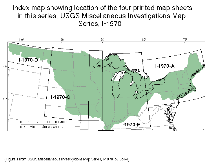
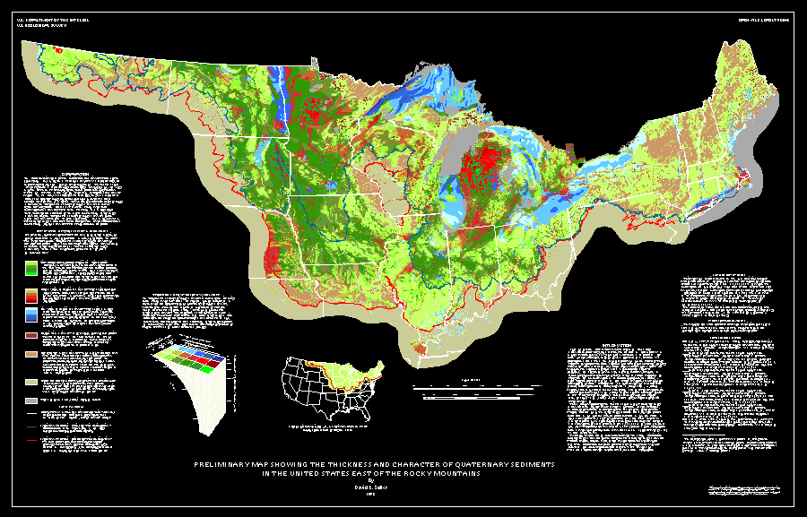
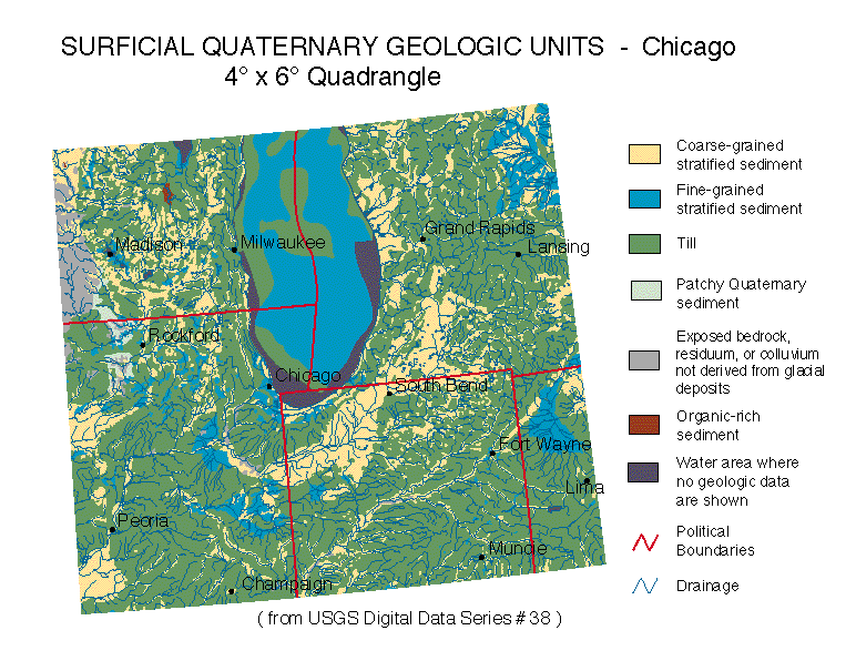
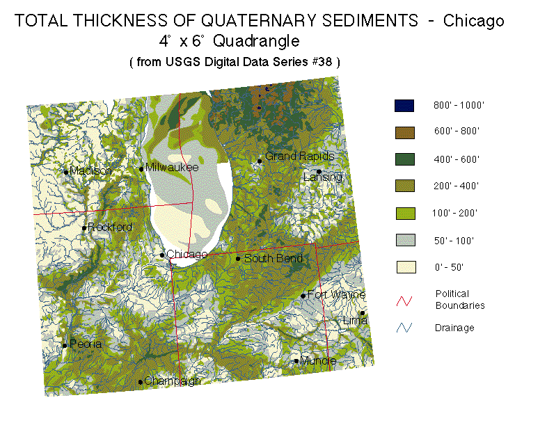
This map, somewhat related to the Quaternary Atlas, has been compiled and published as USGS map I-1970-A, -B, -C, -D (see the index map). Map scale is 1:1,000,000. The digital data are published as USGS DDS-38. The map has been used for a variety of purposes including assessing the contamination potential of aquifers, prioritizing search areas for liquefaction features, general geologic framework in support of various hydrologic studies (e.g., the Groundwater Atlas of the United States, and NAWQA and RASA projects), and as input to habitat delineation studies. A reduced-scale plot of the entire map area also has been published, as USGS OFR93-543 (see a low-resolution image of that plot). Or, view two selected files showing part of the map -- surficial geology and thickness of Quaternary sediment. This map will eventually become part of the NGMDB prototype online map database. For further information, contact the author, Dave Soller (USGS).