

- Usage in publication:
-
- Whitewood limestone*
- Modifications:
-
- [Principal reference]
- AAPG geologic province:
-
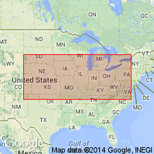
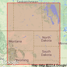
- Powder River basin
- Williston basin
Summary:
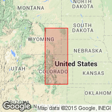
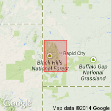
Pg. 383-384, 435; [see also T.A. Jaggar, Jr., 1904, USGS Prof. Paper 26, p. 16, 21 (table); N.H. Darton, 1909, USGS Prof. Paper 65]. Whitewood limestone. Massive sandy limestone of buff color, with brown or reddish spots or mottlings, 0 to 80 feet thick. Underlies Englewood limestone and overlies Deadwood formation. Present in northern portion of Black Hills uplift, western South Dakota and northeastern Wyoming, and to a limited extent, in Bear Lodge range [Bear Lodge Mountains in Crook County, northeastern Wyoming]. Fossils; carries very large upper Trenton fauna (notably nautiloid ENDOCERAS, snail MACLUREA). [ca. 1936, age is considered Late Ordovician (Cincinnatian; pre-Richmond).] Considered = lower massive member of Bighorn limestone, based on fauna and lithologic similarities.
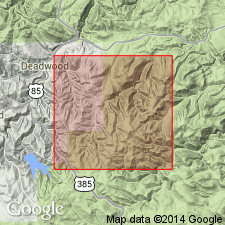
Named from typical exposures in Whitewood Canyon on Fremont, Elkhorn and Missouri Valley RR (Deadwood Branch), below Deadwood, [in T. 5 N., R. 3 E., Sturgis 15-min quadrangle, Lawrence Co.], western SD. Name credited to T.A. Jaggar, Jr.
[See also Furnish and others (1936) entry under Deadwood, for suggested redefinition.]
Source: Publication; US geologic names lexicon (USGS Bull. 896, p. 2327).
- Usage in publication:
-
- Whitewood limestone*
- Modifications:
-
- Revised
- AAPG geologic province:
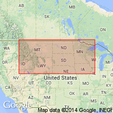
-
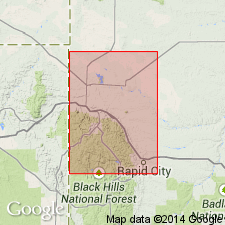
- Williston basin
Summary:
Pg. 7, geol. maps, columnar section. Whitewood limestone. Hard massive limestone, mostly buff or pinkish, with pale-brownish spots. Thickness 60 to 80 feet around Deadwood and in Spearfish Canyon, thins southward and disappears in southeastern part of Lawrence County. Typical exposure is on Whitewood Creek below Deadwood, where it is underlain by a slabby light-colored sandstone showing fucoid markings and worm burrows, which was originally assigned to it but is now regarded as a local top member of the Deadwood formation (Upper Cambrian). Overlain by several feet of gray and yellow shale, which is regarded as base of Englewood limestone (Mississippian). Correlative with Big Horn dolomite of Big Horn Mountains. Fossils (identified by C.D. Walcott) indicate age is Late Ordovician (Richmondian).
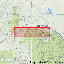
Mapped in Lead 15-min quadrangle, Lawrence Co., western SD.
Source: Publication.
- Usage in publication:
-
- Whitewood formation
- Modifications:
-
- Revised
- Redescribed
- Biostratigraphic dating
- AAPG geologic province:
-
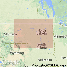
- Williston basin
Summary:
Pg. 1329-1341. Authors reported finding of poorly preserved Ordovician (Middle?) fossils [listed and figured] in upper 70 feet of Deadwood formation of type section, and they recommended transfer of these beds from Deadwood formation to overlying Whitewood limestone (which is classified by the USGS as Upper Ordovician). These 70 feet of beds are described as consisting of (descending): (1) transitional, 10 feet; (2) siltstone member, 20 feet, numerous fossils; and (3) shale member, 40 feet, few fossils. They rest on a sandstone, called "SCOLITHUS [SKOLITHOS] sandstone," 15 feet thick, which has not yielded fossils. Authors conclude with following statements: Data presented seem to indicate that all beds in northern Black Hills above Scolithus sandstone and below typical Whitewood dolomite may be correlated with Middle Ordovician. No diagnostic fossils were found in Scolithus sandstone or subjacent beds, and their age was not determined. Typical Whitewood dolomite presumably is Upper Ordovician. It seems advisable for the present at least to include all Ordovician beds above Scolithus sandstone in Whitewood formation.
Source: US geologic names lexicons (USGS Bull. 896, Deadwood entry p. 578, USGS Bull. 1200, p. 4219).
- Usage in publication:
-
- Whitewood dolomite
- Modifications:
-
- Redescribed
- Revised
- Dominant lithology:
-
- Dolomite
- AAPG geologic province:
-
- Williston basin
Summary:
Pg. 44, 45, 46. Referred to as Whitewood dolomite. Buff to tawny colored dolomite, 50 to 60 feet thick. [Restricts Whitewood Formation of Furnish and others (1936) to their uppermost dolomite member and perhaps part of underlying transitional dolomitic sandy beds.] Underlies Mississippian Englewood dolomite without angular unconformity; gradationally overlies Roughlock siltstone (new); north of Black Hills where Roughlock is absent, overlies Ice Box [Icebox] shale (new). Fossils, notably cephalopods MACLUREA LOGANI and ENDOCERAS ANNULATUM in upper part. Age is considered Middle Ordovician (Mohawkian; Trenton).
[Typographical error (US geologic names lexicon, USGS Bull. 1200, p. 4219): McCoy states on p. 44 the Whitewood is overlain by the Mississippian Englewood without angular unconformity; not with angular unconformity as stated in USGS Bull. 1200.]
Source: Publication; US geologic names lexicon (USGS Bull. 1200, p. 4219).
- Usage in publication:
-
- Whitewood dolomite
- Modifications:
-
- Overview
- AAPG geologic province:
-
- Williston basin
- Powder River basin
Summary:
Classed as Late Ordovician (Richmond) in age in the Black Hills, SD and WY, in Williston and Powder River basins. Underlain unconformably by unnamed beds of Middle Ordovician [Black River] age; overlain unconformably by rocks of Pennsylvanian age. Age assignment questioned by Kay (p. 282), who favors a Middle Ordovician (Trenton) age.
Source: GNU records (USGS DDS-6; Denver GNULEX).
- Usage in publication:
-
- Whitewood formation
- Modifications:
-
- Revised
- AAPG geologic province:
-
- Williston basin
Summary:
Revised lower contact downward at type locality near Deadwood, and in Spearfish Canyon, both in Lawrence Co, SD in Williston basin. Consists of five members described as follows (ascending): 1) Member a, gray limestone, weathering brown, glauconitic, and limestone pebble conglomerate, interbedded green shale, and flaggy quartz sandstone, 20 ft; 2) member b, quartz sandstone, red, buff, and gray, SCOLITHUS [SCOLITHOS] borings throughout, 18 ft; 3) member c, soft, green shale, 45 ft; 4) member d, quartz sandstone, white to buff, friable, grading into overlying dolomite, 15 ft; and 5) member e, buff, massive dolomite, 60 ft. Members a and b may correlate with Winnipeg formation, basal sandstone in Williston basin; member c equals Winnipeg shale; member d is also a recognized member of Winnipeg and probably equivalent to WY's Lander formation; and member e corresponds to part of Red River formation. Members b, c, d, and e are the Aladdin, Icebox, Roughlock, and Whitewood formations of McCoy (1952), respectively. Overlain by Englewood formation; underlain by Deadwood formation (revised). Middle Ordovician in age.
Source: GNU records (USGS DDS-6; Denver GNULEX).
- Usage in publication:
-
- Whitewood dolomite*
- Modifications:
-
- Areal extent
- AAPG geologic province:
-
- Powder River basin
- Williston basin
Summary:
Pg. 443. Whitewood dolomite. Whitewood limestone of Darton is here designated Whitewood dolomite. Its lithologic character is closely similar to that of lower part of Bighorn dolomite. Is restricted to dolomite and sandy dolomite of Ordovician age in Black Hills, and term is used in same sense as that of Darton and Paige (1925). Underlying shales, siltstones, and sandstones [previously included in Whitewood by Butler and others, 1955] are purposely excluded.
Restricted--in Black Hills of SD and WY, Williston and Powder River basins--to the dolomite and sandy dolomite of Ordovician age, as used by Darton and Paige (Darton, 1925). The underlying shales, siltstones, and sandstones [of Ordovician age--Roughlock siltstone, Icebox shale, and Aladdin sandstone of McCoy, 1952] are purposely excluded. Discusses age and correlation with rocks in the subsurface in Williston basin, MT. Lithologic character is very similar to that of lower part of Bighorn dolomite. Is certainly equivalent to no more than Red River formation of subsurface of Williston basin and probably not to all of that. The entire Red River formation [and, presumably, Whitewood dolomite] is believed to be of Cincinnati, Late Ordovician age, based almost entirely on brachiopods and a few corals. Recommends name Whitewood not be used in subsurface of Williston basin.
Source: GNU records (USGS DDS-6; Denver GNULEX).
- Usage in publication:
-
- Whitewood dolomite
- Modifications:
-
- Overview
- AAPG geologic province:
-
- Williston basin
Summary:
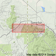
Redescribed type section on east side of Whitewood Creek, 1,200 yards east of junction of U.S. Hwys 14 and 85, sec 13, T5N, R3E, Lawrence Co, SD in the Williston basin. Consists of (ascending): dolomite, silty, buff, massive, 2 ft; dolomite, orange-yellow to olive-brown, medium-crystalline, fossiliferous, 18 ft; dolomite, yellowish-brown to brown, very slightly silty, massive, fossiliferous (cephalopods), 30 ft. Total thickness, 50 ft. Overlain unconformably with an even contact by dolomitic shale of Englewood formation; overlies Roughlock siltstone gradationally. Regional stratigraphic studies indicate that Whitewood represents a southward advance of Trenton-age (upper Middle Ordovician) seas from the paleo-Williston basin. Withdrawal of these same seas likely occurred during lower Upper Ordovician time. Assigned a Middle and Late Ordovician (Trenton to early Richmond) age.
Source: GNU records (USGS DDS-6; Denver GNULEX).
- Usage in publication:
-
- Whitewood formation
- Modifications:
-
- Revised
- Redescribed
- AAPG geologic province:
-
- Williston basin
Summary:
Pg. 9 (fig. 2), 52 (fig. 11); C.G. Carlson, 1958 (1959), Stratigraphy of Deadwood-Winnipeg interval in North Dakota and northwestern South Dakota, 2nd Intl. Williston Basin Symp., p. 20-26. Whitewood formation. Stratigraphically restricted from Butler and others (1955) to include only the top light gray to buff, mottled, medium crystalline, dolomitic limestone beds (their unit E dolomite); essentially = Whitewood formation of McCoy (1952) and Darton and Paige (1925). Overlies Winnipeg formation (revised). Correlative with subsurface Red River formation of North Dakota. Age is Middle Ordovician (Trentonian).
Recognized in Black Hills area, South Dakota.
Source: Publication.
- Usage in publication:
-
- Whitewood dolomite
- Modifications:
-
- Overview
- AAPG geologic province:
-
- Williston basin
- Powder River basin
Summary:
Underlain by Roughlock siltstone of Winnipeg group in northern Black Hills, SD and WY, in Williston and Powder River basins. Middle Ordovician (Trenton) in age, based on correlation with lower part of Red River formation, which, in turn, is correlated with Viola formation of southeastern NE and OK.
Source: GNU records (USGS DDS-6; Denver GNULEX).
- Usage in publication:
-
- Whitewood Formation†
- Modifications:
-
- Abandoned
Summary:
Abandons name in Black Hills, SD and WY, in Williston and Powder River basins, in favor of Red River Formation. States that although the name Whitewood has priority over Red River, name Red River is almost exclusively utilized in subsurface of Williston basin. Name Red River is thus extended to the Black Hills region.
Source: GNU records (USGS DDS-6; Denver GNULEX).

- Usage in publication:
-
- Whitewood Dolomite*
- Modifications:
-
- Areal extent
- AAPG geologic province:
-
- Williston basin
Summary:
Is as much as 60 ft thick in northern Black Hills. Upper contact is unconformable with Englewood Dolomite. Is eroded to south and is not known south of latitude of Nemo, Lawrence Co, SD in the Williston basin. Is of Late Ordovician age. Geologic map.
Source: GNU records (USGS DDS-6; Denver GNULEX).
For more information, please contact Nancy Stamm, Geologic Names Committee Secretary.
Asterisk (*) indicates published by U.S. Geological Survey authors.
"No current usage" (†) implies that a name has been abandoned or has fallen into disuse. Former usage and, if known, replacement name given in parentheses ( ).
Slash (/) indicates name conflicts with nomenclatural guidelines (CSN, 1933; ACSN, 1961, 1970; NACSN, 1983, 2005, 2021). May be explained within brackets ([ ]).