

- Usage in publication:
-
- Wasatch group*
- Modifications:
-
- Original reference
- Dominant lithology:
-
- Clay
- Sand
- AAPG geologic province:
-
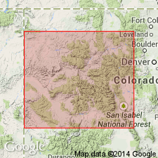
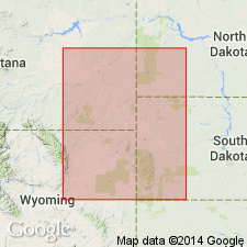
- Uinta uplift
- Wasatch uplift
Summary:
Pg. 191 of 1873 edition. Immediately west of Fort Bridger (Wyoming) commences one of most remarkable and extensive groups of Tertiary beds seen in West. They are wonderfully variegated, some shade of red predominating. This group, to which I have given name Wasatch group, is composed of variegated sands and clays; very little calcareous matter is found in it. In Echo and Weber Canyons (Utah) are wonderful displays of conglomerates, 1,500 to 2,000 feet thick. Although this group occupies vast area and attains thickness of 3,000 to 5,000 feet, yet I have never known any remains of animals to be found in it. I regard it, however, as middle Tertiary age. [Does not explain relations to Green River shales, but assigns both to middle Tertiary and appears to consider them as in part at least equivalent.]
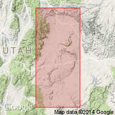
[Named for exposures in Echo and Weber Canyons, Wasatch Mountains, UT.]
Source: US geologic names lexicon (USGS Bull. 896, p. 2277-2278).
- Usage in publication:
-
- Wasatch group*
- Modifications:
-
- Areal extent
- AAPG geologic province:
-
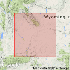
- Uinta uplift
- Wasatch uplift
Summary:
Pg. 147-156. Soon after leaver Carter station [Wyoming] toward the west the Wasatch group of beds come in. They seem to rise from beneath Bridger group. They consist of red indurated arenaceous clays, with beds of grayish and reddish-gray sandstones alternating. Pinkish and purplish clays are dominant features and give lithological character to the groups as far west as Echo Canyon [Utah], where conglomerates prevail. I have included in this group all variegated beds we have observed west of Carter's station.
Source: US geologic names lexicon (USGS Bull. 896, p. 2277-2278).
- Usage in publication:
-
- Wasatch group*
- Modifications:
-
- Not used
- AAPG geologic province:
-
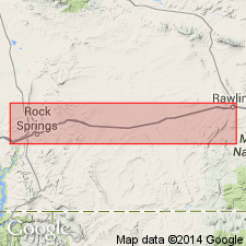
- Green River basin
- Uinta basin
Summary:
Btw. pgs. 435 and 444. Hayden named deposits of western area Wasatch group, and regarded it as synchronous with Green River group of eastern area. Writer has attained same opinion on paleontological grounds and hence has applied name Green River in both areas.
Source: US geologic names lexicon (USGS Bull. 896, p. 2277-2278).
- Usage in publication:
-
- Wasatch group*
- Modifications:
-
- Not used
- AAPG geologic province:
-
- Green River basin
- Uinta basin
Summary:
Map 2 (Green River Basin ) [from advance copy distributed in 1875.] Divided the Tertiary deposits of northeastern Utah and adjacent areas into (descending) Wyoming conglomerate (Pliocene), Uinta (Eocene), Bridger (Eocene), Green River (Eocene), and Vermilion Creek (Eocene).
Source: US geologic names lexicon (USGS Bull. 896, p. 2277-2278).
- Usage in publication:
-
- Wahsatch group*
- Modifications:
-
- Not used
- AAPG geologic province:
-
- Green River basin
- Uinta basin
Summary:
I shall use name Green River group to include also Wahsatch group of Hayden. Cope restricts name to Green River shales. The Wahsatch group and Green River group occupy two distinct basins, but are considered synchronous by Dr. Hayden and Prof. Cope. [This usage of Green River did not prevail, and Peale himself abandoned it in 1878.]
Source: US geologic names lexicon (USGS Bull. 896, p. 2277-2278).
- Usage in publication:
-
- Wasatch group*
- Modifications:
-
- Not used
- AAPG geologic province:
-
- Green River basin
Summary:
Pg. 207-250. Described the Tertiary rocks of Green River region, Bridger Basin, Washakie Basin, and other areas in southwestern Wyoming where Hayden had applied the name Green River group, and divided them as follows (descending): Wyoming conglomerate, Bridger group, Green River group, and Vermilion Creek group.
Source: US geologic names lexicon (USGS Bull. 896, p. 2277-2278).
- Usage in publication:
-
- Wasatch group*
- Modifications:
-
- [Reinstated]
- AAPG geologic province:
-
- Green River basin
Summary:
Pg. 181-185. Wasatch group of Hayden is same as Vermilion Creek group of King, and Wasatch group has priority.
Source: US geologic names lexicon (USGS Bull. 896, p. 2277-2278).

- Usage in publication:
-
- Wasatch group*
- Modifications:
-
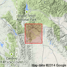
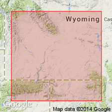
- Areal extent
- AAPG geologic province:
-
- Green River basin
Summary:
Pg. 608. Gave following sequence of Tertiary formations in Green River region (descending): Brown's Park group, Bridger group, Green River group, Wasatch group.
Source: US geologic names lexicon (USGS Bull. 896, p. 2277-2278).

- Usage in publication:
-
- Wasatch group*
- Modifications:
-
- Revised
- AAPG geologic province:
-
- Green River basin
Summary:
Pg. iii-ix. It is probable Wasatch group as now defined and Fort Union group are identical as a whole, or in part at least.
[GNC remark (ca. 1938, US geologic names lexicon, USGS Bull. 896, p. 2277-2278): Although deposits now recognized as belonging to the true Fort Union formation have in the past been included in both Wasatch formation and so-called Laramie formation of southern Wyoming and northwestern Colorado, the Wasatch formation as now recognized overlies Fort Union formation as now interpreted. See under Fort Union formation.]
Source: US geologic names lexicon (USGS Bull. 896, p. 2277-2278).

- Usage in publication:
-
- Wasatch group*
- Modifications:
-
- Not used
- AAPG geologic province:
-
- Green River basin
Summary:
Pg. 339, 353, 355, 360, etc. Vermilion Creek group. Same as Wasatch group of Hayden. A conformable series of fresh-water lake deposits of reddish sandstones, conglomerates, and clays, 0 to 5,000+/- feet thick, unconformably underlying Green River group and unconformably overlying Laramie group (Cretaceous) except at Black Butte, Wyoming, where it is conformable with Laramie. The term Wasatch was originally applied by Hayden to the group of conglomerates and sandstones displayed in Echo Canyon and in the Narrows and at other points in immediate neighborhood of the Wasatch. In attempting to follow his nomenclature in this region [of 40th Parallel Survey] I have been led to reject this name and to apply to these rocks the name Vermilion Creek group, because upon Vermilion Creek [southwestern Wyoming and northwestern Colorado] was exposed the whole thickness of the series, while at the Wasatch the full volume of the group was never seen. Base of Vermilion Creek group is base of Tertiary.
Source: US geologic names lexicon (USGS Bull. 896, p. 2277-2278).
- Usage in publication:
-
- Wasatch [formation]
- Modifications:
-
- Revised
- AAPG geologic province:
-
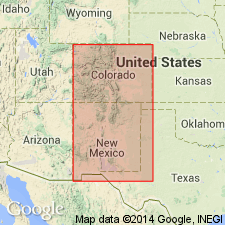
- San Juan basin
Summary:
Pg. 205-207. Estimated thickness of Wasatch beds in New Mexico is about 1,000 feet. Mammalian fossils occur thoughout greater part of vertical range. Lower two-thirds of Wasatch, referred to as Almagre beds (new) and upper horizon, comprising remaining third, the Largo beds (new). Overlies Torrejon formation.
Source: US geologic names lexicon (USGS Bull. 1200, p. 4135-4139).
- Usage in publication:
-
- Wasatch formation*
- Modifications:
-
- Revised
- AAPG geologic province:
-
- Paradox basin
- Uinta basin
- Wasatch uplift
Summary:
Pg. 448-451. Wasatch formation. As recognized in Wasatch Plateau, [notably in Sevier, Sanpete, Emery, and Carbon Counties, central Utah], consists of 3 members --lower member of sandstone, varicolored shale, conglomerate and small amounts of fresh-water limestone, [1,200 to 2,000 feet]; middle member of fresh-water limestone, here called Flagstaff member, [800 to 1,000 feet]; and an upper member of varicolored shale and sandstone. East of Wasatch Plateau, in Book Cliffs, Uinta basin region, the three divisions lose their distinctiveness through wedging out, in many tongues, of the Flagstaff Limestone. [Age is early Tertiary (Paleocene and Eocene).]
Source: US geologic names lexicon (USGS Bull. 1200, p. 4135-4139); supplemental information from GNU records (USGS DDS-6; Denver GNULEX).
- Usage in publication:
-
- Wasatch formation
- Modifications:
-
- Revised
- AAPG geologic province:
-
- Green River basin
Summary:
Wasatch formation. Includes Hiawatha member (new). [Age is early Tertiary (Paleocene and Eocene).]
Source: US geologic names lexicon (USGS Bull. 1200, p. 4135-4139).

- Usage in publication:
-
- Wasatch group*
- Modifications:
-
- Overview
Summary:
According to USGS Bull. 191, 1902, geologists seem to have unanimously adopted Hayden's name Wasatch, instead of King's name Vermilion Creek, and the USGS has discarded latter name. In southwest Wyoming the Wasatch deposits are now called Wasatch group, having been divided by A.C. Veatch (USGS Prof. Paper 56, 1907) into 3 formations (descending) --Knight formation, Fowkes formation, and Almy formation. In other areas they are treated as a single unit and are called Wasatch formation. In southwest Utah the southern development of the Wasatch formation was called "Pink Cliff series" by Dutton.
See under Green River formation for explanation of intertonguing of Green River and Wasatch formations in Moffat County, Colorado, and Sweetwater County, Wyoming.
Named for exposures in Echo and Weber Canyons, Wasatch Mountains, UT.
Source: US geologic names lexicon (USGS Bull. 896, p. 2278).
- Usage in publication:
-
- Wasatch group
- Wasatch formation*
- Modifications:
-
- Biostratigraphic dating
Summary:
Pg. 35-36, pl. 1. Term Wasatch is properly a group. Though usually called a formation, in southwestern Wyoming, especially Uinta County. Early Eocene and (?) Paleocene. By unjustified extensions, term has come to include a wide variety of continental deposits of variegated colors in western North America, of uncertain age, presumed to be early Tertiary, as well as numerous actually dated deposits of Wasatchian age. In spite of its wide use in literature, it is an unfortunate term because the standard "Wasatch faunas" (those of the Bighorn and San Juan basins) occur in formations which are merely called "Wasatch" and the Wasatch group proper is almost without fossil vertebrates. In the Wasatch proper, the La Barge local fauna is equivalent to that of the Lost Cabin, and the Knight fauna to that of the Lysite. Thus, the fossiliferous Wasatch is exactly equivalent, faunally, to the fossiliferous Wind River which, according to most text books and standard manuals, is supposed to overlie it. The exceedingly tentative derminations of the Fowkes as late Paleocene, the Almy as mid-Paleocene, and underlying Evanston as early Paleocene, do not rest on satisfactory evidence. When the "Wasatch fauna" is spoken of, it means in practice one of two things: (1) lower Eocene or Wasatchian of this report or (2) Gray Bull. The latter is difficult to justify because no fauna of Gray Bull age has been found in type Wasatch so that it is not certain that beds of that age are present. Term Canyon Largo group is here resurrected to replace term "San Juan Wasatch" (Holmes, 1877, US Geol. and Geog. Survey Terr. 9th Ann. Rpt. for 1875).
Source: US geologic names lexicon (USGS Bull. 1200, p. 4135-4139).
- Usage in publication:
-
- Wasatch formation
- Modifications:
-
- Areal extent
- AAPG geologic province:
-
- San Juan basin
Summary:
Wasatch formation. Overlying the Nacimiento formation in southern part of San Juan basin, and Animas formation in northern part, is series of gray, tan, and copper-colored conglomerates and sandstones and red and gray clays that, in San Juan basin, for many years has been referred to Wasatch formation. For convenience this usage is continued in present report, with understanding that age limits of beds included in formation are not thereby implied to be same as those included in Wasatch at type locality. Formation occupies all of central part of basin. In part of T. 23 N., R. 1 W., about 1,000 feet stratigraphically above base of formation, is an escarpment capped by a higher horizon of sandstones and conglomerates. Between these higher resistant beds and basal sandstones the lower 1,000 feet of formation consists in large part of soft red and gray clays. Upper part of clays contains the lower faunule division of the Wasatch as recognized by Granger (1914), the Almagre beds. Thickness not less than 2,000 feet. Lower part of formation in northeastern part of basin contains beds of Paleocene age.
Source: US geologic names lexicon (USGS Bull. 1200, p. 4135-4139).
- Usage in publication:
-
- Wasatch group
- Modifications:
-
- Revised
- AAPG geologic province:
-
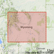
- Wasatch uplift
Summary:
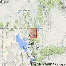
New member recognized at base named the Cowley Canyon member in Cache Co, UT on the Wasatch uplift. Upper part is an unnamed red pebble and cobble conglomerate of brown-weathering calcareous sandstone that averages about 300 ft thick in the Logan quad. Fossil gastropod PHYSA BRIDGENESIS MEEK and PLANORBIS sp. indet. identified. Assigned a Paleocene or early Eocene age. Geologic map.
Source: GNU records (USGS DDS-6; Denver GNULEX).
- Usage in publication:
-
- Wasatch formation
- Modifications:
-
- Revised
- AAPG geologic province:
-
- Green River basin
Summary:
Pg. 62, 64. Wasatch formation. As exposed in south-central Sublette County, the upper Wasatch is divided into two units, Knight member below and New Fork tongue (new). The Knight is stratigraphically succeeded by Green River formation, basal part of which is herein designated Fontenelle formation. [Age is early Tertiary (Paleocene and Eocene).]
Source: US geologic names lexicon (USGS Bull. 1200, p. 4135-4139).
- Usage in publication:
-
- Wasatch group
- Modifications:
-
- Areal extent
- AAPG geologic province:
-
- Uinta basin
Summary:
Pg. 102-106. Wasatch group. Stratigraphic interval between Upper Cretaceous Mesaverde group and Green River formation in Uinta basin was originally referred to by early workers as Wasatch group but later came to be termed Wasatch formation. Spieker (1946) discusses Wasatch problem and in central Utah referred strata formerly assigned to Wasatch formation to North Horn, Flagstaff, and Colton formations. In a later publication, Spieker (1949, Utah Geol. Soc. Gdbk., no. 4) does not use term Wasatch and apparently favors abandoning it, but without offering suitable substitute which can be used on regional basis. Top of Mesaverde group and base of Green River formation are usually readily recognizable horizons in regional mapping; intervening interval will here be designated as Wasatch group. Because lithologic boundaries and time limits do not always coincide, no definite age is assigned to the group other than "Cretaceous-Tertiary transition." As herein defined, Wasatch group may comprise North Horn, Flagstaff, and Colton formations; the 3,500 feet of strata containing the bituminous sandstone deposits at Sunnyside; the several thousand feet of strata assigned to the Wasatch in Piceance Creek basin and adjoining areas in western Colorado; the 780 feet of strata between the Mesaverde and Green River at Ravin Ridge; and Current Creek and Tuscher formations. [Age is early Tertiary (Paleocene and Eocene).]
Source: US geologic names lexicon (USGS Bull. 1200, p. 4135-4139).
- Usage in publication:
-
- Wasatch formation*
- Modifications:
-
- Revised
- AAPG geologic province:
-
- Powder River basin
Summary:
Wasatch formation. In Powder River basin, includes Kingsbury and Moncrief members. Overlies Fort Union formation; underlies White River formation. Base in some areas arbitrarily placed at top of Rowland coal. Age is Eocene.
Source: US geologic names lexicon (USGS Bull. 1200, p. 4135-4139).
- Usage in publication:
-
- Wasatch formation
- Modifications:
-
- Areal extent
- AAPG geologic province:
-
- Piceance basin
Summary:
Wasatch formation. Crops out in relatively broad belt in west-central part of Cathedral Bluffs area [Rio Blanco County, western Colorado]. As defined in this area by Gale (1910, USGS Bull. 415), the formation was believed to include, in its lower part, beds equivalent to Fort Union formation which is of Paleocene age. Paleontological evidence collected by several workers since this early report has demonstrated that lowermost part of formation is of Eocene age. Boundary between Paleocene and Eocene beds is indefinite in Cathedral Bluffs area. Along Cathedral Creek, formation consists mostly of beds of buff sandstone and small amounts of interbedded varicolored shale and clay; to the north, formation consists predominantly of varicolored shale and small amounts of brown sandstone and limestone in lenticular beds. Thickness as much as 371 feet. Contact between Wasatch and overlying Green River (Douglas Creek member) drawn at top of uppermost bed of red shale; near head of Cathedral Creek, boundary drawn directly above uppermost sequence of interbedded thin beds of coal, shale, and redbeds. Overlies Mesaverde formation. Age is Paleocene(?) and Eocene.
Source: Publication; US geologic names lexicon (USGS Bull. 1200, p. 4135-4139).
- Usage in publication:
-
- Wasatch formation*
- Modifications:
-
- Revised
- AAPG geologic province:
-
- Green River basin
Summary:
Pg. 100-103. Wasatch formation. As mapped in this area [central part of Great Divide basin, Sweetwater County, Wyoming], is of early and middle Eocene age. Consists of rocks probably fluviatile and paludal in origin and intertongues throughout most of its vertical extent with rocks of Green River formation. Also intertongues with Battle Spring formation (new). Overlies Fort Union formation. Includes Red Desert and Niland tongues (both new) and Cathedral Bluffs tongue.
Source: US geologic names lexicon (USGS Bull. 1200, p. 4135-4139).
- Usage in publication:
-
- Wasatch formation
- Modifications:
-
- Revised
- AAPG geologic province:
-
- Central Western Overthrust
Summary:
Pg. 128 (table 1), 129, 130. Wasatch formation. In Fossil basin, [Lincoln and Uinta Counties, western Wyoming], overlies Evanston formation and underlies Green River formation. Confusion in original definition of Almy, Fowkes, and Knight formations as subdivisions of Wasatch group, and their areal distribution as mapped in much of Fossil basin, had led to doubt as to validity of these names, especially Almy and Knight. These terms are not included in the Wasatch which is herein termed a formation. Age is Eocene.
Source: US geologic names lexicon (USGS Bull. 1200, p. 4135-4139); Changes in stratigraphic nomenclature, Jan.-June, 1959 (unpub. GNC records, p. 16).
- Usage in publication:
-
- Wasatch Formation*
- Modifications:
-
- Revised
- Age modified
- AAPG geologic province:
-
- Green River basin
Summary:
Divided in the Greater Green River basin of southwest WY into: Chappo Member, of very late Paleocene and earliest Eocene age; a newly named unit at base, La Barge Member of late early Eocene; a newly named unit above Chappo; and a conglomerate member, a peripheral facies deposited on the west side of the basin. Age changed from Eocene to Paleocene and Eocene. These 3 units were formerly designated main body of Wasatch. Conglomerate member is a dark-brown and brick-red interbedded diamictite, conglomerate, sandstone, and mudstone unit. Some blocks in the conglomerate are up to 7 ft long. Fragments in the conglomerate member derived from Madison, Phosphoria, Twin Creek, Thaynes, Nugget, Ankareh and Wells Formations and from some Cretaceous units. Mapped from Slate Creek to north of La Barge. Is at least 1,000 ft thick; may be several thousand ft thick. Of early Eocene age. These strata were assigned to Almy (Paleocene) and Knight (Eocene) Formations by Veatch (1907). Neither Almy nor Knight are considered useful terms in the report area [though neither was abandoned in the report].
Source: GNU records (USGS DDS-6; Denver GNULEX).
- Usage in publication:
-
- Wasatch Formation
- Modifications:
-
- Revised
- AAPG geologic province:
-
- Green River basin
Summary:
Revised in that Nightingale Member assigned as lowermost member of Wasatch. Study area is in area of Rock Springs uplift, Greater Green River basin, WY. Wasatch consists of (ascending): Nightingale Member, Niland Tongue, and Cathedral Bluffs Tongue. Assigns [informal] "Fire Hole Sandstone Facies" to main body of Wasatch in northern part of T15N, R105W, Sweetwater Co. Fire Hole consists of fluviatile red beds. Chart showing previous nomenclature; restored section. Eocene age.
Source: GNU records (USGS DDS-6; Denver GNULEX).
- Usage in publication:
-
- Wasatch Formation*
- Modifications:
-
- Revised
- AAPG geologic province:
-
- Piceance basin
Summary:
Divided into newly named Atwell Gulch Member (Paleocene and Eocene) at base, Molina Member (Eocene), and Shire Member (Eocene) at top in southern Piceance basin. These members had been called the lower, middle and upper members of the Wasatch in earlier reports.
Source: GNU records (USGS DDS-6; Denver GNULEX).
- Usage in publication:
-
- Wasatch Formation*
- Modifications:
-
- Revised
- AAPG geologic province:
-
- Green River basin
Summary:
Used in Fossil basin of Greater Green River basin as defined by Veatch (1907) but subdivided into seven mappable lithologic facies: 1) a local unnamed basal pebble-to-boulder conglomerate member; 2) local lower member; 3) main body; 4) sandstone tongue; 5) mudstone tongue; 6) Bullpen Member (new), at top; and 7) Tunp Member (new) that is at the periphery of the Fossil basin and is equivalent to the members 2-6 in listing. Exposed in much of basin. Includes beds mapped as Almy and Knight by Veatch. Ranges from 1,000 to 2,000 ft thick. Measured sections. Overlies Evanston Formation. Underlies Fowkes Formation. Intertongues with Fossil Butte and Angelo Members, both new, of Green River Formation. Basal and upper parts undated. Assigned to the early Eocene. Fossil charophytes, pollen and spores, ostracods, gastropods, snail, and vertebrates identified. Mostly of alluvial origin but parts are the result of residual weathering, mudflow, rock slide, or deposited in a lake.
Source: GNU records (USGS DDS-6; Denver GNULEX).
- Usage in publication:
-
- Wasatch Formation*
- Modifications:
-
- Revised
- AAPG geologic province:
-
- Paradox basin
Summary:
Restricted in Paradox basin part of report area to beds that unconformably overlie the Pine Hollow Formation and underlie the unnamed Oligocene? white tuffaceous sandstone. Formerly included rocks newly named Pine Hollow and the older Canaan Peak Formation. Divided into pink limestone member, at base of Paleocene and early Eocene age, white limestone member of early or middle Eocene age, and variegated sandstone member of Eocene age. Fresh-water mollusks of early to middle Eocene age found in white limestone member.
Source: GNU records (USGS DDS-6; Denver GNULEX).
- Usage in publication:
-
- Wasatch Formation*
- Modifications:
-
- Age modified
- Biostratigraphic dating
- AAPG geologic province:
-
- Powder River basin
Summary:
Fort Union-Wasatch boundary is noted to have been placed at several horizons by various investigators. Present work makes no recommendations regarding placement of Fort Union-Wasatch boundary; rather it presents palynological data pertaining to recognition of Paleocene-Eocene boundary. Palynological data is presented in framework of the principal coal beds of study interval exposed in Sheridan, Campbell, and Converse Cos, WY in Powder River basin. Presents additional data from Delson's (1971) vertebrate quarries in Johnson Co, WY; Holmes coal, Big Horn Co, MT; and Golden Valley Formation, Mercer and Dunn Cos, ND. Three pollen assemblage zones are recognizable in interval from Wall coal zone up to Scott coal zone: zone X (Paleocene) includes Wall, Canyon, Anderson (Wyodak), and Smith coals; zone Y (younger Paleocene) includes Arvada coal strata at least as high as 100 ft below Felix coal; and zone Z (Eocene) includes Felix coal and strata at least as high as 79 ft below Scott coal. Both vertebrate and palynological data indicate that faunal and floral changes do not coincide with Fort Union-Wasatch formational contact. About the lower 300 ft of Wasatch is Paleocene in vicinity of Delson's vertebrate quarries. Biostratigraphic dating based on palynological evidence suggests that Paleocene-Eocene boundary in Powder River basin can be reasonably defined by first appearance of PLATYCARYA group pollen flora (zone Z assemblage).
Source: GNU records (USGS DDS-6; Denver GNULEX).
- Usage in publication:
-
- Wasatch Formation
- Modifications:
-
- Revised
- AAPG geologic province:
-
- Green River basin
- Yellowstone province
Summary:
Divided in the report area, Sublette and Teton Cos, Greater Green River basin and Yellowstone province, respectively, WY into Chappo Member and Lookout Mountain Conglomerate Member (new). The rocks assigned to the Chappo in this report were identified as part of the Hoback Formation in earlier reports. Rocks assigned to the newly named Lookout Mountain were assigned to the Pass Peak Formation in earlier reports. Geologic maps. Fence diagram. Chappo is about 600 m thick. Lookout Mountain is at least 600 m thick. Wasatch overlies and intertongues with the Hoback. Both members intertongue with, and locally Chappo underlies, the Pass Peak. The Lookout Mountain is not overlain by younger sediments. Of earliest Eocene age.
Source: GNU records (USGS DDS-6; Denver GNULEX).
- Usage in publication:
-
- Wasatch Formation*
- Modifications:
-
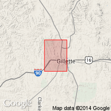
- Age modified
- AAPG geologic province:
-
- Powder River basin
Summary:
Age modified to Paleocene and Eocene in Campbell Co, WY, Powder River basin. Wasatch divided into three informal units. Lower unit: lower contact not exposed, however, on geophysical logs and in adjacent Gillette East quad is mapped at top of Wyodak coal; 100-200 ft thick; and is in Paleocene Y palynological zone of Tschudy (1976). Middle unit: lower contact is unconformable with lower unit and is mapped at base of medium- to very coarse-grained sandstone; 200-350 ft thick; and is in Paleocene Y palynological zone of Tschudy. Upper unit: lower contact is at top of medium- to coarse-grained sandstone 0-20 ft below Felix coal bed but is mapped coincident with base of Felix; 450 ft is exposed in quad; and is in Eocene Z palynological zone of Tschudy.
Source: GNU records (USGS DDS-6; Denver GNULEX).
- Usage in publication:
-
- Wasatch Formation
- Modifications:
-
- Revised
- Overview
- AAPG geologic province:
-
- Green River basin
Summary:
A unit formerly called upper tongue of Wasatch Formation named Desertion Point Tongue of Wasatch along the western margin of Green River basin. The formation is also in the Hoback, Great Divide, and Washakie basins which with Green River basin comprise Greater Green River basin. The surrounding basin margins were the main sediment source. Divisible into redbed fluviatile, pediment, and non-red fluviatile-paludal facies. Separated into Niland, New Fork, Cathedral Bluffs, and Desertion Point Tongues, and the main body. Intertongues with Green River Formation. Intertongues and underlies Bridger Formation. Deposited on an alluvial plain. The variegated red color and the lack of volcanic sediments in Wasatch separate it from Bridger.
Source: GNU records (USGS DDS-6; Denver GNULEX).
- Usage in publication:
-
- Wasatch Formation*
- Modifications:
-
- Revised
- AAPG geologic province:
-
- Piceance basin
Summary:
Section 63+ m thick in Long Point quad, formerly called Shire Member of Wasatch Formation assigned to Cow Ridge Member (new) of Green River Formation. Underlies the newly named Long Point Bed of the Garden Gulch, or of the Anvil Points, or of the Douglas Creek Members of the Green River Formation. Remains an Eocene unit.
Source: GNU records (USGS DDS-6; Denver GNULEX).
- Usage in publication:
-
- Wasatch Formation*
- Modifications:
-
- Revised
- AAPG geologic province:
-
- Paradox basin
- Piceance basin
Summary:
A matrix-supported quartz-pebble conglomerate, conglomeratic sandstone, and sandstone called the Dark Canyon sequence, is recognized at the base of the Wasatch from about 10 mi east of the Green River, Grand Co, UT, Paradox basin, east to Douglas Pass, Garfield Co, Piceance basin [in the Uinta basin of authors]. Sequence ranges 60 to 100 ft thick in west part of area; east of Westwater Canyon in Grand Co, it is 25 to 35 ft thick at most localities. Sequence unconformably overlies Cretaceous rocks. The unconformity represents as much as 15 m.y. The sequence is overlain by main body of Wasatch in its western outcrop area. West of the Green River, the North Horn Formation and Flagstaff Limestone are equivalent to part of the main body. Wasatch is thinner and younger east indicating onlap onto the Douglas Creek arch. The decrease in grain size vertically and from east to west in the Dark Canyon indicates decreasing flow strength through time and in that direction. Dark Canyon could be middle Paleocene age; main body is Eocene age.
Source: GNU records (USGS DDS-6; Denver GNULEX).
- Usage in publication:
-
- Wasatch Formation*
- Modifications:
-
- Biostratigraphic dating
- AAPG geologic province:
-
- Uinta uplift
Summary:
The lower 200-300 m of the Wasatch Formation contains palynomorphs of zones P5 and P6 of Paleocene age. The pollen were recovered in 3 localities in Summit Co, UT on the Uinta uplift. Is about 1,500 m thick in the Mountain Dell-Porterville area and about 1,200 m thick north of the Uinta Mountains.
Source: GNU records (USGS DDS-6; Denver GNULEX).
- Usage in publication:
-
- Wasatch Formation*
- Modifications:
-
- Revised
- AAPG geologic province:
-
- Powder River basin
Summary:
Is formation mapped in Johnson, Sheridan, and Campbell Cos, WY and Big Horn and Powder River Cos, MT in Powder River basin. Main body of Wasatch overlies Kingsbury Conglomerate Member of Wasatch along the mountain front; elsewhere it unconformably overlies Tongue River Member (revised) of the Fort Union Formation (revised). Wasatch is distinguished from Fort Union on basis of: 1) sandstone of the Wasatch is coarser grained and has broader grain size variation than the Fort Union; 2) characteristically weathers buff to tan, while Fort Union varies from light gray to somber shades of gray; 3) brown-weathering, calcareous, iron-rich, cauliflower shaped concretions are most common in the Fort Union, and are generally absent from the Wasatch; 4) heavy minerals in the Wasatch are dominated by sphene, epidote, and garnet in contrast to tourmaline and a pinkish-violet variety of zircon in the Fort Union, and 5) minor accessory minerals in the Wasatch are apatite, epidote, and biotite compared to chloritoid, staurolite, and rutile in the Fort Union. For purposes of this map (and others in same series), the lower contact of the Wasatch is revised downward 200-300 ft from that of most previous mappers in the basin. Strata below the top of Baker's (1929) Roland coal bed are referred to as lower part of Wasatch, while strata above it are called upper part. Authors think the age may only be Eocene. [No age change is considered on basis of this report.]
Source: GNU records (USGS DDS-6; Denver GNULEX).
- Usage in publication:
-
- Wasatch Formation*
- Modifications:
-
- Biostratigraphic dating
- AAPG geologic province:
-
- Paradox basin
Summary:
Two divisions of Wasatch described--Dark Canyon sequence and main body. Presence of pollen species MOMIPITES WALTMANENSIS indicates an early but not earliest Paleocene age for the Dark Canyon sequence at the base of the Wasatch. Age of late early Paleocene assigned to Dark Canyon. A hiatus of 6? m.y. during which erosion and nondeposition occurred may separate Dark Canyon from the main body. In Dark Canyon CARYAPOLLENITES VERIPITES, the pollen species, indicates a late Paleocene age for the basal part of the main body. Upper Eocene part of main body not studied. Western pinchout of the Dark Canyon is about 10 mi east of the Green River, and it thickens rapidly eastward to 150 ft in less than 15 mi. East of Westwater Canyon in Grand Co, UT, the sequence thins and is rarely more than 25 to 35 ft thick. Isolated remnants of the Dark Canyon are present near the CO-UT line. The main body thins and is younger from east to west. Measured sections; correlation chart. Area studied includes the Tuscher, Sego, and Cottonwood Canyons, and Bitter Creek, Grand Co, UT in the Paradox basin.
Source: GNU records (USGS DDS-6; Denver GNULEX).
- Usage in publication:
-
- Wasatch Formation*
- Modifications:
-
- Biostratigraphic dating
- AAPG geologic province:
-
- Piceance basin
Summary:
Biostratigraphic dating based on fossil palynomorphs for USGS paleobotany locality D4626--about 60 ft below top of dark shale facies (middle part of Wasatch)--indicate an Eocene age. Palynomorphs from locality D4636--just above base of formation--indicate a late Paleocene age. Palynomorphs from locality D4775--about 80 ft above base of formation--indicate latest Paleocene age. Fossil list. Fossil localities are in Rio Blanco Co, CO in Piceance basin. Same author, in previous studies (GQ-1131, 1973 and GQ-1195, 1974) assigned same ages as above to formation; however, fossils not listed.
Source: GNU records (USGS DDS-6; Denver GNULEX).
- Usage in publication:
-
- Wasatch Formation*
- Modifications:
-
- Biostratigraphic dating
- AAPG geologic province:
-
- Piceance basin
Summary:
Pollen (genera MOMIPITES and CARYAPOLLENITIES) recovered near Cretaceous-Tertiary unconformity in NW sec 13, T3S, R103W (USGS paleobotany location D5237-C) indicates late Paleocene age for base of Wasatch (D.J. Nichols, written communication, 1987).
Source: GNU records (USGS DDS-6; Denver GNULEX).
- Usage in publication:
-
- Wasatch formation*
- Modifications:
-
- Revised
- AAPG geologic province:
-
- Green River basin
Summary:
Alkali Creek Tongue of Wasatch Formation named. At its type in the western part of Greater Green River basin, Alkali Creek overlies Farson Sandstone Member (new) of Green River Formation and underlies Wilkins Peak Member of Green River. Rocks called Alkali Creek were assigned to New Fork Tongue of Wasatch in earlier reports. New Fork Tongue not used. To north where Wilkins Peak is missing, Alkali Creek overlain by Cathedral Bluffs Tongue of Wasatch. Cathedral Bluffs extended to western Greater Green River basin replacing use of Desertion Point Tongue of Wasatch. Wasatch is assigned an early and middle Eocene age; LAMBDOTHERIUM was found 95 ft below top of main body in sec 25, T24N, R101W; NOTHARCTUS was found 42 ft above base of Cathedral Bluffs Tongue in sec 25, T25N, R102W; HYRACOTHERIUM found near Cathedral Bluffs-Wilkins Peak contact in sec 24, T12N, R99W; these fossils are early Eocene perissodactyle. Stratigraphic diagrams.
Rocks formerly assigned to gray zone of Wasatch Formation (McKay, Bergin, 1974, USGS, GQ-1145) reassigned to Godiva Rim Member (new) of Green River Formation in area from central Sand Wash basin, Moffat Co, CO into adjoining WY on east side of Washakie basin in Greater Green River basin. The gray zone was a 200 ft thick gray claystone and siltstone, and gray and buff sandstone at top of Wasatch above Cathedral Bluffs Tongue of Wasatch and below Laney Member of Green River. Gray zone equivalent across WY state line mapped as basal unnamed tongue of Laney (Roehler, 1985, USGS, I-1615), and to intertongued Laney and Cathedral Bluffs unit. Of early and middle Eocene age. Cross section.
Source: GNU records (USGS DDS-6; Denver GNULEX).
- Usage in publication:
-
- Wasatch Formation
- Modifications:
-
- Overview
Summary:
Charts 22, 24, 25, 26, 27, 28, 29, 30, 31, 32, 72, 73, 75, 76, 80. Wasatch Formation. Recognized in northeastern Utah. p. 72-73.
Source: Publication.
For more information, please contact Nancy Stamm, Geologic Names Committee Secretary.
Asterisk (*) indicates published by U.S. Geological Survey authors.
"No current usage" (†) implies that a name has been abandoned or has fallen into disuse. Former usage and, if known, replacement name given in parentheses ( ).
Slash (/) indicates name conflicts with nomenclatural guidelines (CSN, 1933; ACSN, 1961, 1970; NACSN, 1983, 2005, 2021). May be explained within brackets ([ ]).