

- Usage in publication:
-
- Wading Branch formation*
- Modifications:
-
- Named
- Dominant lithology:
-
- Claystone
- Siltstone
- Sandstone
- AAPG geologic province:
-
- Piedmont-Blue Ridge province
Summary:
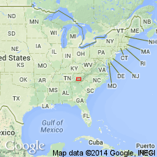
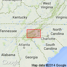
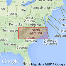
Named as formation in Walden Creek group in Ocoee series. Named for Wading Branch Ridge, west of Pigeon River, about 5 mi southeast of Waterville, Haywood Co., western NC. Type locality is somewhat north along the river, 4.5 mi southeast of Waterville. Occurs from that area southwestward through several outcrop belts as far as Cherokee, NC. Consists of medium-bedded, dark, clastic rocks, including sandy, argillaceous rocks, siltstone, and coarse, pebbly, feldspathic sandstone. Coarse rocks are poorly sorted, have a dark micaceous matrix, and are somewhat graded. A distinctive basal unit, generally 1,000 ft thick, represents reworked residual clay and is exposed throughout the formation. Thickness of whole formation is about 1,500 ft. Unconformably overlies granitic and gneissic rocks (Max Patch granite of Keith); conformably and abruptly underlies Longarm quartzite. Report includes correlation chart and geologic map. Age is later Precambrian.
Source: GNU records (USGS DDS-6; Reston GNULEX).

- Usage in publication:
-
- Wading Branch Formation
- Modifications:
-
- Overview
- AAPG geologic province:
-
- Appalachian basin
Summary:
In Unaka Mountains, used as Precambrian Wading Branch Formation of Snowbird Group of Ocoee Supergroup.
Source: GNU records (USGS DDS-6; Reston GNULEX).
- Usage in publication:
-
- Wading Branch Formation*
- Modifications:
-
- Areal extent
- Overview
- AAPG geologic province:
-
- Appalachian basin
- Piedmont-Blue Ridge province
Summary:
Included in Snowbird Group of Ocoee Series. Mapped in Blue Ridge belt northwest of Greenbrier-Devils Fork fault in Cocke Co., eastern TN, and in Haywood and Madison Cos., northwestern NC. Consists of fine- to very coarse-grained graywacke, in graded beds 1 to 3 ft thick, interbedded with dark sandy slate or schist; contains prominent basal unit 100 ft thick or less, consisting of pale-green or silvery-gray phyllite or quartzose mica schist locally containing abundant, well-rounded fragments. Southeast of Greenbrier-Devils Fork fault, mapped together with Roaring Fork Sandstone and Longarm Quartzite, both of Snowbird Group, in Swain and Haywood Cos., NC. Combined units consist of mostly light-colored feldspathic quartzite or metasandstone and interbedded dark quartz-feldspar-mica schist; contains basal unit of micaceous phyllite or schist with rare quartz-pebble conglomerate. Age is late Precambrian.
Source: GNU records (USGS DDS-6; Reston GNULEX).
- Usage in publication:
-
- Wading Branch Formation
- Modifications:
-
- Overview
- AAPG geologic province:
-
- Piedmont-Blue Ridge province
Summary:
In Blue Ridge belt, used as Late Proterozoic Wading Branch Formation of Snowbird Group of Ocoee Supergroup.
Source: GNU records (USGS DDS-6; Reston GNULEX).
For more information, please contact Nancy Stamm, Geologic Names Committee Secretary.
Asterisk (*) indicates published by U.S. Geological Survey authors.
"No current usage" (†) implies that a name has been abandoned or has fallen into disuse. Former usage and, if known, replacement name given in parentheses ( ).
Slash (/) indicates name conflicts with nomenclatural guidelines (CSN, 1933; ACSN, 1961, 1970; NACSN, 1983, 2005, 2021). May be explained within brackets ([ ]).