

- Usage in publication:
-
- Viola limestone*
- Modifications:
-
- Named
- Dominant lithology:
-
- Limestone
- Chert
- AAPG geologic province:
-
- Ouachita folded belt
- South Oklahoma folded belt
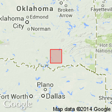
Summary:
Named for village of Viola, Johnson Co, OK, South Oklahoma folded belt province. No type locality designated. Occurs in northwestern part of Atoka quad in Johnston and Atoka counties. Forms low ridges and hills. Is a massive white and bluish limestone with chert or flint concretions in the lower and middle portion. Is largely fine textured but with some beds coarsely crystalline; other beds composed chiefly of shell fragments. Thickness is 700 ft. At base gradual transition from underlying Simpson formation (new); at top overlain by Sylvan shale (new) with abrupt change in lithology. Geologic map. Columnar section. Age determined by fossils is early Silurian (Ordovician). Correlates to east with Stringtown shale, Talihina chert, Standley shale, Jackfork sandstone.
Source: GNU records (USGS DDS-6; Denver GNULEX).

- Usage in publication:
-
- Viola limestone*
- Modifications:
-
- Areal extent
- AAPG geologic province:
-
- Anadarko basin
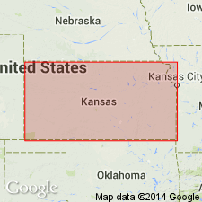
Summary:
Extended into the subsurface of Baca County, Colorado, in the Anadarko basin. Is a cream-colored, partly green-stained, finely crystalline limestone, about 10 feet thick. Contains abundant white chert and small amount of greenish-white dense pyritic chert. Overlies Simpson(?) group (undivided) and underlies Misener sand. Age is Ordovician. Report includes correlation chart.
Source: Modified from GNU records (USGS DDS-6; Denver GNULEX).
- Usage in publication:
-
- Viola Limestone
- Modifications:
-
- Overview
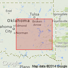
Summary:
(Paleozoic Era; [Cambrian through Mississippian Systems] by E.D. Goebel, p. 15.) Viola Limestone of Simpson Group. The Viola Limestone of Kansas, which represents only part of the Viola of Oklahoma, consists of dolomite and limestone strata containing some cherty beds characterized by black flecks and spicular and tubelike fragments of micro-organisms. In deep parts of the North Kansas basin, the carbonate rocks of the Viola are dominantly dolomite, but toward margins of the basin earthy and granular limestone beds are present, especially at the base. There is an unconformity between Viola and Platteville rocks in Kansas (Lee, 1956) [Kansas Geol. Survey Bull., no. 121, 167 p.]. The Viola occurs throughout the State except in places on the Central Kansas uplift, in northwestern Kansas, on the Chautauqua arch, and on the northern end of the Nemaha anticline. In the Hugoton embayment it is overlain unconformably by Mississippian rocks and oversteps underlying Simpson Group and older rocks eastward (Merriam and Atkinson, 1955) [Kansas Geol. Survey Oil and Gas Inv., no. 13, 28 p.] and westward (Maher and Collins, 1949) [USGS Oil and Gas Inv. Prelim. Map, no. 101]. In eastern Kansas the Viola is 310 feet thick (Washington County), and it thins southward to 20 feet in Harvey County. In southwestern Kansas, where it is difficult to discern from Arbuckle rocks, the Viola thickens from 0 feet to more than 200 feet in the deepest part of the Hugoton embayment at the Oklahoma state line. Age is Middle Ordovician.
Source: Publication.
- Usage in publication:
-
- Viola Group
- Modifications:
-
- Revised
Summary:
[Reference from GNC index card files. Not synopsized to date.]
Source: NA
For more information, please contact Nancy Stamm, Geologic Names Committee Secretary.
Asterisk (*) indicates published by U.S. Geological Survey authors.
"No current usage" (†) implies that a name has been abandoned or has fallen into disuse. Former usage and, if known, replacement name given in parentheses ( ).
Slash (/) indicates name conflicts with nomenclatural guidelines (CSN, 1933; ACSN, 1961, 1970; NACSN, 1983, 2005, 2021). May be explained within brackets ([ ]).