


- Usage in publication:
-
- Trenton Group*
- Modifications:
-
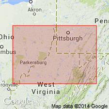
- Areal extent
- AAPG geologic province:
-
- Appalachian basin
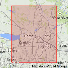
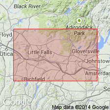
Summary:
Paleozoic cover sequence adjacent to Adirondack massif in western part of Glens Falls quad consists of (ascending): Late Cambrian Potsdam Sandstone, Late Cambrian Ticonderoga Formation, Late Cambrian and Early Ordovician Beekmantown Group (with Whitehall Formation at base), early Middle Ordovician Chazy Group, Middle Ordovician Black River and Trenton Groups, and Mohawk Valley shales (Canajoharie Shale and Snake Hill Formation). Succession is interpreted as a platform sequence.
Source: GNU records (USGS DDS-6; Reston GNULEX).
- Usage in publication:
-
- Trenton Group
- Modifications:
-
- Overview
- AAPG geologic province:
-
- Appalachian basin
Summary:
Middle Trenton strata examined primarily in this report. Authors feel that a refined, unified Trenton stratigraphy, in which stratigraphic units are bounded by key event beds and lithologic deviations is essential. They apply a modified version of Kay's (1968) stratigraphic nomenclature. Middle Trenton units discussed in this paper are ascending, Sugar River Limestone and Denley Limestone. Steuben and Hillier Limestones of the upper Trenton are discussed briefly. Rathbun Member occurs at the top of the Sugar River. Denley is subdivided into Poland, Russia, and Rust Members. City Brook bed (new, informal) marks the base of the Poland Member; Russia is subdivided into informally named Wolf Hollow, Brayton Corners, and High Falls divisions. Base of the Wolf Hollow is marked by the North Gage Road bed (new, informal). Contact of Utica Shale with progressively older Trenton units toward the east is here named the Thruway Discontinuity. Disappearance of upper Denley and Steuben Limestones attributed to erosion before deposition of Utica black muds.
Source: GNU records (USGS DDS-6; Reston GNULEX).
- Usage in publication:
-
- Trenton ("Martinsburg") Formation
- Modifications:
-
- Overview
- AAPG geologic province:
-
- Appalachian basin
Summary:
"Martinsburg" is used parenthetically following Trenton Formation in most instances throughout the text. Author explains that the name Martinsburg was originally given to strata exposed in the Massanutten synclinorium near Martinsburg, WV, where the unit is a flysch sequence of basinal calcareous and argillaceous turbidites. However, many geologists have used that name to refer to thin-bedded fossiliferous strata that occur between the Eggleston or Bays Formation and the Reedsville in southwest VA and nearby areas. In VA, use of the name Martinsburg should be restricted to the turbidites in the Massanutten synclinorium. Although the Trenton ("Martinsburg") Formation terminology is used in this report for strata overlying the Eggleston and Bays Formations, author would prefer a more suitable name such as Dolly Ridge Formation of Trenton Group (Perry, 1972) in this region. [Author does not explain why he uses Trenton ("Martinsburg") Formation if he prefers other nomenclature.]
Source: GNU records (USGS DDS-6; Reston GNULEX).
- Usage in publication:
-
- Trenton Group*
- Modifications:
-
- Age modified
- AAPG geologic province:
-
- Appalachian basin
Summary:
In section C-C' the Trenton Group is primarily Middle Ordovician (Rocklandian to Shermanian) based on brachiopods, trilobites, conodonts, and graptolites from outcrops and drillholes in PA and OH. In the Rome trough, however, the Antes Shale of the Trenton Group steps up section and most likely ranges into the Upper Ordovician (early Edenian). [This refutes Ryder (1992, USGS Misc. Inv. Series Map, I-2264; 1992, USGS Bull.1839-G, p. G1-G25) where an early Edenian age was assigned to the Antes in central PA and WV.]
Source: GNU records (USGS DDS-6; Reston GNULEX).
- Usage in publication:
-
- Trenton Group*, Limestone*
- Modifications:
-
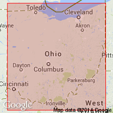
- Revised
- Areal extent
- Age modified
- AAPG geologic province:
-
- Appalachian basin
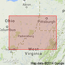
Summary:
In cross section E-E', in the subsurface of central WV and western VA, Trenton Group used for a sequence of limestone and gray to black shale. Follows usage of Wagner (1966), Cardwell and others (1968; State map), and Perry (1971, 1972). Includes Nealmont Limestone and Dolly Ridge Formation in WV but restricts them to vicinity of Allegheny structural front in eastern WV. From Allegheny front to Rome trough, Trenton Group informally subdivided into a lower unnamed limestone and an upper unnamed argillaceous limestone. West of Rome trough in WV, Trenton Group includes lower unnamed limestone and Antes Shale. In VA, between North Mountain fault block and Blue Ridge, replaced by Martinsburg Formation; Trenton Group correlates with lower one half to two thirds of Martinsburg. In OH, lower part of the sequence is called Trenton Limestone; upper part is called Utica Shale. Age is Middle and Late Ordovician (Rocklandian through early Edenian) in WV based on fossils; same for correlative units in OH. [This age assignment subsequently refuted by Ryder and others, 1992, USGS Bull.1839-K, p. K1-K32.]
Source: GNU records (USGS DDS-6; Reston GNULEX).
- Usage in publication:
-
- Trenton Group*
- Modifications:
-
- Revised
- Age modified
- AAPG geologic province:
-
- Appalachian basin
Summary:
In cross section D-D', in the subsurface of PA and WV, Trenton Group is used for a sequence of limestone and gray to black shale. In PA, consists of an unnamed limestone equivalent to the Nealmont Limestone, Salona Limestone, Coburn Limestone of Kay (1944), and the Antes Shale. Kay (1944) assigned a Middle Ordovician age to the Trenton Group; the age is here revised to Middle and Late Ordovician because Sweet and Bergstrom (1976) reassigned the Antes Shale and the uppermost part of the Coburn Limestone to a Late Ordovician age. In WV, Trenton Group consists of the Nealmont Limestone (correlated by Ryder, 1992a with the Nealmont, Salona, and Coburn Limestones of Kay, 1944) and the Dolly Ridge Formation. This usage follows Perry (1972). The Nealmont Limestone as defined by Perry (1972) is here assigned a Middle and Late Ordovician age as was done by Sweet and Bergstrom (1976). The Dolly Ridge Formation is assigned a Late Ordovician age because it correlates with the Antes Shale as revised by Sweet and Bergstrom (1976). Trenton Group in WV is also Middle and Late Ordovician. [This age assignment subsequently refuted by Ryder and others, 1992, USGS Bull.1839-K, p. K1-K32.] On cross section in PA, Trenton Group is labeled as Trenton Group of Kay (1944) and in WV as Trenton Group of Perry (1972) for the convenience of the reader, not to show rejection of usage by USGS.
Source: GNU records (USGS DDS-6; Reston GNULEX).
- Usage in publication:
-
- Trenton Limestone
- Modifications:
-
- Overview
- AAPG geologic province:
-
- Appalachian basin
Summary:
According to traditional time-rock classification of North America, the entire Champlainian Series (represented by the Wells Creek Formation through the Trenton Limestone) has always been regarded as Middle Ordovician. The COSUNA charts, however, based on the global system of time-rock classification of European strata assigned most Champlainian-age rocks to the Late Ordovician. Authors of this report do not agree with the assignments of the COSUNA charts and continue to consider the Black River Group and the Trenton Limestone as Middle Ordovician.
Source: GNU records (USGS DDS-6; Reston GNULEX).
- Usage in publication:
-
- Trenton Group
- Modifications:
-
- Overview
- AAPG geologic province:
-
- Appalachian basin
Summary:
Revised stratigraphic correlations based on reinterpretation of graptolites and K-bentonites in the area suggest that the lower part of the Utica Shale is the lateral equivalent of a large part of the lower Trenton Group and is older than the Denley Limestone, with which it has been previously equated. Authors state that it is not yet clear exactly how much of the lower Trenton Group is equivalent to the lower part of the Utica Shale, which is named the Flat Creek Member in this report. The member lies between the Glens Falls Limestone of the Trenton below and the Dolgeville Formation above in the central Mohawk Valley. Diagram shows the Flat Creek interfingering with the Sugar River Limestone of the Trenton Group near East Canada Creek. The Indian Castle Member (a new name proposed for that upper part of the Utica overlying the Dolgeville Formation) interfingers with the Rust Member of the Denley Limestone between Wolf Hollow Creek and Trenton Falls. The Utica youngs westward and near Trenton Falls oversteps the Steuben and Denley Limestones at the top of the Trenton Group. In the study area, the Trenton ranges in age from Rocklandian to Edenian, while the base of the Utica is Kirkfieldian in the central region and the top reaches the Maysvillian in the western region.
Source: GNU records (USGS DDS-6; Reston GNULEX).
For more information, please contact Nancy Stamm, Geologic Names Committee Secretary.
Asterisk (*) indicates published by U.S. Geological Survey authors.
"No current usage" (†) implies that a name has been abandoned or has fallen into disuse. Former usage and, if known, replacement name given in parentheses ( ).
Slash (/) indicates name conflicts with nomenclatural guidelines (CSN, 1933; ACSN, 1961, 1970; NACSN, 1983, 2005, 2021). May be explained within brackets ([ ]).