

- Usage in publication:
-
- Tecovas formation*
- Modifications:
-
- Named
- Dominant lithology:
-
- Shale
- AAPG geologic province:
-
- Amarillo arch
- Palo Duro basin
Summary:
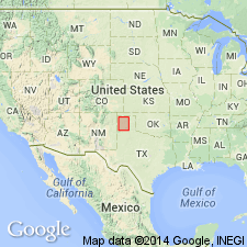
Pg. 20-29. Tecovas Formation of Dockum Group. Name proposed for the basal formation of the Dockum Group (rank raised). Occurs in Palo Duro Canyon and along the Canadian River, in the Panhandle of Texas, on the Amarillo arch and in Palo Duro basin. Consists largely of shales. Divided into 2 parts: lower part is more or less sandy shale, chiefly maroon, lavender, yellow, and white; upper part dark-red or magenta shale. Lower part has three sharply marked zones: lower zone of white, gray, or lavender color; middle zone of maroon or wine color; upper zone of light-yellow or sulphur-yellow. Thickness 90 to 220 feet. Thickness varies at different localities: is 197 [and/or/to?? 200] feet thick in Palo Duro Canyon; 90 feet thick along Canadian River; 67 to 95 feet thick along West Amarillo Creek; 190 feet thick on North Branch of North Canyon of Cita Creek; 90 feet thick on Trujillo Creek, 185 feet thick at mouth of Timber Creek. Unconformably overlies Quatermaster Formation (Permian) and underlies Trujillo Formation (new) of Dockum Group. Report incl. geologic map (Dockum mapped undivided); cross sections; measured sections. Age is Triassic.
Type locality not designated. Named from exposures on Tecovas Creek, Potter Co., panhandle of TX.
Source: US geologic names lexicon (USGS Bull. 896, p. 2122); supplemental information (in brackets) from GNU records (USGS DDS-6; Denver GNULEX).
- Usage in publication:
-
- Tecovas Formation
- Modifications:
-
- Areal extent
- Mapped 1:250k
- Dominant lithology:
-
- Shale
- Clay
- Siltstone
- Sand
- AAPG geologic province:
-
- Palo Duro basin
- Amarillo arch
Summary:
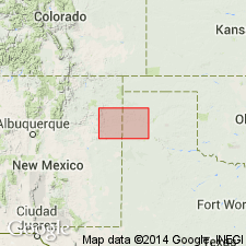
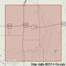
Is Upper Triassic formation in Dockum Group, mapped east of vicinity of NM-TX State line along Canadian River drainage in eastern Quay Co, NM, Oldham and southern Hartley Cos, TX (Palo Duro basin), and western Potter and southwesternmost Moore Cos, TX (Amarillo arch). Overlies Quartermaster Formation (Permian); overlain by Trujillo Formation (Upper Triassic) of Dockum Group. Map unit described as shale, clay, siltstone, and sand. Shale, clay, and siltstone, sandy in places, micaceous, calcareous locally, reddish-brown, various shades of red, maroon, gray, greenish-gray, yellow, and purple. Sand, fine- to medium-grained quartz; locally large petrified logs, unconsolidated, massive, lenticular, white, light-gray. Thickness 125 ft.
Source: GNU records (USGS DDS-6; Denver GNULEX).
- Usage in publication:
-
- Tecovas Formation
- Modifications:
-
- Biostratigraphic dating
- AAPG geologic province:
-
- Permian basin
Summary:
Ostracods have not been reported previously from Tecovas in TX. Three ostracode species found in clay-pebble conglomerate in lower part of formation along Home Creek near Kalgary, Crosby Co., TX in the Permian basin. One is a species of DARWINULA, one of GERDALIA, and one is unidentified. The fauna resembles faunas found in the Bluewater Creek Member of Chinle in central NM and in Monitor Butte Member of Chinle in UT. These ostracodes are of late Carnian age. They indicate a limnic environment. Each species described and pictured.
Source: GNU records (USGS DDS-6; Denver GNULEX).
For more information, please contact Nancy Stamm, Geologic Names Committee Secretary.
Asterisk (*) indicates published by U.S. Geological Survey authors.
"No current usage" (†) implies that a name has been abandoned or has fallen into disuse. Former usage and, if known, replacement name given in parentheses ( ).
Slash (/) indicates name conflicts with nomenclatural guidelines (CSN, 1933; ACSN, 1961, 1970; NACSN, 1983, 2005, 2021). May be explained within brackets ([ ]).