

- Usage in publication:
-
- Stockbridge limestone
- Modifications:
-
- Named
- Dominant lithology:
-
- Limestone
- Marble
- AAPG geologic province:
-
- New England province
Summary:
Named for quarries near Stockbridge and Old West Stockbridge, western MA. Consists of white, clouded, and variously colored, coarse, granular limestone. Known commercially as Stockbridge marble and used as building stone. Assigned as the second bed of limestone in the Taconic system. Separated from the underlying first bed of limestone by magnesian slate and from overlying third bed by granular quartz rock.
Source: GNU records (USGS DDS-6; Reston GNULEX).
- Usage in publication:
-
- Stockbridge limestone
- Modifications:
-
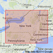
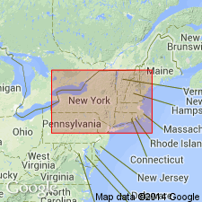
- Areal extent
- Age modified
- AAPG geologic province:
-
- New England province
Summary:
Stockbridge limestone of the Green Mountain is same as the Eolian of VT and extends southward and somewhat westward through Salisbury, CT, and Dover and Pawling, Dutchess Co., NY. It continues for 7 or 8 mi south of Pawling. [Casually called Pawling limestone or Poughquag limestone in report.] Age stated a Early Silurian (Calciferous to Trenton, possibly Chazy).
Source: GNU records (USGS DDS-6; Reston GNULEX).
- Usage in publication:
-
- Stockbridge marble
- Modifications:
-
- Revised
- AAPG geologic province:
-
- New England province
Summary:
Referred to as Stockbridge marble in CT.
Source: GNU records (USGS DDS-6; Reston GNULEX).
- Usage in publication:
-
- Stockbridge limestone
- Modifications:
-
- Revised
- AAPG geologic province:
-
- New England province
Summary:
Inwood marble used instead of Stockbridge limestone in this area. Revises usage on 1906 State Geological Map of Connecticut.
Source: GNU records (USGS DDS-6; Reston GNULEX).
- Usage in publication:
-
- Stockbridge group*
- Modifications:
-
- Revised
- Age modified
- AAPG geologic province:
-
- New England province
Summary:
Stockbridge in MA is equivalent to at least seven formations found in west-central VT: Dunham dolomite, Monkton quartzite, Winooski dolomite, Danby formation, Clarendon Springs dolomite, Canadian limestone, and unnamed marble. These formations range in age from Early Cambrian to Early Ordovician. In this quadrangle, the Stockbridge group includes (ascending): Kitchen Brook dolomite (new), Danby(?) Formation and equivalents, Clarendon Springs dolomite, Shelburne marble, and Bascom formation.
Source: GNU records (USGS DDS-6; Reston GNULEX).
- Usage in publication:
-
- Stockbridge Formation*
- Modifications:
-
- Revised
- Age modified
- AAPG geologic province:
-
- New England province
Summary:
Revised as Stockbridge Formation, a heterogeneous rock group that may be mapped as seven lithostratigraphic units A through G (ascending). Highest bed as mapped by Dale (1923) is interbedded with overlying schist and is reassigned to Walloomsac Formation. Units A, B, and C are mostly dolostone and include important beds of arkose and phyllite. Units D and F are heterogeneous rocks consisting of silty limestone, dolostone, calcite marble, phyllite, and calcareous sandstone. Sandstone shows cross-stratification that allows determination of the top of bedding. Units E and G are massive, white to gray calcite marble that include interbedded pale, massive, fine-grained dolostone. Because of this heterogeneity, the name is revised to Stockbridge Formation. Excellent exposures may be seen at Vossburg Hill and on hillside south of South Egremont village in Egremont quad, MA and NY. Yields no fossils but overlies Cheshire Quartzite of Early Cambrian age and underlies Middle Ordovician Walloomsac Formation; therefore, the Stockbridge spans the age between Early Cambrian and Early or Middle Ordovician.
Source: GNU records (USGS DDS-6; Reston GNULEX).
- Usage in publication:
-
- Stockbridge Group
- Modifications:
-
- Revised
- AAPG geologic province:
-
- New England province
Summary:
In southeast NY, includes Balmville, Copake, Rochdale, Halcyon Lake, Briarcliff, and Pine Plains Formations.
Source: GNU records (USGS DDS-6; Reston GNULEX).

- Usage in publication:
-
- Stockbridge Group*
- Modifications:
-
- Revised
- AAPG geologic province:
-
- New England province
Summary:
On plate 2, Stockbridge Group in southwest MA and northwest CT is subdivided into units A through G as used by Zen (1966). In northwest MA subdivided into Kitchen Brook Dolostone, Danby(?) Formation equivalents, Clarendon Springs Dolostone, Shelburne Marble, and Bascom Formation as used by Herz (1961) in the Cheshire, MA, quad.
Source: GNU records (USGS DDS-6; Reston GNULEX).
- Usage in publication:
-
- Stockbridge Formation*
- Modifications:
-
- Age modified
- AAPG geologic province:
-
- New England province
Summary:
Age changed to Early Cambrian to Early Ordovician. Subdivided into units A to G following usage of Zen (1966).
Source: GNU records (USGS DDS-6; Reston GNULEX).

- Usage in publication:
-
- Stockbridge Formation*
- Modifications:
-
- Overview
- AAPG geologic province:
-
- New England province
Summary:
Used as Stockbridge Formation of Early Cambrian to Early Ordovician age. Divided into three informal Cambrian units and four informal Lower Ordovician units.
Source: GNU records (USGS DDS-6; Reston GNULEX).
- Usage in publication:
-
- Stockbridge Formation*
- Modifications:
-
- Revised
- AAPG geologic province:
-
- New England province
Summary:
Divided into units A through G following the usage of Zen (1966). Unit B is further divided into four dolostone subunits.
Source: GNU records (USGS DDS-6; Reston GNULEX).
For more information, please contact Nancy Stamm, Geologic Names Committee Secretary.
Asterisk (*) indicates published by U.S. Geological Survey authors.
"No current usage" (†) implies that a name has been abandoned or has fallen into disuse. Former usage and, if known, replacement name given in parentheses ( ).
Slash (/) indicates name conflicts with nomenclatural guidelines (CSN, 1933; ACSN, 1961, 1970; NACSN, 1983, 2005, 2021). May be explained within brackets ([ ]).