

- Usage in publication:
-
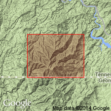
- Snowbird formation*
- Modifications:
-
- Named
- Dominant lithology:
-
- Quartzite
- Conglomerate
- Slate
- Sandstone
- AAPG geologic province:
-
- Appalachian basin
- Piedmont-Blue Ridge province
Summary:
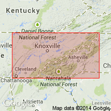
Named for exposures on Snowbird Mountain on boundary between Cocke Co., eastern TN, and Haywood Co., western NC. Consists of mainly fine or coarse quartzite with interstratified conglomerate and arkose and subordinate layers of gray and black slate. Quartzite composition ranges from feldspathic to pure. Wide color variation throughout unit; most beds are white to gray, but lower layers southwest of Max Patch Mountain are dark bluish gray due to iron oxides. Weathering gives the rock a rusty brown or red color. Rocks are dark gray near Stackhouse and bluish gray and black along Shelton Laurel Creek. Arkose beds at base of formation are light gray or reddish, depending on feldspar composition. Thickness ranges from 0 to 5,000 ft. Considered to be base of Cambrian System. Underlies Hiwassee slate; overlies Precambrian crystalline rocks. Age is Early Cambrian.
Source: GNU records (USGS DDS-6; Reston GNULEX).
- Usage in publication:
-
- Snowbird formation*
- Modifications:
-
- Not used
- AAPG geologic province:
-
- Piedmont-Blue Ridge province
Summary:
Formations that Keith (1904, Asheville folio) mapped below Lower Cambrian Cochran conglomerate were called Hiwassee slate and Snowbird formation. These names were also applied to formations of Ocoee series, the type localities of which are in areas of that series and not in Lower Cambrian rocks. Therefore, Hiwassee and Snowbird are not used for Cambrian rocks in this report area. Sandsuck shale is substituted for Hiwassee as it is what Keith used for rocks below the Cochran on Chilhowee Mountain. For beds below the Sandsuck, the named Vann quartzite (new) replaces Snowbird formation.
Source: GNU records (USGS DDS-6; Reston GNULEX).
- Usage in publication:
-
- Snowbird formation*
- Modifications:
-
- Not used
- AAPG geologic province:
-
- Appalachian basin
- Piedmont-Blue Ridge province
Summary:
Hurricane graywacke named for oldest rocks of Ocoee series of late Precambrian age and replaces the name Snowbird formation of Keith (1904, Asheville folio), which he assigned to the Lower Cambrian. He included part of the Great Smoky conglomerate in the Snowbird formation at the Snowbird type locality and elsewhere. He also applied the name to other well-established Lower Cambrian rocks. The name Snowbird is misleading and is not used.
Source: GNU records (USGS DDS-6; Reston GNULEX).
- Usage in publication:
-
- Snowbird formation
- Modifications:
-
- Revised
- Age modified
- AAPG geologic province:
-
- Piedmont-Blue Ridge province
Summary:
Although the term Snowbird may be undesirable, the names proposed to replace it (the Vann quartzite of Stose and Stose (1947) inside the Hot Springs window and the Hurricane graywacke of Stose and Stose (1949) outside the window) are not acceptable. There is no evidence that all the clastic rocks in the window are Early Cambrian and that those outside the window are Precambrian. The correlation of the quartzites over long distances in the Great Smoky Mountains is not well known, even in type areas. The geology of the type area of the Hurricane graywacke is not known well enough to establish the position of Hurricane rocks relative to Keith's Snowbird. Placement of the Snowbird is above granitic basement and below Sandsuck formation, but the age is unknown.
Source: GNU records (USGS DDS-6; Reston GNULEX).
- Usage in publication:
-
- Snowbird formation*
- Modifications:
-
- Revised
- Age modified
- Overview
- AAPG geologic province:
-
- Appalachian basin
Summary:
Snowbird formation assigned to lower part of Ocoee series northeast of Pigeon River. Age is changed from Cambrian (of other workers) to Precambrian. Because the formation shows a definite sequence of units, it may be divisible, in the future, into several formations, some of them at least equivalent to units southwest of Pigeon River.
Source: GNU records (USGS DDS-6; Reston GNULEX).
- Usage in publication:
-
- Snowbird group*
- Modifications:
-
- Revised
- AAPG geologic province:
-
- Appalachian basin
- Piedmont-Blue Ridge province
Summary:
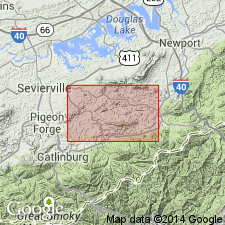
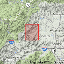
Snowbird raised in rank to group. Includes Wading Branch formation (new), Longarm quartzite (new), Roaring Fork sandstone (new), Pigeon siltstone (revised), and Metcalf phyllite (new). Type section designated as along Pigeon River at southwest and south base of Snowbird Mountain where the group rests on granitic rocks and is conformably overlain by Rich Butt sandstone (new). Mostly occurs in foothills immediately north of Great Smoky Mountains beneath the Greenbrier fault. Extends as far west as Cades Cove and as far northwest as across the French Broad River. Also occurs in southeast part of the mountains above the Greenbrier fault, but is only a tenth as thick and only includes the Wading Branch, Longarm, and Roaring Fork units. In the western part of Great Smoky Mountains, the Metcalf phyllite is equivalent to the other four formations of the Snowbird.
Source: GNU records (USGS DDS-6; Reston GNULEX).
- Usage in publication:
-
- Snowbird group*
- Modifications:
-
- Overview
- AAPG geologic province:
-
- Appalachian basin
Summary:
In the map area, Snowbird group of Ocoee series consists only of Roaring Fork sandstone and Pigeon siltstone; lower formations not present. Separated from Walden Creek Group by major faults throughout region. Here overlain by unnamed rocks of Webb Mountain and Big Ridge, which may be equivalent to Rich Butt sandstone or Cades sandstone of Ocoee series. Age is late Precambrian. Report includes geologic map, cross sections, correlation chart, and measured sections.
Source: GNU records (USGS DDS-6; Reston GNULEX).

- Usage in publication:
-
- Snowbird Group
- Modifications:
-
- Overview
- AAPG geologic province:
-
- Appalachian basin
Summary:
In Unaka Mountains, Precambrian Snowbird Group of Ocoee Supergroup consists of Wading Branch Formation, Longarm Quartzite, Metcalf Phyllite, Roaring Fork Sandstone, and Pigeon Siltstone.
Source: GNU records (USGS DDS-6; Reston GNULEX).
- Usage in publication:
-
- Snowbird Group*
- Modifications:
-
- Areal extent
- Revised
- AAPG geologic province:
-
- Appalachian basin
- Piedmont-Blue Ridge province
Summary:
Geographically extended into northern GA. Revised from a group within the Ocoee series to a group within the Ocoee Supergroup.
Source: GNU records (USGS DDS-6; Reston GNULEX).
- Usage in publication:
-
- Snowbird Group*
- Modifications:
-
- Age modified
- AAPG geologic province:
-
- Appalachian basin
Summary:
Age of Ocoee Supergroup changed to Proterozoic Y and (or) Proterozoic Z [Middle and (or) Late Proterozoic]. [The age of the Snowbird and its formations is therefore also changed to Proterozoic Y and (or) Proterozoic Z.]
Source: GNU records (USGS DDS-6; Reston GNULEX).
- Usage in publication:
-
- Snowbird Group
- Modifications:
-
- Revised
- AAPG geologic province:
-
- Appalachian basin
- Piedmont-Blue Ridge province
Summary:
Parr Branch (new) and Pinelog Formations assigned to Snowbird Group of Ocoee Supergroup. Parr Branch Formation is here named in a small unnamed anticlinorium of Grenville-age basement rocks along the western margin of the Blue Ridge thrust sheet in the Fort Mountain area of north-central GA. Consists of metamorphosed coarse, bouldery conglomerate derived from the nonconformably underlying Fort Mountain Gneiss. Conformably underlies the Wilhite Formation of the Walden Creek Group. Is the lithostratigraphic equivalent of the Pinelog Formation of the Snowbird Group in the Salem Church anticlinorium to the south. Age is Precambrian. McConnell and Costello (1980, Frey and Neathery, eds., Excursions in southeastern Geology, Geological Society of America Field Trip Guidebook v. 1, no. 12, p. 241-258) redefined Hayes' Pinelog conglomerate and Wilhite slate to Pinelog Formation and Wilhite Formation. This report [rather than their 1980 report] serve as formal definition of Pinelog Formation. Pinelog is present in Salem Church anticlinorium and is composed of an interlayered sequence of metaconglomerates, metasandstones, and locally carbonaceous metasiltstone. Basal units that lie nonconformably on Corbin Gneiss Complex (1 b.y.) consist of well-sorted quartz-pebble metaconglomerates, metasandstone, and graphitic phyllite. These in turn are overlain by thickly bedded and graded metaconglomerates, cross-bedded metasandstone, graphitic phyllites, and thin lenses of immature, poorly sorted lithic metaconglomerates (diamictite). Greatest portion was derived from Corbin (as noted by Hayes, 1900).
Gradationally above Pinelog is thin sequence of carbonaceous and noncarbonaceous, locally calcareous metasiltstone, metasandstone, and sandy marble equated with Wilhite slate by Hayes (unpub. data) of Cleveland folio, here formalized as Wilhite Formation. Pinelog is assigned to Snowbird Group of Ocoee Supergroup based on lithologic correlation with Snowbird Group of King and others (158) and position under Wilhite Formation of Walden Creek Group. Age is Precambrian.
Source: GNU records (USGS DDS-6; Reston GNULEX).
- Usage in publication:
-
- Snowbird Group
- Modifications:
-
- Overview
- AAPG geologic province:
-
- Piedmont-Blue Ridge province
Summary:
In Blue Ridge belt, Late Proterozoic Snowbird Group of Ocoee Supergroup consists of Wading Branch Formation, Longarm Quartzite, Roaring Fork Sandstone, and Pigeon Siltstone.
Source: GNU records (USGS DDS-6; Reston GNULEX).
- Usage in publication:
-
- Snowbird Group
- Modifications:
-
- Revised
- Overview
- AAPG geologic province:
-
- Piedmont-Blue Ridge province
Summary:
Metasedimentary rocks of Little Sandymush Bald region are here assigned to Late Proterozoic Snowbird Group of Ocoee Supergroup. These rocks were previously part of Great Smoky Group Of Ocoee Supergroup (North Carolina Geological Survey, 1985; Hadley and Nelson, 1971) or to Great Smoky Conglomerate and Hiwassee Slate (Keith, 1904). Reassignment is necessary because 1) graded beds of metagraywacke and graphitic schist or slate, very common in Great Smoky Group, are rare to virtually absent in Little Sandymush Bald area; 2) tourmaline, which is very abundant in Great Smoky Group (Hadley and Goldsmith, 1963), is rare in this area; and 3) at many nearby places, it is Snowbird Group, not Great Smoky Group, that overlies granitic "Basement" rocks, as is the case here. In the Little Sandymush Bald area, data are insufficient to subdivide the Snowbird Group, but the rocks most likely correlate with Wading Branch Formation.
Source: GNU records (USGS DDS-6; Reston GNULEX).
For more information, please contact Nancy Stamm, Geologic Names Committee Secretary.
Asterisk (*) indicates published by U.S. Geological Survey authors.
"No current usage" (†) implies that a name has been abandoned or has fallen into disuse. Former usage and, if known, replacement name given in parentheses ( ).
Slash (/) indicates name conflicts with nomenclatural guidelines (CSN, 1933; ACSN, 1961, 1970; NACSN, 1983, 2005, 2021). May be explained within brackets ([ ]).