

- Usage in publication:
-
- Shnabkaib shale member*
- Modifications:
-
- Original reference
- Dominant lithology:
-
- Shale
- Sandstone
- Gypsum
- AAPG geologic province:
-
- Great Basin province
Summary:
Pg. 90, 92. Shnabkaib member of Moenkopi formation. Sandy shale and soft sandstone, fine-grained, creamy white, with some pinkish layers and gypsum. Thickness 360 to 630 feet. Lies 405 to 475 feet below top of Moenkopi formation and 400 to 500 feet above Virgin limestone member of Moenkopi, this interval being occupied by brick-red sandstone and shale and reddish and light bluish-gray gypsum. Age is Early Triassic.
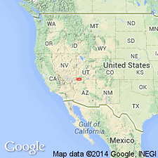
Named from striking isolated Shnabkaib Mesa, 2 mi southwest of town of Washington, on northwestern flank of Washington dome, Washington Co., southwestern UT. Extends into northwestern AZ.
[See also USGS Prof. Paper 129-D, 1922.]
Source: US geologic names lexicon (USGS Bull. 896, p. 1988).
- Usage in publication:
-
- Shnabkaib member*
- Modifications:
-
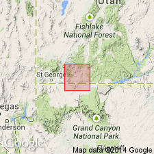
- Areal extent
- AAPG geologic province:
-
- Great Basin province
- Plateau sedimentary province
Summary:
Pg. 60, 61. Shnabkaib member of Moenkopi formation. Described in Zion Park region where it is 216 to 476 feet thick; underlies an unnamed upper red member and overlies an unnamed middle red member. Cream-white, pink, and green-white gypsum in regular beds one-eighth to 3 inches thick and deep-red soft arenaceous gypsiferous mud shales; a few thin layers and oolitic aggregates of marine fossiliferous limestone. Age is Early Triassic.
Source: US geologic names lexicon (USGS Bull. 1200, p. 3582-3583).
- Usage in publication:
-
- Shnabkaib Member*
- Modifications:
-
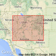
- Areal extent
- AAPG geologic province:
-
- Plateau sedimentary province
- Great Basin province
Summary:
As a member of the Moenkopi, Shnabkaib overlies the middle red and underlies the upper red members of the Moenkopi. Is present in western Coconino and Mohave Cos, northern AZ; western Kane, Iron and Washington Cos, southwest UT; and Clark Co, NV. These areas lie in the Plateau sedimentary and Great Basin provinces. Isopach map. Nomenclature chart. Thickest sections (700+ ft) are in the western part of area. Measured sections. Consists of red siltstone and white gypsum. Gray limestone and dolomite known in western outcrops. Grades into undifferentiated redbeds of Moenkopi south of Lee's Ferry, Coconino Co as the amount of gypsum, limestone, and dolomite decrease to the east from St. George area, UT. To the southwest the amount of limestone and dolomite increase. Gypsum occupies as much as 25 percent of the section at St. George. Lower contact is gradational and intertonguing. Upper contact placed at change from gypsiferous (Shnabkaib) to red siltstone and sandstone. Of Early Triassic age.
Source: GNU records (USGS DDS-6; Denver GNULEX).
- Usage in publication:
-
- Shnabkaib Member*
- Modifications:
-
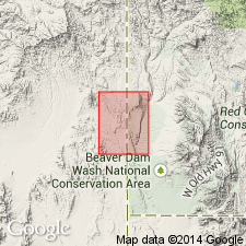
- Mapped
- AAPG geologic province:
-
- Great Basin province
Summary:
Mapped as fourth member from base of Moenkopi Formation. Exposures occur in northwesternmost corner of map and along East Snow Spring Wash fault in center part of southwest quarter of quad, Lincoln Co, NV, Great Basin province. Consists of light gray silty gypsiferous shale and thin-bedded white dolomite. Complete section described in adjacent Dodge Spring quad (Anderson and Hintze, 1992, USGS GQ-1721) where unit is 350 m thick. Conformably overlies Virgin Limestone Member of Moenkopi; conformably underlies upper red member of Moenkopi. Early Triassic age.
Source: GNU records (USGS DDS-6; Denver GNULEX).
For more information, please contact Nancy Stamm, Geologic Names Committee Secretary.
Asterisk (*) indicates published by U.S. Geological Survey authors.
"No current usage" (†) implies that a name has been abandoned or has fallen into disuse. Former usage and, if known, replacement name given in parentheses ( ).
Slash (/) indicates name conflicts with nomenclatural guidelines (CSN, 1933; ACSN, 1961, 1970; NACSN, 1983, 2005, 2021). May be explained within brackets ([ ]).