

- Usage in publication:
-
- Shiloh marls*
- Modifications:
-
- Named
- Dominant lithology:
-
- Marl
- AAPG geologic province:
-
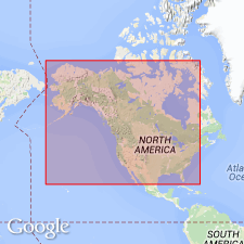
- Atlantic Coast basin
Summary:
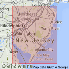
Shiloh marls described at Shiloh, Cumberland Co., southern NJ. Consist of (descending): 2 ft of unfossiliferous "yellow marl"; 2 to 3 ft of unfossiliferous "black marl"; 8 to 10 ft of fossiliferous "shell marl." Contacts between the marls are unconformable. Assigned to Miocene. Overlies barren black sand and underlies Quaternary deposits.
Source: GNU records (USGS DDS-6; Reston GNULEX).
- Usage in publication:
-
- Shiloh marl
- Modifications:
-
- Areal extent
- AAPG geologic province:
-
- Atlantic Coast basin
Summary:
Shiloh marl is gray, highly fossiliferous marl containing undoubted Miocene fossils. Occurs in limited area in Salem and Cumberland Cos., NJ. Rests on Alloway clay and underlies Cohansey sand.
Source: GNU records (USGS DDS-6; Reston GNULEX).
- Usage in publication:
-
- Shiloh marl member*
- Modifications:
-
- Revised
- Overview
- Dominant lithology:
-
- Clay
- Sand
- AAPG geologic province:
-
- Atlantic Coast basin
Summary:
Unit reduced in rank to Shiloh marl member of Kirkwood formation. Described as brown clay and fine clayey gray sand containing great numbers of shells. Thickness 30 ft. Forms top member of Kirkwood formation. Underlies Cohansey sand, probably unconformably. Overlies 80 to 90 ft of chocolate to drab and locally black clay exposed to southwest, around Woodstown and Alloway.
Source: GNU records (USGS DDS-6; Reston GNULEX).
- Usage in publication:
-
- Shiloh Marl Member*
- Modifications:
-
- Mapped
- AAPG geologic province:
-
- Atlantic Coast basin
Summary:
Shiloh Marl Member of Kirkwood Formation. Dark-gray, massive clay with abundant large mollusks. Average thickness about 98 feet (30 m). In subsurface it is mainly a clayey unit at base and a sand at top. Thickness up to 180 feet (55 m). Unconformably underlies Wildwood Member (new) of Kirkwood, or Cohansey Formation. Overlies unnamed lower member of Kirkwood. Fossils. Diatoms recovered from corehole northwest of Mays Landing, Atlantic County, include diagnostic ACTINOPTYCHUS HELIOPELTA (Andrews, G.W., 1987, USGS Bull. 1769), indicating an early Miocene age. Strontium-isotope analysis of shells yielded an age of about 20 Ma (Sugarman and others, 1993, GSA Bull., v. 105, no. 4, p. 423-436). Age is considered early Miocene (early Burdigalian).
Exposed in areas along the Delaware River and Cohansey River, west and south of Bridgeton (see sheet 2).
Source: Publication.
For more information, please contact Nancy Stamm, Geologic Names Committee Secretary.
Asterisk (*) indicates published by U.S. Geological Survey authors.
"No current usage" (†) implies that a name has been abandoned or has fallen into disuse. Former usage and, if known, replacement name given in parentheses ( ).
Slash (/) indicates name conflicts with nomenclatural guidelines (CSN, 1933; ACSN, 1961, 1970; NACSN, 1983, 2005, 2021). May be explained within brackets ([ ]).