

- Usage in publication:
-
- Shady limestone*
- Modifications:
-
- Named
- Dominant lithology:
-
- Limestone
- AAPG geologic province:
-
- Appalachian basin
Summary:
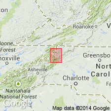
Named for Shady, Johnson County, northeast TN. Formation consists mainly of limestone. Limestone bluish-gray, weathers dull gray or black, some layers mottled, gray, blue, and white and often seamed with calcite, beds thick and massive, thin seams of blue and gray shale in many parts, frequent impurities of sand and chert nodules. Overlies Erwin quartzite; underlies Watauga shale. Thickness 750-800 feet. Stratigraphic column and geologic map in folio.
Source: GNU records (USGS DDS-6; Reston GNULEX).
- Usage in publication:
-
- Shady marble*
- Modifications:
-
- Revised
- Dominant lithology:
-
- Marble
- AAPG geologic province:
-
- Appalachian basin
Summary:
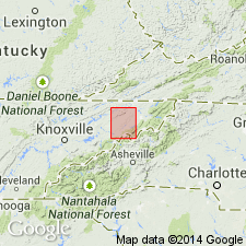
Formation almost entirely marble in this area of Blue Ridge. White or gray with dark blue bands, thick beds or massive. Thickness greater than 600 ft. Overlies Erwin quartzite.
Source: GNU records (USGS DDS-6; Reston GNULEX).
- Usage in publication:
-
- Shady limestone*
- Modifications:
-
- Areal extent
- Dominant lithology:
-
- Limestone
- Dolomite
- AAPG geologic province:
-
- Appalachian basin
Summary:
Geographically extended to NC. Occurs near the TN border. Mainly limestone and dolomite. Overlies Hesse quartzite; underlies Rome formation.
Source: GNU records (USGS DDS-6; Reston GNULEX).
- Usage in publication:
-
- Shady limestone*
- Modifications:
-
- Areal extent
- AAPG geologic province:
-
- Appalachian basin
Summary:
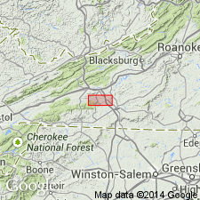
Geographically extended to VA. Substantially the same unit as the Tomstown limestone to the north. Report discusses mine in Rockbridge Co., VA, where the formation name changes from Tomstown to the north and Shady to the south.
Source: GNU records (USGS DDS-6; Reston GNULEX).
- Usage in publication:
-
- Shady limestone
- Modifications:
-
- Areal extent
- AAPG geologic province:
-
- Appalachian basin
Summary:
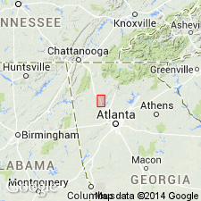
Geographically extended to GA. Was previously called Beaver limestone. Overlies Weisner quartzite; underlies Cartersville formation.
Source: GNU records (USGS DDS-6; Reston GNULEX).
- Usage in publication:
-
- Shady dolomite*
- Modifications:
-
- Revised
- Dominant lithology:
-
- Dolomite
- AAPG geologic province:
-
- Appalachian basin
Summary:
Unit is almost wholly dolomite; therefore name changed to Shady dolomite. Overlies Erwin and Hesse quartzites; underlies Watauga shale.
Source: GNU records (USGS DDS-6; Reston GNULEX).
- Usage in publication:
-
- Shady dolomite*
- Modifications:
-
- Revised
- AAPG geologic province:
-
- Appalachian basin
Summary:
Reassigned the Ivanhoe limestone member into the Rome formation (Ivanhoe is restricted to southwestern VA). They believed this well bedded, fine-grained limestone and dolomite with thin reddish sandy and argillaceous partings resembled Rome more so than the underlying, massive Shady.
Source: GNU records (USGS DDS-6; Reston GNULEX).
- Usage in publication:
-
- Shady limestone*
- Modifications:
-
- Areal extent
- AAPG geologic province:
-
- Appalachian basin
Summary:
Geographically extended to northeast Alabama. Lower Cambrian on stratigraphic column. Thick-bedded, light-gray to white, coarse-grained limestone. Forms valley. Overlies Weisner formation; underlies Rome formation.
Source: GNU records (USGS DDS-6; Reston GNULEX).
- Usage in publication:
-
- Shady formation*
- Modifications:
-
- Revised
- AAPG geologic province:
-
- Appalachian basin
Summary:
Mixture of highly weathered lithologies warrant using Shady formation. Fossils indicate Early Cambrian age. Overlies Weisner formation; underlies Rome formation.
Source: GNU records (USGS DDS-6; Reston GNULEX).
- Usage in publication:
-
- Shady Dolomite*
- Modifications:
-
- Age modified
- AAPG geologic province:
-
- Appalachian basin
Summary:
Mentioned in text that Shady contains both Early and Middle Cambrian faunas (reference GSA abstract by Willoughby, 1976), however, in fig. 3 (stratigraphic column) they show Shady as entirely Lower Cambrian.
Source: GNU records (USGS DDS-6; Reston GNULEX).
- Usage in publication:
-
- Shady Dolomite*
- Modifications:
-
- Revised
- AAPG geologic province:
-
- Appalachian basin
Summary:
Reassigned the Ivanhoe Member (restricted to southwestern VA) back to the Shady Dolomite as referenced to Pfeil and Read (1976: GSA Abstracts w/ Prog, v. 8, p. 244).
Source: GNU records (USGS DDS-6; Reston GNULEX).
- Usage in publication:
-
- Shady Dolomite*
- Modifications:
-
- Overview
- Biostratigraphic dating
- AAPG geologic province:
-
- Appalachian basin
Summary:
The basal carbonate unit of the Sylacauga Marble Group (Tull, 1982), the Jumbo Dolomite, as used by Tull (1982), contains Early and Middle Cambrian archaeocyathids that confirm correlation with the Shady Dolomite.
Source: GNU records (USGS DDS-6; Reston GNULEX).
- Usage in publication:
-
- Shady Dolostone
- Modifications:
-
- Areal extent
- AAPG geologic province:
-
- Warrior basin
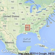
Summary:
Geographically extended the Shady Dolostone into the Warrior basin of MS. Consists of light gray to brown, "salt and pepper", fine- to medium-crystalline, sandy and oolitic dolostone. Thickness is 220 to 1152 feet. Overlies the Weisner Quartzite and underlies the Rome Formation. The Shady is of Early Cambrian age.
Source: GNU records (USGS DDS-6; Reston GNULEX).
- Usage in publication:
-
- Shady Dolomite*
- Modifications:
-
- Revised
- Areal extent
- AAPG geologic province:
-
- Appalachian basin
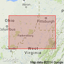
Summary:
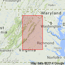
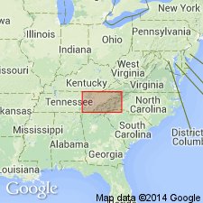
In cross section E-E', in the subsurface of central WV and western VA near Harrisburg and North Mountain, Shady Dolomite is used for limestone, gray shale, and equivalent dolomite(?). Areal extension into WV. Shady preferred over Tomstown Dolomite because it correlates better with type locality of the Shady in Johnson Co., TN than with the type locality of the Tomstown in Franklin Co., PA. Shady Limestone used where limestone predominates over dolomite. Age is Early Cambrian and post-dates the Chilhowee Group in VA, west of the Allegheny structural front.
Source: GNU records (USGS DDS-6; Reston GNULEX).
- Usage in publication:
-
- Shady Dolomite
- Modifications:
-
- Overview
- AAPG geologic province:
-
- Piedmont-Blue Ridge province
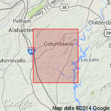
Summary:
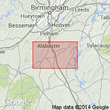
Shady Dolomite in the study area overlies the newly named Mount Zion Church Member of the Wash Creek Slate, but contact has not been recognized. Contact with overlying Rome Formation also has not been observed. Thickness of the unit is estimated at 990 ft in the Columbiana area. Age is Early Cambrian.
Source: GNU records (USGS DDS-6; Reston GNULEX).
For more information, please contact Nancy Stamm, Geologic Names Committee Secretary.
Asterisk (*) indicates published by U.S. Geological Survey authors.
"No current usage" (†) implies that a name has been abandoned or has fallen into disuse. Former usage and, if known, replacement name given in parentheses ( ).
Slash (/) indicates name conflicts with nomenclatural guidelines (CSN, 1933; ACSN, 1961, 1970; NACSN, 1983, 2005, 2021). May be explained within brackets ([ ]).