

- Usage in publication:
-
- Selma chalk, Rotten limestone
- Modifications:
-
- Named
- Dominant lithology:
-
- Chalk
- AAPG geologic province:
-
- Mid-Gulf Coast basin
Summary:
Selma chalk, (also referred to as Rotten limestone), is of comparatively uniform composition. Consists of gray to bluish argillaceous fossiliferous limestone, traversed at intervals by beds of purer limestone, harder in texture. In some places consists of dark-bluish clay marl. Thickness 0 to 1,200 ft. Underlies Ripley group and overlies Coffee (or Eutaw) group.
Source: GNU records (USGS DDS-6; Reston GNULEX).

- Usage in publication:
-
- Selma chalk*
- Modifications:
-
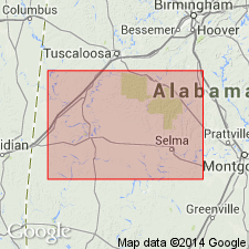
- Overview
- Areal extent
- AAPG geologic province:
-
- Black Warrior basin
- Mid-Gulf Coast basin
- Upper Mississippi embayment
Summary:
In western Tennesee and parts of northern Mississippi overlies Coffee sand and underlies Ripley formation. In east-central Mississippi and western Alabama it overlies Tombigbee sand member of Eutaw formation and for many years included all deposits up to the Eocene. In central Alabama overlies Tombigbee sand member of Eutaw formation and underlies Ripley formation. To east is replaced by Ripley formation. In northeastern Mississippi a tongue of the chalk (named Oktibbeha tongue) was described by Stephenson as overlying Ripley formation. (See L.W. Stephenson, USGS Prof. Paper 81, 1914, Georgia Geol. Survey Bull., no. 26, 1911, and Wash. Acad. Sci. Jour., v. 7, p. 243-250, 1917, for explanation of relations to adjacent formations.) In April 1937 Stephenson proposed (and the USGS adopted) that the beds for many years called Prairie Bluff tongue of Selma chalk be raised to rank of a formation, called Prairie Bluff chalk, and redefined so as to include the beds previously called Oktibbeha tongue of Selma chalk, the latter name being discarded. This is a restriction of Selma chalk as defined by the USGS since 1917. The Prairie Bluff chalk is unconformably on the Selma restricted. (See L.W. Stephenson and W.H. Monroe, AAPG Bull., 1937.)
Source: US geologic names lexicon (USGS Bull. 896, p. 1953).
- Usage in publication:
-
- Selma chalk*
- Modifications:
-
- Revised
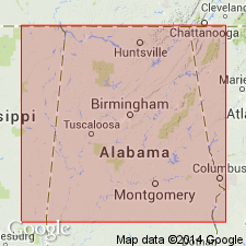
- Overview
- Areal extent
- AAPG geologic province:
-
- Black Warrior basin
Summary:
Selma chalk overlies Eutaw formation unconformably. Consists of nearly 900 ft of chalk in west-central AL, but is broken by minor unconformity or diastem about 300 ft above its base, a few ft above a thin but persistent zone of hard pure limestone layers interbedded with chalk, named here the Arcola limestone member. Northwestward into MS, lower third of Selma passes by merging and intertonguing into Coffee sand; upper third merges into Ripley formation; middle third continues into TN as an impure chalk unit. In eastern part of AL, the part of chalk below Arcola limestone member merges by intertonguing into Blufftown formation, middle part merges into and intertongues with Cusseta sand, and upper part merges into Ripley formation. Selma and Ripley are separated from overlying Prairie Bluff chalk by important unconformity.
Source: GNU records (USGS DDS-6; Reston GNULEX).
- Usage in publication:
-
- Selma chalk*
- Modifications:
-
- Revised
- AAPG geologic province:
-
- Black Warrior basin
Summary:
Selma chalk divided into three distinct lithologic members: unnamed lower member that includes typical chalky marl exposed at Selma, Arcola limestone member, and upper member of purer chalk designated Demopolis member. Chalky sand than underlies Prairie Bluff chalk in Sumter Co. and that merges eastward into Ripley formation has been called part of Selma chalk. In this report, it is treated as chalky facies of Ripley formation, restricting name Selma to purer underlying chalk; thus, Selma is restricted to marl and chalk that intervene between Eutaw formation below and Ripley formation above.
Source: GNU records (USGS DDS-6; Reston GNULEX).
- Usage in publication:
-
- Selma group
- Modifications:
-
- Revised
- AAPG geologic province:
-
- Black Warrior basin
- Upper Mississippi embayment
Summary:
Selma group. Raised to group rank. Includes Mooreville chalk, Coffee sand, Demopolis chalk, Ripley formation, Prairie Bluff chalk, and Owl Creek formation. [Age is Late Cretaceous.]
Source: US geologic names lexicon (USGS Bull. 1200, p. 3520-3521).
- Usage in publication:
-
- Selma Group
- Modifications:
-
- Overview
- AAPG geologic province:
-
- Black Warrior basin
Summary:
Selma Group is represented in Tishomingo Co., MS, only by the Coffee Formation. The Coffee is replaced by the main body of the chalky Selma strata in southern Lee and northwestern Itawamba Cos.
Source: GNU records (USGS DDS-6; Reston GNULEX).

- Usage in publication:
-
- Selma Group
- Modifications:
-
- Overview
- AAPG geologic province:
-
- Mid-Gulf Coast basin
- Black Warrior basin
Summary:
Uppermost Cretaceous unit in AL. Thickness ranges from 800 ft in Sumter Co. to 1600 ft in Montgomery Co. Divided in the west into Mooreville Chalk, Demopolis Chalk, Ripley Formation and Prairie Bluff Chalk. Divided in the east into Blufftown Formation, Ripley Formation and Providence Sand. Unconformably underlies Midway Group (Paleocene) and unconformably overlies Eutaw Formation (Late Cretaceous). Age is Late Cretaceous (Campanian-Maastrichtian).
Source: GNU records (USGS DDS-6; Reston GNULEX).
- Usage in publication:
-
- Selma Chalk
- Modifications:
-
- Overview
- Dominant lithology:
-
- Marl
- AAPG geologic province:
-
- Black Warrior basin
Summary:
Based on field and lab studies, there is only one lithic unit in the Selma Group of MS (and most of AL) that can be called a chalk. The rest is more properly referred to as marl. This impure chalk is near the middle of the Demopolis Formation and is overlain by the Bluffport Marl Member of the Demopolis. The underlying Mooreville Formation is also a marl.
Source: GNU records (USGS DDS-6; Reston GNULEX).
For more information, please contact Nancy Stamm, Geologic Names Committee Secretary.
Asterisk (*) indicates published by U.S. Geological Survey authors.
"No current usage" (†) implies that a name has been abandoned or has fallen into disuse. Former usage and, if known, replacement name given in parentheses ( ).
Slash (/) indicates name conflicts with nomenclatural guidelines (CSN, 1933; ACSN, 1961, 1970; NACSN, 1983, 2005, 2021). May be explained within brackets ([ ]).