

- Usage in publication:
-
- Saluda bed
- Modifications:
-
- Named
- AAPG geologic province:
-
- Cincinnati arch
Summary:
Named Saluda bed for Saluda Creek, Jefferson Co., IN. Name replaces Madison bed, which was preempted. Typical exposures of Saluda, however, remain at Madison, Jefferson Co., IN.
Source: GNU records (USGS DDS-6; Reston GNULEX).
- Usage in publication:
-
- Saluda limestone
- Modifications:
-
- Areal extent
- Dominant lithology:
-
- Limestone
- AAPG geologic province:
-
- Cincinnati arch
Summary:
Saluda extended into KY where it is called the Saluda limestone of Richmond group. Composed almost wholly of sandy and highly magnesian limestone. Commonly close to 40 ft thick. Underlain by Liberty formation; overlain by Brassfield limestone.
Source: GNU records (USGS DDS-6; Reston GNULEX).
- Usage in publication:
-
- Saluda member
- Modifications:
-
- Revised
- AAPG geologic province:
-
- Cincinnati arch
Summary:
Called Saluda Member of Whitewater Formation in OH.
Source: GNU records (USGS DDS-6; Reston GNULEX).
- Usage in publication:
-
- Saluda formation
- Modifications:
-
- Revised
- AAPG geologic province:
-
- Cincinnati arch
Summary:
Pl. 1. Saluda formation of Richmond group. Shown on generalized stratigraphic column of Ordovician and Silurian rocks exposed in Jefferson and Switzerland Counties, [eastern] Indiana (J.J. Galloway, J.B. Patton, and T.G. Perry, compilers, April 1953). Consists of drab-gray, granular, massive to thin-bedded, impure dolomitic limestone. Weathers to banded, buff and salmon surface. Thickness 40 to 65 feet. Overlies Liberty formation and underlies Whitewater formation (both of Richmond group). Fossils [listed]. Coral masses at base. Age is Late Ordovician (Cincinnatian).
Source: Publication; US geologic names lexicon (USGS Bull. 1200, p. 3421-3422).
- Usage in publication:
-
- Saluda Member
- Modifications:
-
- Revised
- AAPG geologic province:
-
- Cincinnati arch
Summary:
Called Saluda Member of Whitewater Formation. Underlain by lower member of Whitewater; overlain by upper member of Whitewater.
Source: GNU records (USGS DDS-6; Reston GNULEX).
- Usage in publication:
-
- Saluda Dolomite Member*
- Modifications:
-
- Revised
- Dominant lithology:
-
- Dolomite
- AAPG geologic province:
-
- Cincinnati arch
Summary:
Saluda Limestone reduced in rank to Saluda Dolomite Member and assigned to Drakes Formation. Consists of greenish-gray, very fine-grained, slightly argillaceous, thick-bedded, faintly banded dolomite, weathers massive to platy, fossils sparse and poorly preserved. 12 to 25 ft thick. Underlain with gradational contact by unnamed member of Drakes Formation [subsequently named the Bardstown Member]; overlain by Brassfield Dolomite.
Source: GNU records (USGS DDS-6; Reston GNULEX).
- Usage in publication:
-
- Saluda Formation
- Modifications:
-
- Revised
- Dominant lithology:
-
- Dolomite
- Limestone
- AAPG geologic province:
-
- Cincinnati arch
Summary:
Called Saluda Formation. Composed chiefly of limestone and dolomite. Underlain by Tanners Creek Formation and overlain by Whitewater formation in IN.
Source: GNU records (USGS DDS-6; Reston GNULEX).
- Usage in publication:
-
- Saluda Dolomite Member*
- Modifications:
-
- Overview
- AAPG geologic province:
-
- Cincinnati arch
Summary:
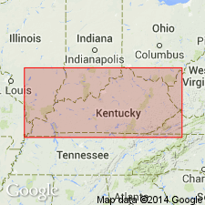
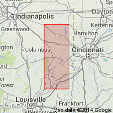
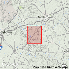
Includes description of lithology and map showing area of exposure of Saluda Dolomite Member of Drakes Formation in north-central Kentucky.
Source: GNU records (USGS DDS-6; Reston GNULEX).

- Usage in publication:
-
- Saluda Formation*, Dolomite Member*
- Modifications:
-
- Overview
- AAPG geologic province:
-
- Cincinnati arch
Summary:
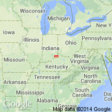
The Saluda is considered a formation in southeastern IN and is a member of the Drakes Formation in south-central KY. The Saluda Dolomite Member of the Drakes on the western side of the Cincinnati Arch consists of 75 ft of dolomite and calcareous dolomite that overlies the Bardstown Member of the Drakes. The Saluda Formation in southeastern IN consists of dolomitic mudstone with a coral-rich zone at the base and a coral-stromatoporoid-rich zone at the top. The Saluda Formation in Indiana conformably overlies the Dillsboro Formation and conformably underlies the Whitewater Formation, or where the Whitewater is absent, it unconformably underlies the Silurian Brassfield Formation. The Saluda is of Late Ordovician (Richmondian) age.
Source: GNU records (USGS DDS-6; Reston GNULEX).
- Usage in publication:
-
- "Saluda"
- Modifications:
-
- Overview
- AAPG geologic province:
-
- Cincinnati arch
Summary:
The Cincinnatian Series is divided into five depositional sequences in this report, which correspond to lithostratigraphic units. The following stratigraphic names in KY should be abandoned as they have been applied to bodies of rock already named in downramp areas of OH and IN: Bardstown (=Lower Whitewater), Reba (=Oregonia), Stingy Creek (=Mount Auburn), Calloway Creek (=Bellevue), and Clays Ferry (=Fairview). The following units in KY, OH, and IN lump dissimilar facies and straddle sequence boundaries and therefore should be abandoned: Drakes, Ashlock, Dillsboro, Tanners Creek, and Bull Fork. Grant Lake has been defined in several different ways and consequently should be abandoned. Several units will be redefined at a later date, including the Upper Whitewater and the "Sunset" and "Saluda" of OH and IN. Formal naming of new lithostratigraphic units will follow further study.
Source: GNU records (USGS DDS-6; Reston GNULEX).

- Usage in publication:
-
- Saluda Formation*, Dolomite Member*
- Modifications:
-
- Overview
- Age modified
- AAPG geologic province:
-
- Cincinnati arch
Summary:
Saluda Formation (and its Hitz Limestone Member) used in southeastern IN and Saluda Dolomite Member (and its Hitz Limestone Bed) of Drakes Formation used in KY. Age is refined to Cincinnatian (Richmondian).
Source: GNU records (USGS DDS-6; Reston GNULEX).
For more information, please contact Nancy Stamm, Geologic Names Committee Secretary.
Asterisk (*) indicates published by U.S. Geological Survey authors.
"No current usage" (†) implies that a name has been abandoned or has fallen into disuse. Former usage and, if known, replacement name given in parentheses ( ).
Slash (/) indicates name conflicts with nomenclatural guidelines (CSN, 1933; ACSN, 1961, 1970; NACSN, 1983, 2005, 2021). May be explained within brackets ([ ]).