

- Usage in publication:
-
- Salt Wash sandstone member*
- Modifications:
-
- Original reference
- Dominant lithology:
-
- Sandstone
- AAPG geologic province:
-
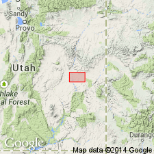
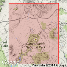
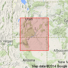
- Paradox basin
Summary:
Pg. 127. Salt Wash sandstone member of McElmo formation. Gray conglomeratic sandstone that crops out in cliffs. In places is lenticular, soft, and friable. Thickness 150 to 175 feet. Top lies 325 to 350 feet below Dakota sandstone [Dakota(?) now], and base lies 700+/- feet above the very cross-bedded coarse gray La Plata sandstone, the 700 feet of intervening beds consisting of red sandstone, thin-bedded above and massive below. [Age is Late Jurassic.]
[Named from Salt Wash, Grand Co., central eastern UT.]
Source: GNU records (USGS DDS-6; Denver GNULEX).

- Usage in publication:
-
- Salt Wash sandstone member*
- Modifications:
-
- Revised
- AAPG geologic province:
-
- Paradox basin
Summary:
Salt Wash sandstone member of Morrison formation. Age is Late Jurassic. Recognized in central eastern Utah (San Rafael Swell to northern San Juan Co.) and central western Colorado.
As a result of detailed work in eastern Utah and western Colorado by several geologists (especially J.B. Reeside, Jr., W.T. Thom, Jr., W.T. Lee, H.D. Miser, A.A. Baker, and James Gilluly) the so-called "McElmo formation" of some Utah reports is now divided into Morrison formation above and Summerville formation below, and the so-called "McElmo formation" of other Utah reports is now divided into Morrison, Summerville, Entrada, and Carmel formations. The so-called "La Plata sandstone" is also now divided into several formations, and "McElmo formation" and "La Plata sandstone" have both been discarded. The base of Morrison formation is drawn at base of Salt Wash sandstone member. (See USGS Press Bull. 6064, Mar. 30, 1926; AAPG Bull., v. 11, no. 8, p. 785-806, 1927; and USGS Prof. Paper 150-D, Feb. 15, 1928.)
Source: US geologic names lexicon (USGS Bull. 896, p. 1899-1900).

- Usage in publication:
-
- Salt Wash Member*
- Modifications:
-
- Geochronologic dating
- AAPG geologic province:
-
- Paradox basin
Summary:
Pg. 11, 12, geologic time scale (inside front cover). Salt Wash Member of Morrison Formation (Jurassic). Three samples from unaltered sandstone, in Slick Rock district, Hamm Canyon and Horse Range Mesa quadrangles, San Miguel County, Colorado, yielded Pb-alpha ages of 755 +/-85 Ma, 715 +/-80 Ma, and 630 +/-70 Ma (zircon) [Precambrian Y to Cambrian]. Ages do not reflect age of sandstone (Jurassic) but is composite age inherited from source rocks; published and discussed by Shawe and others (1968). Ages recalculated using decay constants of Steiger and Jager, 1977 (Earth Planet. Sci. Letters, v. 36, p. 359-362).
Source: Publication.
- Usage in publication:
-
- Salt Wash Member*
- Modifications:
-
- Revised
- AAPG geologic province:
-
- Paradox basin
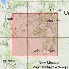
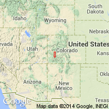
- Piceance basin
Summary:
Basal Morrison contact is an unconformity, the J-5, which represents a major regional break in the Western Interior. The contact is both angular and erosional, and occurs 4.8 to 28.6 m below the base of Salt Wash. Some earlier workers have placed this unit beneath Salt Wash in Summerville Formation, rather than at the unconformity. Salt Wash is a lenticular channel sandstone sequence of fluviatile origin. Some beds are cross-bedded, locally coarse-grained and conglomeratic. Forms high cliffs, ledgy slopes, and broad benches. Is recognized over large area of UT and CO. Wedges out near Glenwood Springs, CO. East from that location, Morrison is not divided. Ranges from 90-125 m thick in central UT. Is of Late Jurassic age. Area of occurrence is in the Paradox and Piceance basins.
Source: GNU records (USGS DDS-6; Denver GNULEX).
- Usage in publication:
-
- Salt Wash Member
- Modifications:
-
- Geochronologic dating
- AAPG geologic province:
-
- Paradox basin
Summary:
Samples taken from bentonites and bentonitic mudstones in the Morrison Formation near Notom, Wayne Co, UT in Paradox basin, show that the Morrison at this locality is post-Kimmeridgian, Tithonian or Late Jurassic, Neocomian to [Barremian, Aptian] Albian or Early Cretaceous age. Fission-track data on 6 samples (5 from zircon, 1 from apatite) from the Salt Wash, one of three members of Morrison, at Notom yielded ages that ranged from 195 +/-8 Ma to 132 +/-10 Ma. The sedimentation rates for Salt Wash as well as underlying Tidwell Member and overlying lower part of the Brushy Basin Member were about 6.2 m/m.y., whereas the sedimentation rate for upper part of Brushy Basin was only about 0.6 m/m.y. The reduction in sedimentation rate in late Morrison time was probably related to reduction in plutonic activity caused by slowing of collision at about 140 to 145 m.y. between North American and Farallon plates.
Source: GNU records (USGS DDS-6; Denver GNULEX).
- Usage in publication:
-
- Salt Wash Member*
- Modifications:
-
- Revised
- AAPG geologic province:
-
- San Juan basin
Summary:
As the basal member of the Morrison Formation between Sanostee Wash and Beclabito dome, San Juan Co, NM, San Juan basin, overlies intertongued Horse Mesa Member (new) of Wanakah Formation-Cow Springs Sandstone sequence.
Source: GNU records (USGS DDS-6; Denver GNULEX).
- Usage in publication:
-
- Salt Wash Member*
- Modifications:
-
- Revised
- AAPG geologic province:
-
- Paradox basin
- San Juan basin
- Black Mesa basin
- Plateau sedimentary province
Summary:
As a member of Morrison Formation interfingers with and overlies Tidwell Member (new) of Morrison over most of Colorado Plateau in Paradox, San Juan, and Black Mesa basins, and in Plateau sedimentary province. The J-5 unconformity marks base of member where Tidwell is missing in western part of Plateau sedimentary province. Overlies Romana Sandstone (new) at type section of Romana on Romana Mesa, Kane Co, UT. Is overlain by Fiftymile Member (new) of Morrison in western part of Plateau sedimentary province. Interfingers with and is overlain by Recapture Member of Morrison in Black Mesa basin, and by Brushy Basin Member of Morrison elsewhere. Of Late Jurassic age. Correlation chart. Cross sections.
Source: GNU records (USGS DDS-6; Denver GNULEX).
- Usage in publication:
-
- Salt Wash Member*
- Modifications:
-
- Revised
- AAPG geologic province:
-
- Piceance basin
Summary:
Some of the nomenclature assigned to Jurassic rocks in the western Black Canyon at the Smith Fork of the Gunnison River, Gunnison Co., CO, Piceance basin is revised. Rocks previously assigned to the upper part of the Wanakah Formation are reassigned to the lower part of the Morrison Formation of Late Jurassic age. In previous reports on this area, Wanakah was thought to underlie Salt Wash Member of Morrison. In this report, the name Tidwell Member of Morrison is applied to the former upper Wanakah. Tidwell is divisible into (ascending): bed A, lower gypsiferous beds, and upper beds, Tidwell overlies beds of Sawpit at top of Wanakah beneath the J-3 unconformity and underlies Salt Wash Member. The unit "bed at Smith Fork" which lies in the middle part of the upper beds of the Tidwell replaces use of name Junction Creek Sandstone for the 73 ft thick, gray to white, fine grained, cross-bedded sandstone. The bed at Smith Fork pinches out southward; it is not present at South Smith Fork measured section; it dips under younger rocks less than 1 mi east of Smith Fork measured section. Cross section.
Source: GNU records (USGS DDS-6; Denver GNULEX).
For more information, please contact Nancy Stamm, Geologic Names Committee Secretary.
Asterisk (*) indicates published by U.S. Geological Survey authors.
"No current usage" (†) implies that a name has been abandoned or has fallen into disuse. Former usage and, if known, replacement name given in parentheses ( ).
Slash (/) indicates name conflicts with nomenclatural guidelines (CSN, 1933; ACSN, 1961, 1970; NACSN, 1983, 2005, 2021). May be explained within brackets ([ ]).