

- Usage in publication:
-
- Rye gneiss
- Modifications:
-
- Named
- Dominant lithology:
-
- Gneiss
- AAPG geologic province:
-
- New England province
Summary:
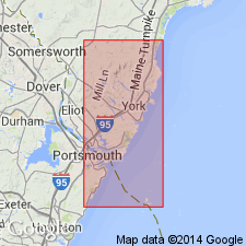
Rye gneiss named for typical exposures along Rye coast of New Hampshire. The most northerly outcrops occur on Gerrish's Island, Kittery, ME. The unit has been traced southward into Portsmouth, Rye, North Hampton, and Hampton, NH. At type locality the Rye is banded, consisting of alternations of light feldspathic layers, which become pegmatitic, with dark fine biotite-rich schistose bands. On Garrish's Island the rock is fine-grained, but banding is absent. As narrow stringers of feldspathic material penetrate the rock it loses its sedimentary habit. A number of dikes cut the gneisses. The unit is overlain by the Kittery quartzite.
Source: GNU records (USGS DDS-6; Reston GNULEX).

- Usage in publication:
-
- Rye formation
- Modifications:
-
- Revised
- AAPG geologic province:
-
- New England province
Summary:
Revised to Rye formation due to metasedimentary and metavolcanic lithologies. It is divided into two informal members, a lower metasedimentary member and an upper metavolcanic member. The Rye is believed to be at least 4000 feet thick with each member being approximately 2000 feet thick. Age is thought to be Ordovician based on stratigraphic position.
Source: GNU records (USGS DDS-6; Reston GNULEX).
- Usage in publication:
-
- Rye Formation
- Modifications:
-
- Geochronologic dating
- Overview
- AAPG geologic province:
-
- New England province
Summary:
Rye Formation consists of a series of variably mylonitized, polymetamorphosed calcareous and noncalcareous metasandstone and metasiltstone, migmatized and non-migmatized metapelite, rusty-weathering sulfidic graphitic phyllite, marble, and amphibolite. Age of the Rye is uncertain. Assigned an age of Precambrian Z(?) to Ordovician based on cross-cutting metadiorite that yielded an age of 477 Ma (Rb/Sr, Gaudette and others, 1984) and an approximate 460 40Ar/39Ar metamorphic age on hornblende from amphibolite not involved in later ductile faulting (West, 1993).
Source: GNU records (USGS DDS-6; Reston GNULEX).

- Usage in publication:
-
- Rye Complex*
- Modifications:
-
- Overview
- Revised
- AAPG geologic province:
-
- New England province
Summary:
Used as Rye Complex. Revised from Rye Formation to Rye Complex because unit consists of Ordovician granite intruding Late Proterozoic gneissic and granulose metasedimentary and metavolcanic rock. Plutonic rock described as gray, foliated, two-mica granite and pegmatite, and minor hornblende-biotite diorite. Metasedimentary rock described as light-colored to gray, variably mylonitized schists and gneisses, quartzites, and amphibolites. Western contact with Kittery Formation is Portsmouth fault. Includes Breakfast Hill Granite of Novotny (1964) in what had been the upper metavolcanic member of the Rye Formation of Novotny (1969). It consists of blastomylonitic quartz-feldspar granitic gneiss and pegmatite intrusive into Rye Complex, forming a migmatite. Age changed from Paleozoic (probably Ordovician and Silurian) to Late Proterozoic(?) to Ordovician(?). Report includes geologic map and correlation chart, cross sections, and four 1:500,000-scale derivative maps.
Source: GNU records (USGS DDS-6; Reston GNULEX).
For more information, please contact Nancy Stamm, Geologic Names Committee Secretary.
Asterisk (*) indicates published by U.S. Geological Survey authors.
"No current usage" (†) implies that a name has been abandoned or has fallen into disuse. Former usage and, if known, replacement name given in parentheses ( ).
Slash (/) indicates name conflicts with nomenclatural guidelines (CSN, 1933; ACSN, 1961, 1970; NACSN, 1983, 2005, 2021). May be explained within brackets ([ ]).