

- Usage in publication:
-
- Reynolds sandstone member*
- Modifications:
-
- Original reference
- Dominant lithology:
-
- Sandstone
- AAPG geologic province:
-
- Appalachian basin
Summary:
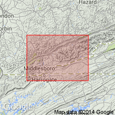
Pg. 31, 33, 43. Reynolds sandstone member of Hignite formation. Massive cliff-making sandstone, 50 to 100 feet thick, in Hignite formation, lying 180 feet above base of formation. Age is Pennsylvanian.
[Named from Hanging Rock of Reynolds Mountain, Bell Co., southeastern KY. Extends into northeastern TN.]
Source: US geologic names lexicon (USGS Bull. 896, p. 1801).
- Usage in publication:
-
- Reynolds sandstone member*
- Modifications:
-
- Areal extent
- AAPG geologic province:
-
- Appalachian basin
Summary:
Pg. 31, 33, 43. Reynolds sandstone member of Hignite formation. Massive locally conglomeratic sandstone. In Hignite formation between High Splint coal above and Fossil limestone.
Source: US geologic names lexicon (USGS Bull. 1200, p. 3254).
- Usage in publication:
-
- Reynolds sandstone member*
- Modifications:
-
- Mapped
- AAPG geologic province:
-
- Appalachian basin
Summary:
Reynolds sandstone member of Hignite Formation. Fine-grained, light-gray, thick-bedded to massive, micaceous sandstone. Thickness 60 to 80 feet.
Source: Modified from GNU records (USGS DDS-6; Reston GNULEX).
- Usage in publication:
-
- Reynolds Sandstone Member(?)*
- Modifications:
-
- Areal extent
- AAPG geologic province:
-
- Appalachian basin
Summary:
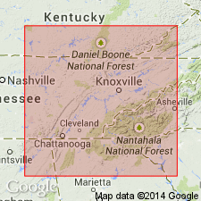
Reynolds Sandstone Member tentatively identified in Virginia and assigned to Wise Formation. [Age is Middle Pennsylvanian].
Source: GNU records (USGS DDS-6; Reston GNULEX).

- Usage in publication:
-
- Reynolds Sandstone Member*
- Modifications:
-
- Revised
- AAPG geologic province:
-
- Appalachian basin
Summary:
Reynolds Sandstone Member of Hignite Formation reassigned as member of Breathitt Formation.
Source: GNU records (USGS DDS-6; Reston GNULEX).

- Usage in publication:
-
- Reynolds Sandstone Member*
- Modifications:
-
- Areal extent
- AAPG geologic province:
-
- Appalachian basin
Summary:
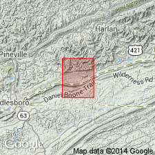
Reynolds Sandstone Member of Breathitt Formation. Sandstone in middle part of Breathitt Formation below the Morris (or No. 11) coal bed and above Magoffin Member. Age is Middle Pennsylvanian.
Recognized locally in Upper Cumberland River district, southeastern KY.
Source: Publication.

- Usage in publication:
-
- Reynolds Sandstone Member
- Modifications:
-
- Areal extent
- AAPG geologic province:
-
- Appalachian basin
Summary:
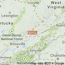
Corr. chart. Reynolds Sandstone Member of Four Corners Formation of Breathitt Group (KY); Reynolds Sandstone Member of Wise Formation (VA). In southeastern Kentucky, is a member in lower part of Four Corners Formation; lies below Low Splint (Morris, No. 11) coal bed and above Magoffin Member of Four Corners Formation. In southwestern Virginia, is a member in upper part of Wise Formation; lies below Morris coal zone and above Magoffin Member of Wise Formation. Age is Middle Pennsylvanian (Westphalian; Atokan).
[Correlates with beds below the Winifrede coal and above the Hazard No. 4 coal, which Peppers (1996, GSA Memoir 188, p. 9, pl.) placed in Westphalian C, TORISPORA SECURIS-T. LAEVIGATA (SL) miospore assemblage zone of western Europe. Eble and others (2009, Kentucky Geol. Survey, ser. XII, Spec. Pub. 10, fig. 5.2) placed the Winifrede coal zone of West Virginia at the Duckmantian/Bolsovian (Westphalian B/C) boundary on basis of miospores. Unpublished collections from overlying Stoney Fork Member of Princess Formation in Kentucky, and its equivalents, informal Lake City member of Cross Mountain Formation in Tennessee and Blunt Run (Boggs) limestone of Pottsville Group in Ohio, yielded distinctive conodonts correlative with the marine Aegir bed (=base of Westphalian C) thus shifting the Four Corners, Vowell Mountain, lower part of Cross Mountain, and upper part of Pottsville, downward into Westphalian B (R.G. Stamm, USGS, pers. commun., Oct. 17, 2013).]
[See also Chesnut, 1997 (revised Oct. 12, 1999), Stratigraphy of the coal-bearing strata of the Eastern Kentucky coal field, available online through the Kentucky Geol. Survey (http://www.uky.edu/KGS/coal/coalcorrel.htm) and geologic descriptions of stratigraphic units in the Kentucky Geological Survey database (http://kgs.uky.edu/kgsmap/KGSLitho/lithoSearch.asp#). See also entry under Magoffin.]
Source: Publication.
For more information, please contact Nancy Stamm, Geologic Names Committee Secretary.
Asterisk (*) indicates published by U.S. Geological Survey authors.
"No current usage" (†) implies that a name has been abandoned or has fallen into disuse. Former usage and, if known, replacement name given in parentheses ( ).
Slash (/) indicates name conflicts with nomenclatural guidelines (CSN, 1933; ACSN, 1961, 1970; NACSN, 1983, 2005, 2021). May be explained within brackets ([ ]).