

- Usage in publication:
-
- Purcell lava
- Modifications:
-
- Named
- Dominant lithology:
-
- Lava
- AAPG geologic province:
-
- Northern Rocky Mountain region
Summary:
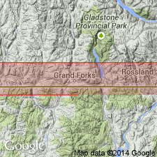
Named as the sixth formation (of 8) of the Lewis series. Overlies Siyeh formation of Lewis series in the Clarke, Galton and Lewis Ranges, or Kitchener formation in the McGillivray Range. Underlies Shepard formation (or its equivalent, the Gateway formation) of Lewis series in the Clarke, Galton and Lewis Ranges, or Kitchener formation in the McGillivray Range. Is well exposed (west to east) in the McGillivray Range, Galton Range, Clarke Range and Lewis Range, BC in the Northern Rocky Mountain region. Its black lava and associated dikes and sills are stratigraphic markers in this area. Is named for Purcell Mountain system of CN. No type locality designated. Geologic maps. Is 465 ft thick in McGillivray Range where it has a 40 ft thick mottled brecciated lava at base and an overlying amygdaloidal to porphyritic lava, and related dikes and sills. Is 390 ft thick in the Galton Range, 260 ft thick in the Clarke Range, and 58 ft thick in the Lewis Range. Chemical analyses. Assigned a Middle Cambrian? Age. Deposited on a sea floor.
Source: GNU records (USGS DDS-6; Denver GNULEX).
- Usage in publication:
-
- Purcell lava
- Modifications:
-
- Revised
- AAPG geologic province:
-
- Northern Rocky Mountain region
Summary:
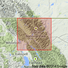
Described in a generalized section composited from information on Glacier National Park, MT in the Northern Rocky Mountain region, and adjoining Waterton Lakes National Park in southern BC and AT, CN. [Not possible to determine exact areal extent.] Described as an extrusive, basic, dark-green lava that occurs with 3 to 7 distinct flows interbedded with green meta-argillite. Is 100 to 200 ft thick. Pillow structures, pipes, and inclusions of highly metamorphosed sediments are common. Maximum thickness noted as near Boulder Pass. Overlies Hole-in-the-Wall member (first published use), basal member of Boulder Pass formation (first published use). Underlies Shepard member (reduced from formation rank) of Boulder Pass. Of Algonkian, Proterozoic age.
Source: GNU records (USGS DDS-6; Denver GNULEX).

- Usage in publication:
-
- Purcell basalt
- Modifications:
-
- Overview
- Dominant lithology:
-
- Basalt
- AAPG geologic province:
-
- Northern Rocky Mountain region
Summary:
Purcell Basalt. A term applied by Canadian geologists to altered basalt, of pre-Cambrian age, underlying Mooyie Formation and overlying Kitchner Formation in SW Alberta, SE British Columbia, and NW Montana (Glacier National Park). "Since it has its max known thickness in McGillivray division of Purcell Mtn system, the formation has been called Purcell Lava." (R.A. Daly, 1913, Can. Dept. Int. Rpt. Chief Asst. 1910, v. 2, p. 207.) Daly mapped the formation in 1912 (Can. Geol. Surv. Dept. Mines Mem. 38, several sheets). C.H. Clapp, 1932 (Mont. Bur. Mines and Geol. Mem. 4, p. 21-22), says "Purcell Lava consists of basalt flows in Siyeh and Missoula groups of Belt series."
Source: US geologic names lexicon (USGS Bull. 896, p. 1746).

- Usage in publication:
-
- Purcell Basalt*
- Modifications:
-
- Redescribed
- Overview
- Dominant lithology:
-
- Basalt
- AAPG geologic province:
-
- Northern Rocky Mountain region
Summary:
Recognized in the Whitefish Range, Northern Rocky Mountain region. Redescribed--designation Purcell Lava changed to Purcell Basalt. Is a unit in the Missoula Group of the Precambrian Belt Supergroup. Purcell Lava still used in Canada. See figures 4 and 5 for correlation with formations of Belt Supergroup in the Northern Rocky Mountain region, and with the Purcell Supergroup of Alberta and British Columbia, Canada.
Source: GNU records (USGS DDS-6; Denver GNULEX).
- Usage in publication:
-
- Purcell Lava*
- Modifications:
-
- Overview
- AAPG geologic province:
-
- Northern Rocky Mountain region
Summary:
Occurs in member 6 of Snowslip Formation, basal formation of Missoula Group of Middle Proterozoic Belt Supergroup in a reference section of the Snowslip east of Boulder Pass in east-facing wall of Hole-in-the-Wall cirque, Glacier National Park, west of continental divide, Flathead Co, MT in the Northern Rocky Mountain region. Is 95 m thick at Snowslip reference section. Three facies--pillow lava, vent, and pahoehoe facies at Hole-in-the-Wall section. Deposited in a peritidal environment in water depths of 9 to 15 m at time of emplacement. Oxidation of uppermost flows suggests a diastemic period following emplacement of lava. Fence diagram. Stratigraphic chart.
Source: GNU records (USGS DDS-6; Denver GNULEX).
For more information, please contact Nancy Stamm, Geologic Names Committee Secretary.
Asterisk (*) indicates published by U.S. Geological Survey authors.
"No current usage" (†) implies that a name has been abandoned or has fallen into disuse. Former usage and, if known, replacement name given in parentheses ( ).
Slash (/) indicates name conflicts with nomenclatural guidelines (CSN, 1933; ACSN, 1961, 1970; NACSN, 1983, 2005, 2021). May be explained within brackets ([ ]).