

- Usage in publication:
-
- Puckett sandstone member*
- Modifications:
-
- Original reference
- Dominant lithology:
-
- Sandstone
- AAPG geologic province:
-
- Appalachian basin
Summary:
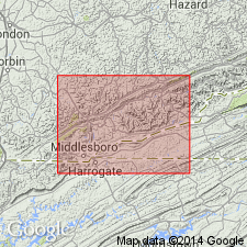
Pg. 31, 33, 40. Puckett sandstone member of Mingo formation of Pottsville group. Cliff-making sandstone, 0 to 100 feet thick, in Mingo formation, lying 160 feet below top of Mingo. Age is Pennsylvanian.
[Named from Puckett Creek, Bell Co., southeastern KY. Extends into northeastern TN.]
Source: US geologic names lexicon (USGS Bull. 896, p. 1739).
- Usage in publication:
-
- Puckett sandstone member*
- Modifications:
-
- Areal extent
- AAPG geologic province:
-
- Appalachian basin
Summary:
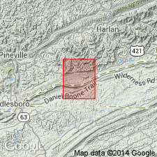
Pg. 99, 102, 104, 148. Puckett sandstone member of Mingo formation. In Mingo formation between Wallins Creek coal (above) and Slater sandstone. Recognized in southeastern Kentucky and northeastern Tennessee. Age is Middle Pennsylvanian.
Source: US geologic names lexicon (USGS Bull. 1200, p. 3148).
- Usage in publication:
-
- Puckett sandstone member*
- Modifications:
-
- Mapped
- AAPG geologic province:
-
- Appalachian basin
Summary:
Puckett sandstone member of Mingo formation. "Sandstone, fine-grained, light-gray, micaceous, massive." Thickness 40 feet. Occurs in upper part of Mingo formation.
Source: Modified from GNU records (USGS DDS-6; Reston GNULEX).

- Usage in publication:
-
- Puckett Sandstone Member*
- Modifications:
-
- Revised
- AAPG geologic province:
-
- Appalachian basin
Summary:
Puckett Sandstone Member of Mingo Formation reassigned as member of Breathitt Formation in Kentucky.
Source: GNU records (USGS DDS-6; Reston GNULEX).

- Usage in publication:
-
- Puckett Sandstone Member*
- Modifications:
-
- Areal extent
- AAPG geologic province:
-
- Appalachian basin
Summary:
Puckett Sandstone Member of Breathitt Formation. Sandstone in middle part of Breathitt Formation below the Fire Clay, No. 7, or Wallins Creek coals, and above Kendrick Shale Member. Age is Middle Pennsylvanian.
Recognized locally in Upper Cumberland River district, southeastern KY.
Source: Publication.

- Usage in publication:
-
- Puckett Sandstone Member
- Modifications:
-
- Areal extent
- AAPG geologic province:
-
- Appalachian basin
Summary:
Corr. chart. Puckett Sandstone Member of Hyden Formation of Breathitt Group. Sandstone. Recognized in southeastern Kentucky [Upper Cumberland River district] in lower part of Hyden Formation above basal Kendrick Shale Member. Lies below the Stray coal zone and above the Creech (Upper Taggart) coal zone in underlying Pikeville Formation. Age is Middle Pennsylvanian (Westphalian; Atokan).
[The Puckett lies btw. the Whitesburg (= Stray coal zone) and Amburgy coals, which Peppers (1996, GSA Memoir 188, p. 9, pl.) placed in upper part of Westphalian B, MICRORETICULATISPORITES NOBILIS-FLORINITES JUNIOR (NJ) miospore assemblage zone of western Europe. Eble and others (2009, Kentucky Geol. Survey, ser. XII, Spec. Pub. 10, fig. 5.2) placed correlative beds of West Virginia (btw. the Cedar Grove and No. 2 Gas coals) in middle part of Duckmantian (Westphalian B) on basis of miospores.]
[At some point btw. 1992 and 1997, the Puckett Sandstone Member was transferred to Hyden Formation. See also Chesnut, 1997 (revised Oct. 12, 1999), Stratigraphy of the coal-bearing strata of the Eastern Kentucky coal field, available online through the Kentucky Geol. Survey (http://www.uky.edu/KGS/coal/coalcorrel.htm) and geologic descriptions of stratigraphic units in the Kentucky Geological Survey database (http://kgs.uky.edu/kgsmap/KGSLitho/lithoSearch.asp#).]
Source: Publication.
For more information, please contact Nancy Stamm, Geologic Names Committee Secretary.
Asterisk (*) indicates published by U.S. Geological Survey authors.
"No current usage" (†) implies that a name has been abandoned or has fallen into disuse. Former usage and, if known, replacement name given in parentheses ( ).
Slash (/) indicates name conflicts with nomenclatural guidelines (CSN, 1933; ACSN, 1961, 1970; NACSN, 1983, 2005, 2021). May be explained within brackets ([ ]).