

- Usage in publication:
-
- Prairie Bluff limestone
- Modifications:
-
- Named
- Dominant lithology:
-
- Limestone
- AAPG geologic province:
-
- Mid-Gulf Coast basin
Summary:
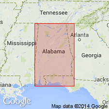
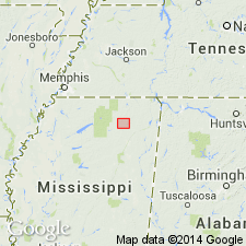
Prairie Bluff limestone is here described as a white limestone, 6 ft thick, exposed at the top of the section at Prairie Bluff, in Wilcox Co., southwestern AL. In upper part unit contains a bed of dark-colored disintegrated limestone 4 ft thick, with obscure casts of fossils. Lower portion contains an abundance of them, and base is almost entirely made up of well-preserved EXOGYRA COSTATA and GRYIPHAEA MUTABILIS. Unit is presumed to be equivalent to Black's Bluff limestone and is uppermost member of Cretaceous series of AL.
Source: GNU records (USGS DDS-6; Reston GNULEX).
- Usage in publication:
-
- Prairie Bluff tongue
- Modifications:
-
- Revised
- AAPG geologic province:
-
- Mid-Gulf Coast basin
Summary:
Prairie Bluff tongue of Selma chalk is revival of Winchell's name Prairie Bluff limestone. Unit is contemporaneous with Oktibbeha tongue of MS and extends eastward from main body of Selma chalk in Marengo Co. nearly through Wilcox Co. It is separated from underlying Ripley sand by an unconformity.
Source: GNU records (USGS DDS-6; Reston GNULEX).

- Usage in publication:
-
- Prairie Bluff chalk*
- Modifications:
-
- Revised
- Areal extent
- AAPG geologic province:
-
- Mid-Gulf Coast basin
Summary:
L.W. Stephenson and W.H. Monroe in April 1937 proposed that the Prairie Bluff deposits be raised to rank of formation, designated Prairie Bluff chalk, unconformably overlying the Selma chalk restricted in a limited area in Mississippi and Alabama, and elsewhere unconformably overlying the Ripley; and that the definition of Prairie Bluff be expanded so as to include the deposits heretofore designated "Oktibbeha tongue of Selma chalk," which was discarded. This is present [ca. 1938] approved name and definition of the USGS. (See AAPG Bull., 1937.)
Source: US geologic names lexicon (USGS Bull. 896, p. 1725).
- Usage in publication:
-
- Prairie Bluff chalk
- Modifications:
-
- Revised
- AAPG geologic province:
-
- Mid-Gulf Coast basin
Summary:
Prairie Bluff chalk assigned to Selma group. [Age is Late Cretaceous.]
Source: US geologic names lexicon (USGS Bull. 1200, p. 3126).
- Usage in publication:
-
- Prairie Bluff chalk
- Modifications:
-
- Overview
- AAPG geologic province:
-
- Mid-Gulf Coast basin
Summary:
Prairie Bluff described in Kemper Co. where it consists of massive hard brittle glaring white to blue-gray chalk. Thickness about 30 ft. Disconformably overlies Ripley formation; unconformably overlain by Chalybeate limestone member of Clayton formation.
Source: GNU records (USGS DDS-6; Reston GNULEX).
- Usage in publication:
-
- Prairie Bluff chalk*
- Modifications:
-
- Areal extent
- Overview
- AAPG geologic province:
-
- Mid-Gulf Coast basin
Summary:
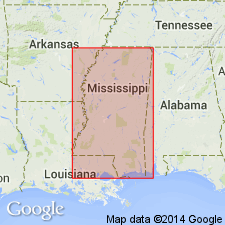
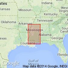
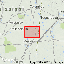
Unit consists dominantly of impure sandy chalk with subordinate amounts of clay, sand, and chalky limestone. Maximum thickness about 70 ft; 15 ft at type locality. Recognizable from southernmost Tippah Co., MS, to Bullock Co., AL, where it interfingers with Providence sand. In northeastern MS, interfingers with Owl Creek formation; in northern MS, overlain by Clayton formation. Overlies Ripley formation. Age is Late Cretaceous.
Source: GNU records (USGS DDS-6; Reston GNULEX).

- Usage in publication:
-
- Prairie Bluff Chalk
- Modifications:
-
- Overview
- Areal extent
- AAPG geologic province:
-
- Mid-Gulf Coast basin
Summary:
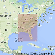
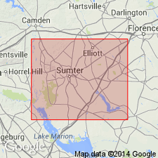
According to the usage of the Alabama Geological Survey the Prairie Bluff Chalk of Selma Group is a bluish-gray firm sandy, fossiliferous, brittle chalk. Unit crops out from Sumter Co. to south-central Bullock Co., AL, where it grades into the Providence Sand. The Prairie Bluff reaches a maximum thickness of about 110 ft in Lowndes Co. Age is Late Cretaceous (Maastrichtian).
Source: GNU records (USGS DDS-6; Reston GNULEX).
- Usage in publication:
-
- Prairie Bluff Chalk*
- Modifications:
-
- Biostratigraphic dating
- AAPG geologic province:
-
- Mid-Gulf Coast basin
Summary:
Prairie Bluff Chalk shown as Late Cretaceous (middle and late Maastrichtian) on fig. 1. Middle and late Maastrichtian age based in part on late Maastrichtian CRASSATELLA VADOSA collected from Wilcox and Lowndes Cos., central AL, and SCAMBULA PERPLANA collected from Montgomery Co., central AL.
Source: GNU records (USGS DDS-6; Reston GNULEX).
- Usage in publication:
-
- Prairie Bluff Chalk*
- Modifications:
-
- Age modified
- Overview
- AAPG geologic province:
-
- Mid-Gulf Coast basin
Summary:
Figure 4 of report shows Prairie Bluff Chalk in AL correlating with upper part of Peedee Formation of eastern SC and assignment to Navarroan provincial stage.
Source: GNU records (USGS DDS-6; Reston GNULEX).
For more information, please contact Nancy Stamm, Geologic Names Committee Secretary.
Asterisk (*) indicates published by U.S. Geological Survey authors.
"No current usage" (†) implies that a name has been abandoned or has fallen into disuse. Former usage and, if known, replacement name given in parentheses ( ).
Slash (/) indicates name conflicts with nomenclatural guidelines (CSN, 1933; ACSN, 1961, 1970; NACSN, 1983, 2005, 2021). May be explained within brackets ([ ]).