

- Usage in publication:
-
- Pinney Hollow schist
- Modifications:
-
- Named
- Dominant lithology:
-
- Schist
- AAPG geologic province:
-
- New England province
Summary:
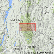
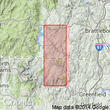
Pg. 161. Pinney Hollow schist. A uniform pale-green quartz-chlorite-sericite schist usually intensely plicated and resembling Bethel schist in lithology and origin. Lies stratigraphically below Ottauquechee formation and above a group of light-brown or gray quartzites. Assigned to Cambrian(?). Type exposures in Pinney Hollow, in Plymouth Township [Windsor County], Vermont.
Source: US geologic names lexicon (USGS Bull. 896, p. 1666).
- Usage in publication:
-
- Pinney Hollow schist
- Modifications:
-
- Age modified
- AAPG geologic province:
-
- New England province
Summary:
Table opp. p. 288. Pinney Hollow schist. Assigned this schist to Lower Cambrian.
Source: US geologic names lexicon (USGS Bull. 896, p. 1666).
- Usage in publication:
-
- Pinney Hollow schist
- Modifications:
-
- Overview
- AAPG geologic province:
-
- New England province
Summary:
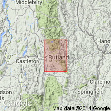
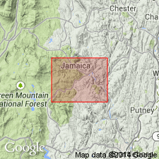
Pg. 1-61. Pinney Hollow schist. Probably Late Cambrian, is 3,500+/- feet thick. Typically exposed in Pinney Hollow [Woodstock quadrangle] from Pinney Hollow School westward nearly to Plymouth village. Lies unconformably on series of pre-Cambrian or older Cambrian quartzites, conglomerates, dolomite, and schists.
Source: US geologic names lexicon (USGS Bull. 896, p. 1666).
- Usage in publication:
-
- Pinney Hollow schist
- Modifications:
-
- Overview
- AAPG geologic province:
-
- New England province
Summary:
Pg. 360, 405. Pinney Hollow schist. Assigned this formation to Lower Cambrian.
Source: US geologic names lexicon (USGS Bull. 896, p. 1666).
- Usage in publication:
-
- Pinney Hollow formation
- Modifications:
-
- Revised
- AAPG geologic province:
-
- New England province
Summary:
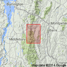
Revised the Pinney Hollow to the Pinney Hollow formation in eastern sequence of Green Mountain anticlinorium. Unit is 1000 to 1500 feet thick and includes the Hancock member (new) in the middle part of the formation. The Pinney Hollow overlies the Granville formation (new) and underlies the Ottauquechee formation, and is of Cambrian age.
Source: GNU records (USGS DDS-6; Reston GNULEX).
- Usage in publication:
-
- Pinney Hollow formation
- Modifications:
-
- Redescribed
- Dominant lithology:
-
- Phyllite
- Greenstone
- Siltstone
- AAPG geologic province:
-
- New England province
Summary:
The Pinney Hollow formation consists of three parts: a lower white green phyllite, green albitic phyllite and grit, thin black phyllite, a middle green white phyllite, thin greenstone, black phyllite, and an upper green phyllite, finely banded green and gray siltstone. Unit overlies the Grahamville formation and underlies the Ottauquechee formation. The Pinney Hollow is 3500 to 4000 feet thick and is of Cambrian and Ordovician age.
Source: GNU records (USGS DDS-6; Reston GNULEX).
- Usage in publication:
-
- Pinney Hollow formation
- Modifications:
-
- Overview
- AAPG geologic province:
-
- New England province
Summary:
The Pinney Hollow formation is divided into four mappable units on the Vermont State geologic map: 1) pale green quartz-sericite-chlorite phyllite and schist with abundant magnetite, chloritoid phyllite and schist, quartz-sericite-albite-chlorite schist and rare beds of carbonaceous and schistose quartzite, 2) a Chester phyllite member consisting of thin-layered, ligniform amphibolite and hornblende schist with actinolitic greenstone, 3) greenstone and actinolite greenstone, and 4) carbonaceous phyllite and schist. The Pinney Hollow formation overlies the Hoosac formation and is of Cambrian age.
Source: GNU records (USGS DDS-6; Reston GNULEX).
- Usage in publication:
-
- Pinney Hollow formation*
- Modifications:
-
- Overview
- AAPG geologic province:
-
- New England province
Summary:
The Pinney Hollow formation in the Camels Hump group consists of quartzitic schist and interbedded greenstone. It grades into the underlying Hazens Notch formation and overlying Ottauquechee formation. The quartzitic schist can be distinguished from similar lithologies in the Hazens Notch and Ottauquechee by the lack of carbonaceous interbeds in the Pinney Hollow. Unit is of Early Cambrian age.
Source: GNU records (USGS DDS-6; Reston GNULEX).
- Usage in publication:
-
- Pinney Hollow Formation*
- Modifications:
-
- Age modified
- AAPG geologic province:
-
- New England province
Summary:
The age of the Pinney Hollow Formation is changed to Late Proterozoic and Early Cambrian on figure 9. Age change is based on stratigraphic relationships with other Vermont stratigraphic units.
Source: GNU records (USGS DDS-6; Reston GNULEX).

- Usage in publication:
-
- Pinney Hollow Formation*
- Modifications:
-
- Areal extent
- AAPG geologic province:
-
- New England province
Summary:
In Glens Falls quad, rocks of eastern Green Mountain terrane, east of Richardson Memorial Contact (an eastward-facing unconformity or possibly a tectonic contact) include the Hoosac, Pinney Hollow, Ottauquechee, and Stowe Formations (of probable Cambrian through Early Ordovician age), Moretown Formation (probably Ordovician), and Barnard Volcanic Member of Missisquoi Formation [unclear as to its stratigraphic position or age here]. West of Richardson Memorial Contact, rocks include conglomeratic units such as Tyson Formation as used by Doll and others (1961) [no age provided, but presumably Cambrian].
Source: GNU records (USGS DDS-6; Reston GNULEX).

- Usage in publication:
-
- Pinney Hollow Formation
- Modifications:
-
- Overview
- Dominant lithology:
-
- Schist
- Greenstone
- Graywacke
- AAPG geologic province:
-
- New England province
Summary:
Pinney Hollow Formation in the study area contains four major unnamed members: silvery green schist, greenstone, metagraywacke, and quartzose schist. Age according to map symbols is Proterozoic and Cambrian.
Source: GNU records (USGS DDS-6; Reston GNULEX).
- Usage in publication:
-
- Pinney Hollow Formation
- Modifications:
-
- Not used
- AAPG geologic province:
-
- New England province
Summary:
Cover rocks east of and above Hoosac Formation were mapped by Doll and others (1961, State bedrock geologic map) as an eastward-topping section consisting of Pinney Hollow, Ottauquechee, and Stowe Formations. In adjacent MA, Hatch and others (1966) and Chidester and others (1967) were unable to map sequence because of both lateral and vertical variation of rock types in the belt. They chose not to use the VT nomenclature and applied the name Rowe Schist for all rocks between top of Hoosac and first beds of Moretown Formation. Pinney Hollow, Ottauquechee, and Stowe are not used in this report area because of heterogeneous discontinuous nature of those formations in this belt and uncertainty of correlation of the formations to their type sections 50 to 100 km to the north. Rowe Schist is used instead.
Source: GNU records (USGS DDS-6; Reston GNULEX).
For more information, please contact Nancy Stamm, Geologic Names Committee Secretary.
Asterisk (*) indicates published by U.S. Geological Survey authors.
"No current usage" (†) implies that a name has been abandoned or has fallen into disuse. Former usage and, if known, replacement name given in parentheses ( ).
Slash (/) indicates name conflicts with nomenclatural guidelines (CSN, 1933; ACSN, 1961, 1970; NACSN, 1983, 2005, 2021). May be explained within brackets ([ ]).