


- Usage in publication:
-
- Perryville formation
- Modifications:
-
- First used
- Dominant lithology:
-
- Limestone
- AAPG geologic province:
-
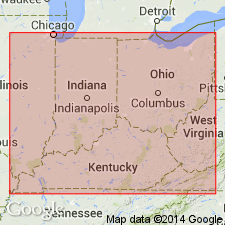
- Cincinnati arch
Summary:
First use as Perryville Formation of Lexington Group. Name apparently first published in this paper. Shown in table only, not discussed in text.
Source: GNU records (USGS DDS-6; Reston GNULEX).
- Usage in publication:
-
- Perryville bed
- Modifications:
-
- Revised
- AAPG geologic province:
-
- Cincinnati arch
Summary:
Name changed slightly to Perryville bed of Lexington Limestone.
Source: GNU records (USGS DDS-6; Reston GNULEX).
- Usage in publication:
-
- Perryville limestone*
- Modifications:
-
- Overview
- AAPG geologic province:
-
- Cincinnati arch
Summary:
Used as Perryville limestone.
Source: GNU records (USGS DDS-6; Reston GNULEX).
- Usage in publication:
-
- Perryville Limestone Member*
- Modifications:
-
- Revised
- AAPG geologic province:
-
- Cincinnati arch
Summary:
Perryville Limestone Member of Lexington Limestone adopted by the USGS. Consists of medium-gray, light-gray-weathering, cryptograined, conchoidally fracturing limestone. Contains some interbeds of very fine grained bioclastic limestone and irregularly bedded brachiopodal limestone. Underlain by Tanglewood Limestone Member and overlain by Sulphur Well Member, both of Lexington Limestone.
Source: GNU records (USGS DDS-6; Reston GNULEX).
- Usage in publication:
-
- Perryville Member*
- Modifications:
-
- Overview
- AAPG geologic province:
-
- Cincinnati arch
Summary:
Contains comprehensive general description of Perryville Member including lithology, paleontology, areal distribution, environment of deposition, and stratigraphic setting. Perryville Member is divided into the Faulconer, Salvisa, and Cornishville Beds, ascending. Faulconer is composed of brownish-gray somewhat fossiliferous calcilutite in rough surfaced beds; Salvisa is composed of very light gray calcilutite interbedded with brownish-gray calcilutite in even beds from several inches to about 1 ft thick; Cornishville is nodular-bedded fossiliferous limestone. Thickness of Perryville ranges from 0 to over 50 ft. Underlain by Tanglewood Member and overlain by Brannon Member of Lexington Limestone.
Source: GNU records (USGS DDS-6; Reston GNULEX).
- Usage in publication:
-
- Perryville Member*
- Modifications:
-
- Overview
- AAPG geologic province:
-
- Cincinnati arch
Summary:
Contains comprehensive general description of Perryville Member. Includes information about history of name, lithology, thickness, areal distribution, and stratigraphic setting.
Source: GNU records (USGS DDS-6; Reston GNULEX).

- Usage in publication:
-
- Perryville Limestone Member*
- Modifications:
-
- Overview
- AAPG geologic province:
-
- Cincinnati arch
Summary:
The Perryville Limestone Member of the Lexington Limestone is divided into three units (ascending): (1) the Faulconer Bed consists of 40 feet of brownish-gray, fossiliferous, micritic limestone with ostracodes, pelecypods, gastropods, brachiopods, bryozoans, crinoids, corals, and stromatoporoids, (2) the Salvisa Bed consists of 10 to 15 feet of interbedded light-gray to light-olive-gray micritic limestone and brownish-gray micritic limestone that contains a sparse fauna of ostracodes, gastropods, and pelecypods, and (3) the Cornishville Bed consists of 2 to 10 feet of nodular bedded calcisiltite and fine-grained calcarenite with abundant brachiopods and bryozoans. The Perryville only occurs in the southern outcrop area. Overlies and intertongues with the Tanglewood Limestone Member of the Lexington and underlies the Brannon Member of the Lexington. The Faulconer Bed is interpreted to be deposited in shallow, quiet water of normal salinity, the Salvisa Bed in quiet hypersaline water, and the Cornishville Bed in shallow, moderately agitated water with normal salinity.
Source: GNU records (USGS DDS-6; Reston GNULEX).

- Usage in publication:
-
- Perryville Limestone Member*
- Modifications:
-
- Age modified
- AAPG geologic province:
-
- Cincinnati arch
Summary:
Perryville Limestone Member of Lexington Limestone is Champlainian (Shermanian) in age.
Source: GNU records (USGS DDS-6; Reston GNULEX).
For more information, please contact Nancy Stamm, Geologic Names Committee Secretary.
Asterisk (*) indicates published by U.S. Geological Survey authors.
"No current usage" (†) implies that a name has been abandoned or has fallen into disuse. Former usage and, if known, replacement name given in parentheses ( ).
Slash (/) indicates name conflicts with nomenclatural guidelines (CSN, 1933; ACSN, 1961, 1970; NACSN, 1983, 2005, 2021). May be explained within brackets ([ ]).