

- Usage in publication:
-
- Oswego gray sandstone
- Modifications:
-
- First used
- AAPG geologic province:
-
- Appalachian basin
Summary:
First used term gray sandstone of Oswego or Oswego gray sandstone for sandstone that overlies the Hudson River shales and underlies the Medina red sandstone.
Source: GNU records (USGS DDS-6; Reston GNULEX).

- Usage in publication:
-
- Oswego sandstone
- Modifications:
-
- Named
- Dominant lithology:
-
- Sandstone
- AAPG geologic province:
-
- Appalachian basin
Summary:
Named the Oswego sandstone for Oswego Co., NY. Unit is gray sandstone that overlies the Hudson shales-Oswego sandstone transition (170 feet of gray sandstone and blue shale) and underlies the Red Medina. Thickness of the Oswego sandstone is 210 feet. Oswego is of Late Ordovician age.
Source: GNU records (USGS DDS-6; Reston GNULEX).
- Usage in publication:
-
- Oswego†
- Modifications:
-
- Abandoned
- AAPG geologic province:
-
- Appalachian basin
Summary:
Did not use the name Oswego sandstone; authors believe unit is same as Medina sandstone. However, they did use term Oswego period for their basal division of the Ontaric or Siluric system which included the Medina sandstone and Oneida conglomerate.
Source: GNU records (USGS DDS-6; Reston GNULEX).
- Usage in publication:
-
- Oswego sandstone
- Modifications:
-
- Reinstated
- AAPG geologic province:
-
- Appalachian basin
Summary:
Reinstated the Oswego sandstone in western NY. Unit underlies the Medina and is correlative to the Oneida conglomerate of Herkimer, Co., NY.
Source: GNU records (USGS DDS-6; Reston GNULEX).
- Usage in publication:
-
- Oswego sandstone*
- Modifications:
-
- Overview
- AAPG geologic province:
-
- Appalachian basin
Summary:
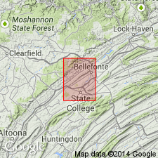
In the Bellefonte quadrangle of central PA, the Oswego sandstone is nonfossiliferous, thick-bedded, greenish gray, iron-speckled, somewhat arkosic sandstone. Thickness is 800 feet. Overlies the ORTHORHYNCHULA zone at the top of the Reedsville shale and underlies the Juniata formation.
Source: GNU records (USGS DDS-6; Reston GNULEX).

- Usage in publication:
-
- Oswego sandstone
- Modifications:
-
- Areal extent
- AAPG geologic province:
-
- Appalachian basin
Summary:
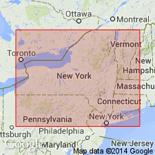
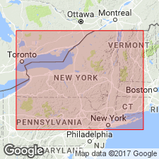
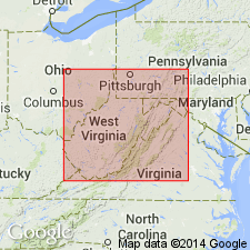
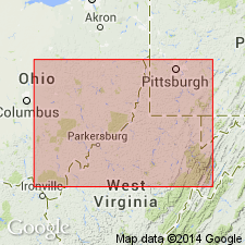
Geographically extended the Oswego sandstone into WV. Crops out in two belts: (1) eastern outcrop in Berkeley, Morgan, Hampshire, and Hardy Cos., and (2) western belt in Grant and Pendleton Cos. Unit has previously been called "Gray Medina sandstone" by West Virginia Geological Survey. Thickness is as much as 350 feet. Oswego is considered of Late Ordovician (Maysvillian or Richmondian) age.
Source: GNU records (USGS DDS-6; Reston GNULEX).
- Usage in publication:
-
- Oswego Sandstone
- Modifications:
-
- Revised
- AAPG geologic province:
-
- Appalachian basin
Summary:
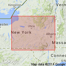
[See also Master Legend, 1971; and Rickard, L.V., Isachsen, Y.W., and Fisher, D.W., 1970, Adirondack sheet and Hudson-Mohawk sheet, scale 1:250,000.] Oswego Sandstone of Lorraine Group. Sandstone with thin red or green shales. Is top formation of Lorraine Group. Lies above Pulaski and Whetstone Gulf Formations [undifferentiated] of Lorraine Group, and in places, Austin Glen Formation (Pawlet in Vermont). Lies below Queenston Formation. Age is Ordovician.
Mapped in northeastern part of Finger Lakes sheet, and in adjacent Adirondack and Hudson-Mohawk sheets, western and central New York.
Source: Publication.
- Usage in publication:
-
- Oswego Formation
- Modifications:
-
- Overview
- AAPG geologic province:
-
- Appalachian basin
Summary:
The Oswego Formation in northwestern VA consists of greenish gray, brown weathering, fine-grained sandstone, tan shale, and conglomerate. Overlies the Martinsburg Formation and underlies the Juniata Formation. The combined thickness of the Oswego with the Juniata is 450 to 500 feet. The Oswego and Juniata intertongue and in places the Oswego underlies the Tuscarora Formation.
Source: GNU records (USGS DDS-6; Reston GNULEX).
- Usage in publication:
-
- Oswego Formation
- Modifications:
-
- Revised
- AAPG geologic province:
-
- Appalachian basin
Summary:
Revised the Oswego Formation to be included in the Judy Gap Group in WV. The Oswego has also been called the Gray Medina and Bald Eagle in WV. Overlies the Martinsburg Formation and underlies the Juniata Formation.
Source: GNU records (USGS DDS-6; Reston GNULEX).
- Usage in publication:
-
- Oswego Sandstone
- Modifications:
-
- Overview
- AAPG geologic province:
-
- Appalachian basin
Summary:
The Oswego Sandstone in eastern WV consists of gray to green sandstone, partly conglomeratic, and unfossiliferous. Overlies the Martinsburg or Reedsville Formations and underlies the Juniata Formation. The Oswego is of Ordovician age.
Source: GNU records (USGS DDS-6; Reston GNULEX).
- Usage in publication:
-
- Oswego Sandstone*
- Modifications:
-
- Areal extent
- Age modified
- AAPG geologic province:
-
- Appalachian basin
Summary:
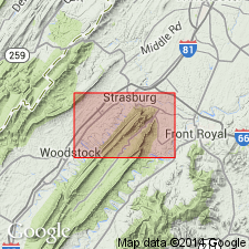
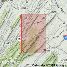
In cross section E-E'. Area of coverage is subsurface of central West Virginia and northern Virginia. Oswego Sandstone used in Allegheny structural front for argillaceous sandstone overlying Reedsville Formation. Pre-Silurian erosion has removed it from areas between North Mountain thrust fault to Blue Ridge. Age is Late Ordovician (latest Maysvillian through earliest Richmondian) based on fossils.
Source: GNU records (USGS DDS-6; Reston GNULEX).
For more information, please contact Nancy Stamm, Geologic Names Committee Secretary.
Asterisk (*) indicates published by U.S. Geological Survey authors.
"No current usage" (†) implies that a name has been abandoned or has fallen into disuse. Former usage and, if known, replacement name given in parentheses ( ).
Slash (/) indicates name conflicts with nomenclatural guidelines (CSN, 1933; ACSN, 1961, 1970; NACSN, 1983, 2005, 2021). May be explained within brackets ([ ]).