

- Usage in publication:
-
- Oranda formation
- Modifications:
-
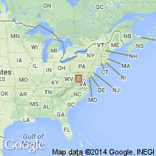
- Named
- Dominant lithology:
-
- Limestone
- Clay
- Shale
- Siltstone
- AAPG geologic province:
-
- Appalachian basin
Summary:
Proposed Oranda Formation for 30 foot zone, characterized by occurrence of REUSCHELLA "EDSONI" and its associates, which overlies the Edinburg and directly underlies SINNUITES beds of the Martinsburg. Unit is composed mainly of very argillaceous limestone with metabentonite clays, shales, and ledge-making siltstones. The Oranda is important as zone of reference below which the facies changes in Edinburg are observable between Lacey Spring and Winchester, VA. Corresponds to "CHRISTIANIA" bed of Chambersburg limestone of southern Pennsylvania.
Source: GNU records (USGS DDS-6; Reston GNULEX).
- Usage in publication:
-
- Oranda formation
- Modifications:
-
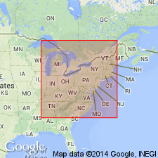
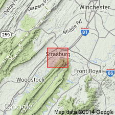
- Areal extent
- AAPG geologic province:
-
- Appalachian basin
Summary:
Geographically extended the Oranda formation to West Virginia and Pennsylvania. Chart on p. 1402 shows Oranda is present in southeastern West Virginia, Cumberland Valley, Pennsylvania, and Shenandoah Valley, Virginia.
Source: GNU records (USGS DDS-6; Reston GNULEX).
- Usage in publication:
-
- Oranda Formation
- Modifications:
-
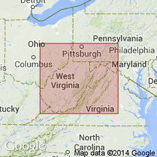
- Revised
- AAPG geologic province:
-
- Appalachian basin
Summary:
The stratigraphic section and description of geologic map units on the Geologic Map of West Virginia shows the Oranda Formation as part of the Trenton Group in the northeastern part of the State.
Source: GNU records (USGS DDS-6; Reston GNULEX).
- Usage in publication:
-
- Oranda Formation
- Modifications:
-
- Overview
- AAPG geologic province:
-
- Appalachian basin
Summary:
The Oranda Formation is generally poorly exposed. It consists of gray to brownish-gray calcareous siltstone; black, silty shale; dark-gray, calcareous mudstone; cobbly weathering, gray, fossiliferous and argillaceous limestone; and tan to brown metabentonites. The unit is between 50 and 60 feet (15 to 18 meters) thick. The lower contact of the Oranda is placed at the base of calcareous siltstone which overlies dark, medium- to coarse-grained limestones of the St. Luke Member of the Edinburg Formation. The upper contact is placed at the top of the youngest black siltstone overlain by black argillaceous limestone and calcareous shale of the Martinsburg Formation.
Source: GNU records (USGS DDS-6; Reston GNULEX).

- Usage in publication:
-
- Oranda Formation*
- Modifications:
-
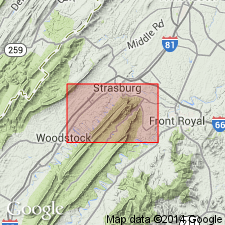
- Biostratigraphic dating
- AAPG geologic province:
-
- Appalachian basin
Summary:
Conodont biostratigraphy indicates that the Oranda Formation in the Winchester 30 X 60 minute quadrangle is of Middle Ordovician (Blackriveran? and Rocklandian) age. The occurrence of PHRAGMODUS UNDATUS in the lower 100 m of this formation indicates restricts this part of the unit to the lower part of the P. UNDATUS Zone.
Source: GNU records (USGS DDS-6; Reston GNULEX).
- Usage in publication:
-
- Oranda†
- Modifications:
-
- Abandoned
- AAPG geologic province:
-
- Appalachian basin
Summary:
The Oranda Formation of Cooper and Cooper (1946) is abandoned and replaced by part of the Stickley Run Member of the Martinsburg Formation. The basal 7.5 ft of cobbly limestone is placed in the underlying Edinburg Formation. Mapping in the Shenandoah Valley of VA and the eastern panhandle of WV indicates that the Oranda and its contacts were not satisfactorily delimited. Unit is abandoned based on difficulties in recognizing the Oranda as a mappable lithologic unit. Rocks previously assigned to the Oranda are included in basal 50 ft of the new Stickley Run Member of the Martinsburg, a 610 to 900 ft unit consisting of shaly limestone and calcareous shale.
Source: GNU records (USGS DDS-6; Reston GNULEX).
For more information, please contact Nancy Stamm, Geologic Names Committee Secretary.
Asterisk (*) indicates published by U.S. Geological Survey authors.
"No current usage" (†) implies that a name has been abandoned or has fallen into disuse. Former usage and, if known, replacement name given in parentheses ( ).
Slash (/) indicates name conflicts with nomenclatural guidelines (CSN, 1933; ACSN, 1961, 1970; NACSN, 1983, 2005, 2021). May be explained within brackets ([ ]).