

- Usage in publication:
-
- Oliverian petrogenic cycle
- Modifications:
-
- Original reference
- Dominant lithology:
-
- Granite
- AAPG geologic province:
-
- New England province
Summary:
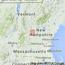
Four major periods of intrusive igneous activity have been recognized in central New Hampshire: The Highlandcroft, Oliverian, New Hampshire, and White Mountain petrogenic cycles.
The Highlandcroft cycle includes diorite, quartz diorite, granodiorite, and granite. They are younger than Partridge slate and older than Clough conglomerate; are definitely pre-Silurian, and probably late Ordovician.
The Oliverian rocks are largely biotite granite; younger than [Early] Devonian but older than major period of orogeny.
The New Hampshire magma series consists of diorite, quartz diorite, granodiorite, trondhjemite, and granite, younger than [Early] Devonian and essentially contemporaneous with the great period of folding.
Youngest of all is White Mountain ("alkaline") magma series, which is younger than [Early] Devonian, and later than the period of orogeny.
Thus 3 of the igneous series are younger than [Early] Devonian, and to them belong 90 percent of the igneous rocks of central New Hampshire. The other 10 percent (the Highlandcroft group) is pre-Silurian, probably late Ordovician but possibly older. On 1932 geologic map of US only the White Mountain magma series is shown as Paleozoic; all others being included in pre-Cambrian. In other words, Paleozoic intrusives are much more abundant than map shows.
M. Billings (April 26, 1935, personal commun.) stated Oliverian was chosen from stream of that name (Oliverian Brook) in southwestern corner of Moosilauke 15-min quadrangle, Grafton Co., northwestern NH.
Source: US geologic names lexicon (USGS Bull. 896, p. 1544, Highland Croft entry p. 955).
- Usage in publication:
-
- Oliverian magma series
- Modifications:
-
- Revised
- Age modified
- AAPG geologic province:
-
- New England province
Summary:
Revised as Oliverian magma series for a series of intrusive igneous rocks which are definitely younger than Early Devonian and older than the great period of folding (age given as late Devonian or late Carboniferous). In Moosilauke 15-min quad, is represented only by Owls Head granite, but other types of this series are present in Mt. Cube and Romney 15-min quads.
Source: GNU records (USGS DDS-6; Reston GNULEX).
- Usage in publication:
-
- Oliverian magma series
- Modifications:
-
- Revised
- Age modified
- AAPG geologic province:
-
- New England province
Summary:
Oliverian magma series shown in far western edge of Cardigan 15-min quad. Represented only by Smarts Mountain granite. Age is Devonian and is shown as older than New Hampshire magma series and younger than Littleton schists.
Source: GNU records (USGS DDS-6; Reston GNULEX).
- Usage in publication:
-
- Oliverian magma series
- Modifications:
-
- Revised
- Age modified
- AAPG geologic province:
-
- New England province
Summary:
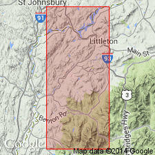
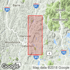
Report includes two maps published separately in 1938 by each of the authors. In Mascoma 15-min quad, Oliverian magma series is shown divided into (ascending) the Lebanon group (granite and gneiss), the Croydon group (quartz diorite and granodiorite), Smarts Mountain group (quartz diorite and granodiorite), and the Mascoma group (quartz diorite, granodiorite, quartz monzonite, and granite). Age given as probably Late Devonian. In Mt. Cube 15-min quad (New Hampshire portion only), Oliverian magma series is divided into (ascending) the Mascoma group (quartz diorite, oligoclase granodiorite, quartz monzonite, and granite), the Smarts Mountain granite [not group as in Mascoma quad], and the Baker Pond gneiss (mostly quartz monzonite, some granodiorite), and the Baker Pond gneiss (a border phase of quartz diorite gneiss). Age given as probably Late Devonian.
Source: GNU records (USGS DDS-6; Reston GNULEX).
- Usage in publication:
-
- Oliverian magma series
- Modifications:
-
- Revised
- AAPG geologic province:
-
- New England province
Summary:
The Oliverian magma series in this area in southwestern NH is represented by the Croydon and Unity groups. The Croydon consists of quartz diorite, quartz monzonite, and granodiorite. The Unity is very similar, but mostly quartz diorite. Both groups manifest themselves as domes. [The term Oliverian dome is introduced here. Oliverian domes are defined in this report as having a central, igneous core of biotite gneiss surrounded by concentric belts of Ammonoosuc volcanics and successively younger formations. They are arranged in a narrow belt extending northeast to southwest for over 125 miles. Each dome is composed of rocks of the Oliverian magma series, a concept that often caused confusion in later reports. Subdivisions of the magma series were sometimes called, without explanation, plutons or domes instead of a lithodemic name.]
Source: GNU records (USGS DDS-6; Reston GNULEX).
- Usage in publication:
-
- Oliverian magma series
- Modifications:
-
- Revised
- Age modified
- AAPG geologic province:
-
- New England province
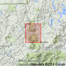
Summary:
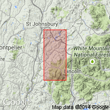
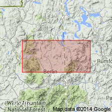
Represented in the Percy 15-min quad by quartz diorite, biotite-quartz monzonite, or coarse syenite. No contacts between each rock type have been observed. Includes rocks previously called Berlin gneiss in the southeastern corner of the quadrangle. Shown as Middle Devonian in map explanation, although the series as a whole is middle or late Devonian.
Source: GNU records (USGS DDS-6; Reston GNULEX).
- Usage in publication:
-
- Oliverian magma series
- Modifications:
-
- Areal extent
- Age modified
- AAPG geologic province:
-
- New England province
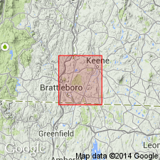
Summary:
The Oliverian magma series in the Keene, NH, and Brattleboro, VT, area in southwestern New Hampshire is represented by three plutons. The Westmoreland-Swazey pluton consists of granodiorite, quartz monzonite, and local areas or granite. The Vernon pluton is mostly quartz diorite. The Warwick pluton consists of granodiorite. The Oliverian magma series is geographically extended into VT in the vicinity of the town of Central Park. The age of the series in this area is Middle Devonian.
Source: GNU records (USGS DDS-6; Reston GNULEX).
- Usage in publication:
-
- Oliverian plutonic series*
- Modifications:
-
- Revised
- Age modified
- AAPG geologic province:
-
- New England province
Summary:
Revised as the Oliverian plutonic series. Includes the Whitefield gneiss and Lebanon granite. Age changed to Middle and Late Devonian(?).
Source: GNU records (USGS DDS-6; Reston GNULEX).
- Usage in publication:
-
- Oliverian Plutonic Suite*
- Modifications:
-
- Revised
- Age modified
- Areal extent
- AAPG geologic province:
-
- New England province
Summary:
Revised as Oliverian Plutonic Suite. Age dated at 445 m.y., making the age Ordovician. Areally extended into ME in the vicinity of the Milan 15-min quad. Intrudes the "Chickwolnepy complex" which in turn intrudes the Albee Formation and parts of the Middle Ordovician Ammonoosuc Volcanics.
Source: GNU records (USGS DDS-6; Reston GNULEX).
- Usage in publication:
-
- Oliverian Plutonic Suite*
- Modifications:
-
- Areal extent
- Age modified
- AAPG geologic province:
-
- New England province
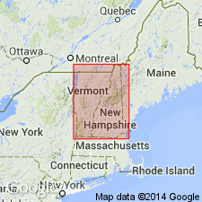
Summary:
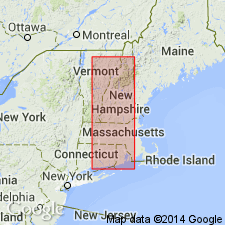
Age of the Oliverian Plutonic Suite has been verified as Middle Ordovician by Naylor (1969), Foland and Loiselle (1980), and Zartman and Leo (1981). Oliverian domes [presumably composed of Oliverian Plutonic Suite rocks] are shown mapped in NH, MA, VT, and CT, thereby extending the Suite from NH and ME to VT, CT, and MA.
Source: GNU records (USGS DDS-6; Reston GNULEX).
- Usage in publication:
-
- Oliverian Plutonic Suite*
- Modifications:
-
- Age modified
- AAPG geologic province:
-
- New England province
Summary:
In the White Mountains area of NH, the age of the Oliverian Plutonic Suite is Middle and Late Ordovician.
Source: GNU records (USGS DDS-6; Reston GNULEX).
- Usage in publication:
-
- Oliverian gneiss*
- Modifications:
-
- Revised
- Geochronologic dating
- Age modified
- AAPG geologic province:
-
- New England province
Summary:
Revised [incorrectly] as Oliverian gneiss. A careful distinction is made between Oliverian gneiss and Oliverian domes. The Oliverian domes are the geologic structures composed of Oliverian gneiss and mantling rocks. Isotopic age dating yields an emplacement age of 444+/-8 m.y. for six Oliverian domes. Results from Foland and Loiselle (1981) of 441+/-5 m.y. and of Leo and others (1984) of 456+/-10 m.y. are included in the calculations. These dates relate to the emplacement of the gneiss; the domes were probably formed during the Middle Devonian (380 to 370 m.y. ago) based on regional syntheses by Thompson and others (1968) and Robinson and Hall (1980).
Source: GNU records (USGS DDS-6; Reston GNULEX).

- Usage in publication:
-
- Oliverian Plutonic Suite*
- Modifications:
-
- Revised
- AAPG geologic province:
-
- New England province
Summary:
Revised again as Oliverian Plutonic Suite. Mapped undivided with rocks of Highlandcroft Plutonic Suite. Given an Ordovician age.
Source: GNU records (USGS DDS-6; Reston GNULEX).
- Usage in publication:
-
- Oliverian Plutonic Suite*
- Modifications:
-
- Overview
- AAPG geologic province:
-
- New England province
Summary:
Describes four distinct gneisses for domes of the Oliverian Plutonic Suite in New England: 1) compositionally homogeneous, intrusive plutons displaying slight to strong foliation that are typically granite, but include subordinate syenite, granodiorite, and tonalite (Oliverian in strict sense), 2) trondhjemite related to Ammonoosuc Volcanics, 3) thickly layered to nearly homogeneous quartz-plagioclase gneisses, and 4) layered gneisses, including paragneisses, quartzite, and calcareous granofels in addition to metavolcanic rocks. The Oliverian Plutonic Suite is of Late Ordovician age (444 Ma) and locally intrudes the Ammonoosuc Volcanics of early Late Ordovician age (approximately 455 Ma).
Source: GNU records (USGS DDS-6; Reston GNULEX).

- Usage in publication:
-
- Oliverian Plutonic Suite*
- Modifications:
-
- Age modified
- Overview
- Geochronologic dating
- AAPG geologic province:
-
- New England province
Summary:
Rocks mapped as Oliverian Plutonic Suite include weakly to strongly foliated, locally gneissic, intrusive rocks of the plutons that make up cores of the domes defining the Bronson Hill anticlinorium, in accordance with the usage of Billings (1956). Rocks are shown as discrete, named plutons on this map; each pluton is more or less centrally in a dome that carries the currently accepted name of the dome (Example: the Owls Head pluton of biotite granite forms an intrusive core of the Owls Head dome; the Jefferson batholith, composed of several rock types attributed to the Oliverian Plutonic Suite, is the intrusive core of the Jefferson dome). Isotopic data provided with the report indicate that most plutons are Ordovician (Cincinnatian or Mohawkian). But, Moody Ledge pluton is tentatively considered Silurian (Llandoverian) or Ordovician (Cincinnatian) on the basis of U-Pb zircon age of 435 +/-3 Ma obtained from mylonitized granite (Aleinikoff and Moench, (1987) reanalyzed by Aleinikoff, this report). Additionally, syenite to quartz syenite and some other rock types of the Jefferson batholith are considered either Silurian (Llandoverian) or Ordovician (Cincinnatian) on the basis of Rb-Sr whole-rock age of 441 +/-5 Ma (Foland and Loiselle, 1981), which is on the Ordovician side of the Ordovician-Silurian boundary on time scale of Tucker and others (1990; also Ross and others, 1982, modified by Ross, 1992, written commun.). Age of the Oliverian Plutonic Suite is therefore Silurian(?) and Ordovician.
Source: GNU records (USGS DDS-6; Reston GNULEX).

- Usage in publication:
-
- Oliverian Plutonic Suite*
- Modifications:
-
- Overview
- Age modified
- Geochronologic dating
- AAPG geologic province:
-
- New England province
Summary:
Used as Oliverian Plutonic Suite. Generally consists of pink, weakly to moderately foliated, locally porphyritic biotite granitoids occurring in mantled gneiss domes; includes facies metamorphosed to amphibolite. Mafic varieties contain hornblende. Mapped as 18 unnamed separate bodies on 1:250,000 (Moody Ledge Granite included in Early Silurian granite body). Accompanying 1:500,000-scale map showing formally and informally named plutons and isotopic age data shows the following units and their ages (in Ma):
1. Whitefield Gneiss: 458 +-8 U/Pb (Zartman and Leo, 1985).
2. Jefferson dome intrusive rocks: 441 +-5 Rb/Sr (Foland and Loiselle, 1981); 444 +-8 U/Pb (Zartman and Leo, 1985); 456 +-3 U/Pb (Aleinikoff and Moench, 1987); 454 +-5 U/Pb (J.N. Aleinikoff, oral commun., 1994).
3. Moody Ledge Granite displaced by Mount Clough pluton: 435 +-3 U/Pb (Aleinikoff and Moench, 1987).
4. Landaff dome intrusive rocks: 444 +-8 U/Pb (Zartman and Leo, 1985); 447 +-4 U/Pb (J.N. Aleinikoff, oral commun., 1994).
5. Sugar Hill dome intrusive rocks: 444 +-8 U/Pb (Zartman and Leo, 1985).
6. Owls Head dome intrusive rocks: 444 +-8 U/Pb (Zartman and Leo, 1985).
7. Lebanon intrusive rocks: 431 +-30 Rb/Sr (Naylor, 1969).
8. Mascoma Granite: 431 +-30 Rb/Sr, and 450 +-25 U/Pb (Naylor, 1969).
9. Keene dome intrusive rocks: 444 +-8 U/Pb (Zartman and Leo, 1985).
10. Warwick dome intrusive rocks: 444 +-8 U/Pb (Zartman and Leo, 1985).
Other formally or informally named rock bodies of Oliverian Plutonic Suite shown on 1:500,000-scale map (without age data) are: Moody Ledge Granite, Baker Pond dome intrusive rocks, Plainfield intrusive rocks, Smarts Mountain Granite, Croydon dome intrusive rocks, Unity dome intrusive rocks, Sugar River intrusive rocks, Alstead dome intrusive rocks, Surry dome intrusive rocks, and Vernon pluton. Age of Oliverian changed to Late Ordovician and Silurian based on isotopic ages presented above. Report includes geologic map and correlation chart.
Source: GNU records (USGS DDS-6; Reston GNULEX).
For more information, please contact Nancy Stamm, Geologic Names Committee Secretary.
Asterisk (*) indicates published by U.S. Geological Survey authors.
"No current usage" (†) implies that a name has been abandoned or has fallen into disuse. Former usage and, if known, replacement name given in parentheses ( ).
Slash (/) indicates name conflicts with nomenclatural guidelines (CSN, 1933; ACSN, 1961, 1970; NACSN, 1983, 2005, 2021). May be explained within brackets ([ ]).