


- Usage in publication:
-
- Oakdale quartzite*
- Modifications:
-
- Original reference
- Dominant lithology:
-
- Quartzite
- AAPG geologic province:
-
- New England province
Summary:
Pg. 59, 60-62, 76-78. Oakdale quartzite. Fine, even-grained flaggy quartzite, in many places greatly jointed, reddish brown from development of secondary biotite in minute scales or greenish from development of actinolite in small lenses or subordinate beds that were originally calcareous. Presumably = Merrimack quartzite, but because of some uncertainty regarding the correlation, and because of its wide separation, it seems best for present to give the quartzite of Worcester trough the name Oakdale, from village in town of Sterling [Township], Massachusetts, where it is conspicuously displayed. In my opinion the Oakdale quartzite grades into Paxton quartz schist to west. It is overlain by Worcester phyllite. [Age is considered Carboniferous.]
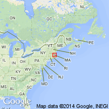
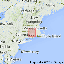
[Recognized in central MA, central southern NH, and northeastern CT.]
Source: US geologic names lexicon (USGS Bull. 896, p. 1523).
- Usage in publication:
-
- Oakdale Formation*
- Modifications:
-
- Revised
- Age modified
- Overview
- AAPG geologic province:
-
- New England province
Summary:
Oakdale Quartzite (Emerson, 1917) is renamed Oakdale Formation after work by Grew (1970) and Pease (1981) because it is not a quartzite [revision was made previously by Pease (1980) in USGS Professional Paper 1175, p. 62, but this was not noted in this report]. Oakdale is calcareous metasiltstone and pelite, part of sequence described by Peck (1976), Grew (1970, 1973), and Robinson (1978) in Clinton, Worcester, and Shirley area that includes [parts of units previously mapped as] Worcester Formation and orthoquartzite of Tower Hill and Vaughn Hills Quartzites. Oakdale of Emerson (1917) is separated by Wekepeke fault into eastern and western belts. West of fault, Oakdale is equivalent to unit 5 of Peck, 1976); east of fault, Oakdale is equivalent to unit 2 of Peck and unit DSd of Grew (1973). Interpreted as turbidite deposit by Peck (1976) but stratigraphic order of internal units and correlation with other units in region is difficult because of faulting and thrusting. Sequence is separated from Proterozoic Z or Ordovician Nashoba Formation by Clinton-Newbury fault zone, but some evidence indicates that the Oakdale lies unconformably over Nashoba. Continuous with Merrimack Group of southeastern NH and southern ME which has been correlated with Silurian fossiliferous strata in central ME (Osberg, 1968). Also continuous with Hebron Formation of CT (Rodgers and others, 1959). Both Oakdale and Hebron are intruded by granite dated as Silurian (R.E. Zartman and R.S. Naylor, written commun., 1978), and as pointed out by Dixon (1976), Hebron (and Oakdale) could be older than Silurian. Oakdale is here assigned a probable Silurian age.
Source: GNU records (USGS DDS-6; Reston GNULEX).

- Usage in publication:
-
- Oakdale Formation*
- Modifications:
-
- Overview
- AAPG geologic province:
-
- New England province
Summary:
Used as Oakdale Formation of Silurian age. Consists of siltstone and schist. Probable low-grade equivalent of Paxton Formation.
Source: GNU records (USGS DDS-6; Reston GNULEX).
- Usage in publication:
-
- Oakdale Formation*
- Modifications:
-
- Revised
- Age modified
- AAPG geologic province:
-
- New England province
Summary:
The Oakdale Formation is here revised to include strata previously mapped in CT and adjacent MA as the Hebron Formation and the Scotland Schist. The Scotland Member (Pease, 1980) is renamed the Scotland Schist Member of the Oakdale. The Oakdale is a homogeneous, calcareous metasiltstone at the base of a thick stratigraphic sequence in a geosyncline terrane and extends from NH to the Honey Hill fault in eastern CT. In central eastern CT it underlies the Hebron Formation; in northeast CT and adjacent MA it underlies conformably the Dudley Formation of the Paxton Group; in central MA it underlies the Paxton Group undivided. The lower part of the Oakdale is cut out along the Clinton-Newbury fault zone. Thickness in type area is about 1500 m. Correlative with the Gove Member of the Berwick Formation in NH and the Gonic Formation in ME. Age is Late Proterozoic(?) based on intrusion of 440 Ma Hedgehog Hill gneiss in the upper part of the Brimfield Group at the top of the stratigraphic sequence, and an age of 1188 Ma for detrital zircons from the Paxton in north-central MA.
Source: GNU records (USGS DDS-6; Reston GNULEX).
For more information, please contact Nancy Stamm, Geologic Names Committee Secretary.
Asterisk (*) indicates published by U.S. Geological Survey authors.
"No current usage" (†) implies that a name has been abandoned or has fallen into disuse. Former usage and, if known, replacement name given in parentheses ( ).
Slash (/) indicates name conflicts with nomenclatural guidelines (CSN, 1933; ACSN, 1961, 1970; NACSN, 1983, 2005, 2021). May be explained within brackets ([ ]).