

- Usage in publication:
-
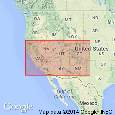
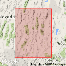
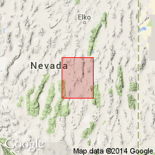
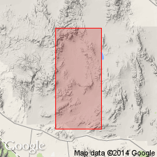
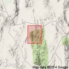
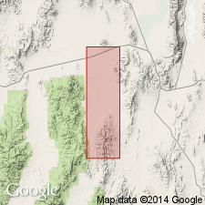
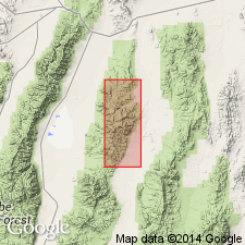
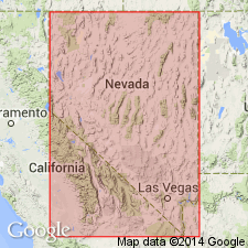
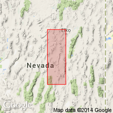
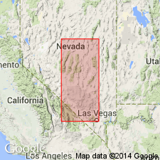
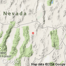
- Nevada
- Modifications:
-
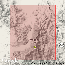
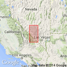
- Areal extent
- AAPG geologic province:
-
- Great Basin province
Summary:
Map 4 (Nevada Plateau) of northeastern Nevada. "Nevada (Chemung to Upper Helderberg)." [Shown as upper part of Devonian, and younger than Ogden quartzite.].
Source: US geologic names lexicon (USGS Bull. 896, p. 1479).
- Usage in publication:
-
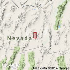
- Nevada limestone*
- Modifications:
-
- Named
- Biostratigraphic dating
- Dominant lithology:
-
- Limestone
- AAPG geologic province:
-
- Great Basin province
Summary:
Named for great development in NV. [no type locality designated] Occurs in Mahogany Group [Hills], northern Fish Creek Mtns, Modoc Peak, Silverado Group [Diamond Mountains], Alhambra Hills. One exposure in Fish Creek Valley. Mainly composed of limestone, but intercalated beds of shale and saccharoidal texture, quartzite occur. Generally lower strata are indistinctly bedded, highly siliceous, and gray in color, passing up into brown, reddish-brown, and gray beds which are distinctly bedded and frequently banded producing somewhat variegated appearance; upper strata are more massive, usually well bedded and normally bluish black limestone. Thickness of longest continuous section estimated at 5,400 ft. Grades into underlying Lone Mountain dolomite (Silurian); contact arbitrarily placed, with poorly defined lithological distinctions. Conformably overlain by White Pine shale (Devonian). Contains rich and well preserved fauna of brachiopods and corals (and a ctenacanthus-like tooth). Age is Devonian (upper Helderberg, Hamilton and Chemung).
Source: GNU records (USGS DDS-6; Menlo GNULEX).
- Usage in publication:
-
- Nevada limestone*
- Modifications:
-
- Overview
- AAPG geologic province:
-
- Great Basin province
Summary:
Gives typical sections afforded at Modoc Peak, Combs Mtns, Atrypa Peak, Woodpeckers Peak, and Newark Mtn. Measured Section at Modoc Peak included. Age is Devonian (Upper Helderberg, Hamilton, and Chemung). [In (Kindle, E.M.,1908, The fauna and stratigraphy of the Jefferson limestone in the northern Rocky Mountain region: Bulletin of American Paleontology, v.4 no.20, p.20+) is correlated with Nevada limestone]
Source: GNU records (USGS DDS-6; Menlo GNULEX).
- Usage in publication:
-
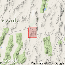
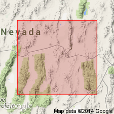
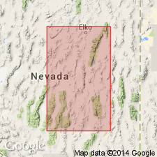
- Nevada limestone*
- Modifications:
-
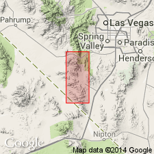
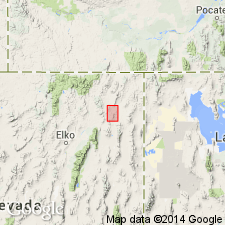
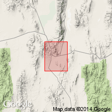
- Areal extent
- AAPG geologic province:
-
- Great Basin province
Summary:
Mapped in Ely area (Ely quad), NV. Occurs immediately NW of Ely and near Weary Flat, although lower part may include Ordovician Lone Mountain. Generally bleached and locally metamorphosed. Composed of massive beds of limestone, usually separated by ill-defined parting. Color dark gray to dark blue to nearly black. Generally contains poorly preserved fossils. Age Devonian based on brachiopods. [Same fossils as in Nevada limestone found in Inyo Range near Kearsarge, CA (Kirk, E., 1918, USGS Prof. Paper 110).]
Source: GNU records (USGS DDS-6; Menlo GNULEX).
- Usage in publication:
-
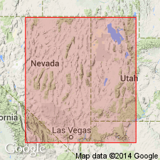
- Nevada limestone*
- Modifications:
-
- Age modified
- AAPG geologic province:
-
- Great Basin province
Summary:
Nevada limestone of Eureka district correlated with Devonian sections at Gold Hill and Pioche areas, at least in basal part. Previous authors erroneously referred to Nevada limestone as Lower Devonian. Nevada limestone clearly Middle and Upper Devonian. (STRINGOCEPHALUS is found at Dutch John Mtns, 40 mi north of Pioche, NV)
Source: GNU records (USGS DDS-6; Menlo GNULEX).

- Usage in publication:
-
- Nevada limestone*
- Modifications:
-
- Not used
- AAPG geologic province:
-
- Great Basin province
Summary:
Nevada limestone not used in Pioche district, eastern Lincoln Co, NV for Middle and Upper Devonian rocks, Silverhorn limestone (new) and overlying West Range limestone (new) (Upper Devonian). Silverhorn limestone (new) (Middle Devonian) contains characteristic facies of brown dolomite called "spaghetti limestone".
Source: GNU records (USGS DDS-6; Menlo GNULEX).
- Usage in publication:
-
- Nevada limestone
- Modifications:
-
- Not used
- AAPG geologic province:
-
- Great Basin province
Summary:
Nevada limestone not used in Goodsprings quad, southern NV; Sultan limestone (new) used instead. Fauna in Sultan limestone (new) (Middle Devonian) correlative with fauna in upper part of Nevada Limestone in Eureka area.
Source: GNU records (USGS DDS-6; Menlo GNULEX).
- Usage in publication:
-
- Nevada formation*
- Modifications:
-
- Redescribed
- Revised
- AAPG geologic province:
-
- Great Basin province
Summary:
Type section: sequence exposed at Modoc Peak [39 deg 30' 04"N 116 deg 02' 29"W], Roberts Mountain quad [now Whistler Mtn. 15' quad], Eureka Co, NV. Restricted to lower 2,448 ft of Devonian strata above Lone Mountain formation as exposed at Lone Mountain; upper 2,065 ft of Devonian strata exposed at Devils Gate and in Modoc Ridge are named Devils Gate formation (new). Lower limit of Nevada formation drawn at top of barren, more or less massive dolomite of Lone Mountain formation. Upper limit arbitrarily established at top of Stringocephalus zone. With lowering of the upper limit of Nevada fm to top of Stringocephalus zone it appears desirable to abandon use of the term "Nevada limestone" (Spencer, 1917 p.25) for those beds in Ely area which seem to correlate with the Devils Gate. Early and Middle Devonian ages. [see also geol. map of Roberts Mtn (Merriam and Anderson, 1942] [shown as Coblenzian, Middle Dev. & Upper Dev., correlates with Sevy and Simonson dol. and lower part of Guilmette Ls in Gold Hill area, UT (Cooper, G.A. and others, 1942] [Rugose corals described by Stumm, 1940]
Source: GNU records (USGS DDS-6; Menlo GNULEX).
- Usage in publication:
-
- Nevada formation*
- Modifications:
-
- Overview
- AAPG geologic province:
-
- Great Basin province
Summary:
Exposed along crest of southern Ruby Mtns. and eastern Flank. Consists of various shades of gray crystalline, fine-to-medium grained, uniform to laminated or mottled, flaggy dolomite, and limy dolomite. Particularly distinctive are beds of irregularly mixed black and white dolomite. Measured section south of Pearl Peak. Base of Nevada formation is placed within change from massive uniform light-colored Silurian [Lone Mountain] dolomite to darker flaggy irregular dolomite and limy dolomite. Age in this area is Middle Devonian.
Source: GNU records (USGS DDS-6; Menlo GNULEX).
- Usage in publication:
-
- Nevada formation*
- Modifications:
-
- Overview
Summary:
Nevada formation at Lone Mountain (central Nevada) is correlated with Simonson dolomite in east White Pine Co (east-central Nevada) and adjacent Utah. Both contain similar fauna. Simonson dolomite represents the shoreward facies of part of Nevada limestone of central Nevada.
Source: GNU records (USGS DDS-6; Menlo GNULEX).
- Usage in publication:
-
- Nevada formation*
- Modifications:
-
- Overview
- Revised
- AAPG geologic province:
-
- Great Basin province
Summary:
Divided into 5 members (ascending) Beacon Peak dolomite, Oxyoke Canyon sandstone, Sentinel Mountain dolomite, Woodpecker limestone, and Bay State dolomite members (all new). Members appear to be valid for a N-S distance of more than 25 mi in Diamond Mtns and W of Eureka at least in part. Overlies Lone Mountain formation; underlies Devils Gate limestone. Contact between Lone Mountain and Nevada may represent unconformity based on sedimentary breccias below contact and sandstone above it. Upper contact with Devils Gate recognized by lithologic change from limestone to dolomite occurring within narrow zone of about 50 ft in thickness. Measured sections at Lone Mountain, Newark Mountain, Alhambra Hills and Phillipsburg Mine. Age is Early and Middle Devonian based on brachiopods and corals.
Source: GNU records (USGS DDS-6; Menlo GNULEX).
- Usage in publication:
-
- Nevada formation*
- Modifications:
-
- Revised
- AAPG geologic province:
-
- Great Basin province
Summary:
In Sulphur Springs and Pinyon Ranges, subdivided into (ascending) McColley Canyon, Union Mountain, and Telegraph Canyon members (all new). McColley Canyon member (new) is correlative to Beacon Peak dolomite member; the Union Mountain (new) to Oxyoke Canyon Sandstone; and Telegraph Canyon (new) to Sentinel Mountain dolomite, Woodpecker limestone, and Bay State dolomite members of Nevada formation. Contact between Nevada formation and Lone Mountain dolomite is conformable and easily drawn at the upward termination of alternating light and dark-gray dolomite beds of upper Lone Mountain. No evidence of unconformity. Gives measured sections at Old Whalen, Bald Mountain, Telegraph Canyon, Williams Canyon, McColley Canyon, Union Mountain, and Dry Creek-Coffin Mountain. Age is Middle Devonian.
Source: GNU records (USGS DDS-6; Menlo GNULEX).
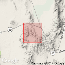
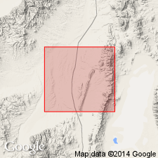
- Usage in publication:
-
- Nevada formation*
- Modifications:
-
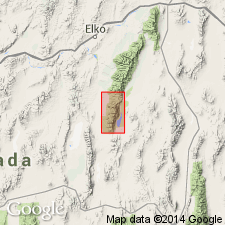
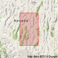
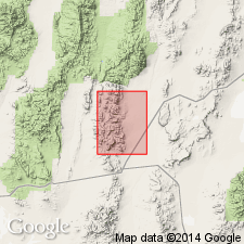
- Areal extent
- AAPG geologic province:
-
- Great Basin province
Summary:
Can be recognized in Yucca Flat area (near Captain Jack Springs, at Mine Mtn S Ranger Mtns) and in Frenchman Flat area of Atomic Energy Commission proving grounds. Divided into 3 units (ascending): A,B, and C. A is 460 ft of interbedded dolomite, limestone and quartz. Base of A is distinctive buff to reddish-brown limestone. B is 260 ft of interbedded light-gray and black dolomite. C is 350 ft of interbedded limestone and dolomite characterized by spaghetti beds (Amphora). Total thickness 1070 ft. Shown on map as Devils Gate and Nevada formations undifferentiated. Overlain by Devils Gate limestone (?); underlain by undifferentiated middle Paleozoic dolomite. At Mine Mtn the Nevada and overlying rocks thrust over Mississippi strata. Age is Middle Devonian based on faunal evidence. [tentatively correlated with parts of Los Burro fm in Quartz Spring area, CA and part of Sultan Ls in Goodsprings area, NV (Poole and others, 1961)] [Unconformably underlies Oaksprings formation (Tertiary) (Hansen and others, 1963)]
Source: GNU records (USGS DDS-6; Menlo GNULEX).
- Usage in publication:
-
- Nevada formation*
- Modifications:
-
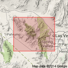
- Areal extent
- AAPG geologic province:
-
- Great Basin province
Summary:
Nevada limestone as originally defined by Hague (1892) recognized in White Pine Range at Cathedral Canyon, Babylon Ridge, Eberhard Canyon, and on Pogonip Ridge (in SW part of district where best exposure occurs). Lower part consists of thin-bedded limestone with buff and reddish partings (250 to 350 ft thick). Upper part consists of massive medium-gray to bluish-gray limestone (between 1250 and 1350 ft thick. Total thickness about 1500 ft. Unconformably underlies Pilot shale (Mississippian) and locally in fault contact with overlying Lone Mountain dolomite. No Stringocephalus fossils occur. Lower part is Middle Devonian age. Upper part is mostly Late Devonian age. [Author does not recognize Devils Gate].
Source: GNU records (USGS DDS-6; Menlo GNULEX).
- Usage in publication:
-
- Nevada formation*
- Modifications:
-
- Areal extent
- AAPG geologic province:
-
- Great Basin province
Summary:
Occurs in N Simpson Park Range (Coal Canyon) [Horse Creek Valley 15' quad, Eureka Co, NV]. "Between the Roberts Mountain formation and Nevada formation is lithologic unit not recognized in Roberts Mountains but which may correlate with similarly placed unit in Copenhagen Canyon, 50 mi south in Monitor Range. Unit, termed "Rabbit Hill formation" by Merriam (oral commun.) consists of tan-weathering silty limestone and calcareous shale, lighter colored than underlying Roberts Mountain formation and more silty and thinly bedded than overlying Nevada formation. Contact with Roberts Mountain and Nevada formations appear conformable and gradational. Is very fossiliferous, lower beds being rich in TENTACULITES and upper beds rich in brachiopods (mainly small LEPTOCOELIA) and trilobites. According to Merriam Rabbit Hill formation at its type locality contains Helderbergian or lowermost Devonian fauna and our fossils from this unit are similar." [adapted from Winterer and Murphy, 1960]
Source: GNU records (USGS DDS-6; Menlo GNULEX).
- Usage in publication:
-
- Nevada Formation*
- Modifications:
-
- Revised
- AAPG geologic province:
-
- Great Basin province
Summary:
Proposed "that McColley Canyon, originally defined as a member of Nevada Formation (Carlisle and others, 1957), be elevated to formation rank." [author does not state in this paper the need to elevate Nevada Formation to group rank nor to change the rank of other members of Nevada Formation in same area. The McColley Canyon Formation unconformably underlies the Union Mountain Member of Nevada Formation in his correlation diagram.]
Source: GNU records (USGS DDS-6; Menlo GNULEX).
- Usage in publication:
-
- Nevada Formation*
- AAPG geologic province:
-
- Great Basin province
Summary:
In Sulphur Springs Range Sevy Formation is correlated with lower part of Union Mountain and McColley Canyon Members of Nevada Formation; Simonson Dolomite is correlated with upper part of Union Mountain and Telegraph Canyon Members of Nevada Formation. In Eureka area, Sevy Formation is correlated with lower part of Oxyoke Canyon Sandstone and Beacon Peak Dolomite Members of Nevada Formation; Simonson Dolomite is correlated with upper part of Oxyoke Canyon Sandstone, Sentinel Mountain Dolomite, Woodpecker Limestone and Bay State Dolomite Members of Nevada Formation.
Source: GNU records (USGS DDS-6; Menlo GNULEX).
- Usage in publication:
-
- Nevada Formation*
- Modifications:
-
- Age modified
- AAPG geologic province:
-
- Great Basin province
Summary:
Beacon Peak Dolomite, Oxyoke Canyon Sandstone, Sentinel Mountain Dolomite and Bay State Dolomite Members (of Nevada Formation) are mapped in central part of middle Diamond Mtns. Map explanation shows age of Nevada Formation as Lower Devonian, but the following: "The presence of STRINGOCEPHALUS in the Bay State Dolomite Member of the Nevada Formation indicates its Middle Devonian age..." Unit underlies Devils Gate Limestone and disconformably overlies Lone Mountain Dolomite.
Source: GNU records (USGS DDS-6; Menlo GNULEX).
- Usage in publication:
-
- Nevada Formation*
- Modifications:
-
- Areal extent
- AAPG geologic province:
-
- Great Basin province
Summary:
Occurs on W side only of Antelope Valley near N end of Antelope Range. Divided into an upper, middle, and lower part. Is in fault contact with underlying Lone Mountain dolomite (Silurian). Age is Early and Middle Devonian.
Source: GNU records (USGS DDS-6; Menlo GNULEX).
- Usage in publication:
-
- Nevada formation*
- Modifications:
-
- Areal extent
- AAPG geologic province:
-
- Great Basin province
Summary:
Occurs in central part of Specter Range where divided into 2 informal units, upper cliff-forming massive dolomite member and lower slope-forming quartzite member. Is 1605 ft thick in Specter Range. [2 units at base probably equivalent to 2 members at Eureka, Beacon Peak Dolomite and Oxyoke Canyon Sandstone Members]. Includes stratigraphic column of rocks in area. Contact between Nevada and overlying Devils Gate limestone is placed at top of dark-gray thick-bedded dolomite of Nevada. Contains corals and brachiopods including STRINGOCEPHALUS. Age is Early and Middle Devonian.
Source: GNU records (USGS DDS-6; Menlo GNULEX).
- Usage in publication:
-
- Nevada formation*
- Modifications:
-
- Not used
- AAPG geologic province:
-
- Great Basin province
Summary:
Nevada formation not used in N Toquima Range, the McMonnigal limestone (of Ice Canyon sequence) and Tor limestone (of June Canyon sequence) used for partly equivalent Devonian rocks. These formations seem to be siltier and equivalent to Beacon Peak dolomite member of Nevada formation. Nevada formation is shown in Antelope Range in correlation chart.
Source: GNU records (USGS DDS-6; Menlo GNULEX).
- Usage in publication:
-
- Nevada Group
- Modifications:
-
- Revised
- AAPG geologic province:
-
- Great Basin province
Summary:
Nevada Formation is raised to group rank in "westernmost localities" of central NV where limestone is predominant carbonate rock. McColley Canyon Formation [raised earlier to formation rank by Johnson (1962)] and a newly proposed formation, the Denay Limestone (Johnson, in press), constitute Nevada Group. [see Johnson (1966)]
Source: GNU records (USGS DDS-6; Menlo GNULEX).
- Usage in publication:
-
- Nevada Group
- Modifications:
-
- Revised
- AAPG geologic province:
-
- Great Basin province
Summary:
Denay Limestone (new) is named for Middle Devonian rocks formerly "unnamed limestone" in J-D Window of Johnson (1962) [and upper part of Nevada formation in J-D window of Roberts and others (1958)]. The Denay Limestone and underlying McColley Canyon Formation constitute the Nevada Group in Roberts Mountain and N Simpson Park Range areas.
Source: GNU records (USGS DDS-6; Menlo GNULEX).
- Usage in publication:
-
- Nevada Group
- Modifications:
-
- Biostratigraphic dating
- AAPG geologic province:
-
- Great Basin province
Summary:
Nevada Group with McColley Canyon Formation and Telegraph Canyon Formation recognized in Table Mountain-Mahogany Hills area. The member divisions of Nevada Formation in Diamond Mtns of Nolan and others (1956) not recognized in Table Mtn. Here, McColley Canyon is approx 510 ft thick and Telegraph Canyon is 2255 ft. thick. Telegraph Canyon Formation underlies Devils Gate Limestone, and McColley Canyon Formation overlies Lone Mountain Dolomite. Units contain brachiopods. Age is Early and Middle Devonian.
Source: GNU records (USGS DDS-6; Menlo GNULEX).
- Usage in publication:
-
- Nevada Group
- Modifications:
-
- Revised
- AAPG geologic province:
-
- Great Basin province
Summary:
Nevada Formation of Carlisle and others (1957) in Sulphur Springs and Pinyon Ranges raised in rank to Nevada Group. Union Mountain and Telegraph Canyon Members raised in rank to Union Mountain and Telegraph Formations, [McColley Canyon Formation, previously raised to formation rank by Johnson (1962)]. McColley Canyon Formation divided into 3 members (ascending): Kobeh, Bartine, and Coils Creek Members (all new).
Source: GNU records (USGS DDS-6; Menlo GNULEX).
- Usage in publication:
-
- Nevada Group
- Modifications:
-
- Revised
- AAPG geologic province:
-
- Great Basin province
Summary:
Chart shows Nevada Group in Roberts Mtns, Simpson Park Range, Sulphur Spring Range, and east of Eureka. Woodpecker Limestone? shown in Sulphur Spring Range [rocks formerly called limestone tongue of Telegraph Canyon Member of Nevada Formation by Carlisle and others (1957)].
Source: GNU records (USGS DDS-6; Menlo GNULEX).
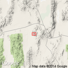
- Usage in publication:
-
- Nevada Formation*
- Modifications:
-
- Areal extent
Summary:
Extended to include sequence of Devonian rocks on Bare Mountain, earlier designated Fluorspar Canyon Formation (Cornwall and Kleinhampl, 1961). Name Fluorspar Canyon Formation herewith abandoned. Mapped mostly undifferentiated with Devils Gate Dolomite in Nye County. Total thickness in Bare Mtn 1700 ft. Conformably overlies Lone Mountain Dolomite. Fossils identified by Merriam. Age is Early and Middle Devonian.
Source: GNU records (USGS DDS-6; Menlo GNULEX).
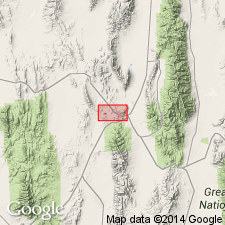
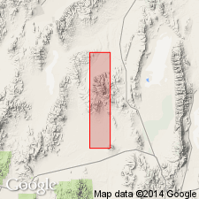
- Usage in publication:
-
- Nevada Formation*
- Modifications:
-
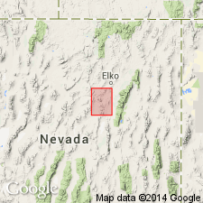
- Areal extent
- AAPG geologic province:
-
- Great Basin province
Summary:
Recognized in Windermere Hills [Wells Peak 7.5' quad, Elko Co, NV]. Measured section of Black Mtn sequence shows 1700 ft of Nevada Formation underlying 300 ft of Guilmette Formation (both Middle Devonian age). Base of Nevada Formation not exposed. Mapped in figure sketch of Windermere Hills. Includes recrystallized coral and brachiopod fragments (only a few specimens of STRINGOCEPHALUS).
Source: GNU records (USGS DDS-6; Menlo GNULEX).
- Usage in publication:
-
- Nevada Formation*
- Modifications:
-
- Revised
- AAPG geologic province:
-
- Great Basin province
Summary:
In Lone Mountain divided into 5 (ascending) units, 1 to 5. Unit 1 and lowermost part of unit 2 are Early Devonian. Middle and part of unit 2 upward thru unit 4 are Middle Devonian. Unit 5 is approx. equivalent to Bay State Dolomite Member in Diamond Mtns. belt. Unit 5 contains STRINGOCEPHALUS but no identifiable Rugosa at Lone Mountain.
Source: GNU records (USGS DDS-6; Menlo GNULEX).
- Usage in publication:
-
- Nevada Formation*
- Modifications:
-
- Areal extent
- AAPG geologic province:
-
- Great Basin province
Summary:
Recognized in NW Spring Mountains (Wheeler Pass thrust plate only), NW of Las Vegas, NV. Stratigraphic column shows unit underlies Devils Gate Limestone and overlies Laketown Dolomite. Age given is Devonian although text mentions "Lower Devonian dolomite beds" of Nevada Formation.
Source: GNU records (USGS DDS-6; Menlo GNULEX).
- Usage in publication:
-
- Nevada Formation*
- Modifications:
-
- Revised
- AAPG geologic province:
-
- Great Basin province
Summary:
In Lone Mountain divided into five (ascending 1 to 5): 1) at Coral Gulch consists of 260 ft of thick-bedded dolomite, dolomitic limestone, and light to mouse-gray limestone; overlies Lone Mountain Dolomite; contains ACROSPIRIFER KOBEHANA fauna (about Emsian age); 2) at Coral Gulch and upper Fossil Gulch, consists of 720 ft partly argillaceous, thin-bedded and shaly bands; contains abundant favositid head; is Early Middle Devonian age; probably correlates with Oxyoke Canyon Sandstone Member in Diamond Mtns; 3) on south side, consists of 285 ft. of dark-gray, well-bedded and relatively nonargillaceous limestone scarce fossils tending to be crinoidal debris; 4) west side of ridge between Reef Point and North Peak consists of 675 ft of well-bedded dense, resistant, fine-grained limestone, dolomite limestone and dolomite (dull mouse to medium dark gray, weathering light gray), and abundant colonial rugose corals (middle Middle Devonian) equivalent to Woodpecker Limestone Member (Nolan and others, 1956); 5) at summit ridge between Flag Point and North Peak consists of 570 ft of thick-bedded and massive saccharoidal dolomite and dolomitic limestone of dark to light-gray color; contains deposits of STRINGOCEPHALUS; is approx equivalent of Bay State Dolomite Member. Units 1 and 2 also occur in Sulphur Springs Range. Nevada formation may also be represented in Hot Creek Range (H.E. Cook, written commun, 1966)
Source: GNU records (USGS DDS-6; Menlo GNULEX).
- Usage in publication:
-
- Nevada Formation*
- Modifications:
-
- Revised
- AAPG geologic province:
-
- Great Basin province
Summary:
Two newly-named members adopted and assigned to Nevada Formation. Now includes (ascending): unnamed basal quartzite unit; Beacon Peak Dolomite Member, Grays Canyon Limestone Member (new), Oxyoke Canyon Sandstone Member, Sentinel Mountain Dolomite Member, Woodpecker Limestone Member, South Hill Sandstone Member (new) and Bay State Dolomite Member in Pinto Summit 15' quad, Eureka and White Pine Cos, NV. South Hill Sandstone and Grays Canyon Limestone Members exposed only in Grays Canyon. In Grays Canyon area the Grays Canyon Sandstone Member (new) represents Oxyoke Canyon Sandstone Member and South Hill Sandstone Member (new) represents Woodpecker Limestone Member. Basal quartzite unit unconformably overlies Lone Mountain Dolomite. The upper Bay State Dolomite Member underlies Devils Gate Limestone. Age is Early and Middle Devonian.
Source: GNU records (USGS DDS-6; Menlo GNULEX).
- Usage in publication:
-
- Nevada Formation*
- Modifications:
-
- Areal extent
- AAPG geologic province:
-
- Great Basin province
Summary:
Recognized in Hot Creek Range, Tybo quad, Nye Co, NV. In least altered section predominantly limestone containing scattered lenticular layers of carbonate breccia; dolomite occurs in basal part. Most prominent breccia (25 ft thick) occurs at top in Rawhide Mtn area. Fossils from uppermost 100 ft are late Middle Devonian age. Fossils from 50-75 ft above base are medial Middle Devonian age. Westernmost Nevada exposure in upper Empire Canyon is fine-grained quartzite. Total thickness over 650 ft. Unconformably underlies Eleana Formation (Mississippian). Overlies Devonian beds, probably correlative with Lone Mountain Dolomite. Age is Early and Middle Devonian.
Source: GNU records (USGS DDS-6; Menlo GNULEX).
- Usage in publication:
-
- Nevada Formation*
- Modifications:
-
- Areal extent
- AAPG geologic province:
-
- Great Basin province
Summary:
Recognized in Carlin-Pinon Range area. Includes measured sections for an upper dolomite member, Oxyoke Canyon Sandstone Member and Beacon Peak Dolomite Member which are shown on map. Three upper members in Eureka area (Nolan and others, 1956) are equivalent to [unnamed] upper dolomite member. Thickness of Nevada Fm from 1600 to 3200 ft in area of report. Underlies Devils Gate Limestone; overlies Lone Mountain Dolomite. Fossils are scarce and poorly preserved; coral "spaghetti" beds occur throughout area. Early and Middle Devonian age established from studies S of mapped area.
Source: GNU records (USGS DDS-6; Menlo GNULEX).
- Usage in publication:
-
- Nevada Formation*†
- Modifications:
-
- Abandoned
- AAPG geologic province:
-
- Great Basin province
Summary:
"Because every member of the Nevada Formation possesses all the characteristics of a formation, we here elevate each of its members to formation rank and abandon the name Nevada Formation." p. 1 [authors do not mention Nevada Formation in areas where it is not subdivided into named members, e.g., in White Pine Range, Windermere Hills, Nevada Test Site, Hot Creek Range, etc.]
Source: GNU records (USGS DDS-6; Menlo GNULEX).
- Usage in publication:
-
- Nevada Group†
- Modifications:
-
- Abandoned
- Overview
Summary:
Includes history of stratigraphic nomenclature of Nevada Limestone, Formation and "Group" in central Nevada. Abandonment of name "useful change because Nevada was collection of distinctive rock units deposited in variety of depositional environments: (1) western belt predominantly limestone and including slope-deposited and basinal rocks (the Denay Limestone); (2) an eastern belt, predominantly dolomite of shallow-water origin, (in Diamond Range); and (3) transitional belt in which major lithofacies intertongue (the Modoc Peak area)." (adapted from Kendall and others, 1983)
Source: GNU records (USGS DDS-6; Menlo GNULEX).
For more information, please contact Nancy Stamm, Geologic Names Committee Secretary.
Asterisk (*) indicates published by U.S. Geological Survey authors.
"No current usage" (†) implies that a name has been abandoned or has fallen into disuse. Former usage and, if known, replacement name given in parentheses ( ).
Slash (/) indicates name conflicts with nomenclatural guidelines (CSN, 1933; ACSN, 1961, 1970; NACSN, 1983, 2005, 2021). May be explained within brackets ([ ]).