

- Usage in publication:
-
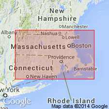
- Mount Toby conglomerate
- Modifications:
-
- Named
- Dominant lithology:
-
- Conglomerate
- AAPG geologic province:
-
- New England province
- Deerfield basin
- Hartford basin
Summary:
Coarse schist and quartzite conglomerate deposits along the eastern margin of the Triassic basin in Massachusetts are named the Mount Toby conglomerate. Age is Late Triassic.
Source: GNU records (USGS DDS-6; Reston GNULEX).
- Usage in publication:
-
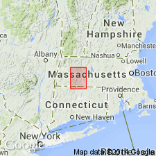
- Mount Toby conglomerate*
- Modifications:
-
- Overview
- Dominant lithology:
-
- Argillite
- Schist
- Gravel
- AAPG geologic province:
-
- New England province
- Deerfield basin
Summary:
In the Holyoke 15-min quadrangle, the Mount Toby conglomerate consists of argillite, quartz schist, and vein quartz in a coarse gravel matrix. It is synchronous with the Sugarloaf arkose to the west, is interbedded with the Longmeadow sandstone, overlies the Deerfield diabase, and also underlies it at its north and south ends at Sunderland and Deerfield.
Source: GNU records (USGS DDS-6; Reston GNULEX).
- Usage in publication:
-
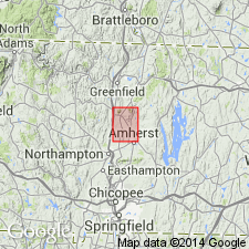
- Mount Toby conglomerate*
- Modifications:
-
- Revised
- AAPG geologic province:
-
- New England province
- Deerfield basin
Summary:
Because of the obvious age difference between the rocks above and below the Deerfield diabase, the Mount Toby conglomerate is here revised to include only the conglomerates overlying the Deerfield diabase and the coarse talus breccia on the east face of Mount Toby that was named the Leverett breccia by Reynolds and Leavitt (1927). As defined by Emerson (1898), the Mount Toby also included arkosic boulder conglomerate underlying the Deerfield diabase, now included in the Sugarloaf formation, and sandstone overlying the Deerfield, now included in the Turners Falls sandstone. Age is Late Triassic.
Source: GNU records (USGS DDS-6; Reston GNULEX).
- Usage in publication:
-
- Mount Toby Conglomerate*
- Modifications:
-
- Revised
- AAPG geologic province:
-
- New England province
- Deerfield basin
Summary:
Strata originally mapped by Emerson (1898) in this area as Mount Toby Conglomerate are here assigned to the Portland Formation of Early Jurassic age.
Source: GNU records (USGS DDS-6; Reston GNULEX).
- Usage in publication:
-
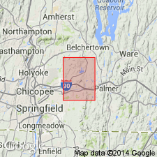
- Mount Toby Conglomerate*
- Modifications:
-
- Areal extent
- AAPG geologic province:
-
- New England province
- Hartford basin
Summary:
The Mount Toby Conglomerate is here abandoned [in the study area]. In the Hampden quadrangle, unmetamorphosed sedimentary rocks, including the Mount Toby Conglomerate, Longmeadow Sandstone, and Chicopee Shale, which are structurally and stratigraphically above the Hampden Basalt, are assigned to the Portland Formation. They are not time-stratigraphic units and cannot be distinguished on the basis of widely scattered exposures.
Source: GNU records (USGS DDS-6; Reston GNULEX).

- Usage in publication:
-
- Mount Toby Formation*
- Modifications:
-
- Overview
- AAPG geologic province:
-
- New England province
Summary:
Used as Mount Toby Formation of Early Jurassic age. Includes two separately mapped breccia units interpreted as landslide deposits.
Source: GNU records (USGS DDS-6; Reston GNULEX).
- Usage in publication:
-
- Mount Toby Formation*
- Modifications:
-
- Revised
- AAPG geologic province:
-
- New England province
- Deerfield basin
- Hartford basin
Summary:
The Mount Toby Conglomerate is here revised and renamed the Mount Toby Formation of the Newark Supergroup. It includes only the sedimentary strata in the Deerfield basin above the slump zone unconformity defined by Cornet (1977), or its projected equivalent at its contact with the underlying Turners Falls Sandstone. It includes conglomerates at the type locality, landslide deposits within the conglomerate, and sandstone and lake beds above the slump zone unconformity, which were formerly included in the Turners Falls Sandstone. Other rocks mapped as Mount Toby Conglomerate by Emerson (1898) in the Hartford, Deerfield, and Northfield basins have been assigned to the Portland, Sugarloaf, and Turners Falls Formations. Age is Sinemurian and Pliensbachian, based on the discovery by Cornet (1977) of palynoflora in these strata.
Source: GNU records (USGS DDS-6; Reston GNULEX).
For more information, please contact Nancy Stamm, Geologic Names Committee Secretary.
Asterisk (*) indicates published by U.S. Geological Survey authors.
"No current usage" (†) implies that a name has been abandoned or has fallen into disuse. Former usage and, if known, replacement name given in parentheses ( ).
Slash (/) indicates name conflicts with nomenclatural guidelines (CSN, 1933; ACSN, 1961, 1970; NACSN, 1983, 2005, 2021). May be explained within brackets ([ ]).