
- Usage in publication:
-
- Moretown Formation*
- Modifications:
-
- Overview
- AAPG geologic province:
-
- New England province
Summary:
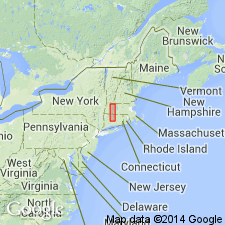
Used as Middle Ordovician or older Moretown Formation. Consists of light-greenish-gray to buff, fine-grained, pinstriped granofels and schist. Includes five other informal subdivisions based on lithology.
Source: GNU records (USGS DDS-6; Reston GNULEX).
- Usage in publication:
-
- Moretown Formation*
- Modifications:
-
- Revised
- Areal extent
- Age modified
- AAPG geologic province:
-
- New England province
Summary:
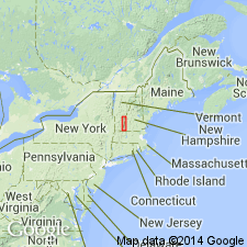
Moretown Formation is divided into four unnamed members. Predominant member is primarily very light-gray, light-gray-green, or light-buff, fine-grained quartz-plagioclase-mica granulite or granular schist characterized either by pinstriping or by alternating and complexly folded granulose and schistose layers. Lowest member is recognized only a few kilometers inside of northern part of MA and consists of light-gray to buff, medium- to coarse-grained irregularly schistose, poorly bedded quartz-plagioclase-muscovite-biotite-garnet schist containing characteristic chlorite clots. Another member is mapped at top of formation from VT border south to 2 km past Chester village and consists of pale-brown to light-silvery-gray, fine- to medium-grained muscovite-quartz-plagioclase-biotite-garnet-chlorite schist characterized by garnets giving it a nubbly appearance. Carbonaceous garnet schist lenses are mapped within upper part of member. A fourth, more schistose member is found only in southern part of MA and consists of light-gray, fine-grained muscovite-quartz-biotite schist containing conspicuous staurolite and kyanite porphyroblasts and thin beds of pink, fine-grained quartz-garnet coticule granulite. Uncertainty exists as to nature of contacts between Moretown and both Rowe Schist and Hawley Formation and whether contacts are tectonic or depositional. Evidence along western contact with Rowe does not suggest either with certainty; map relations in northern MA suggest possible unconformity on surface of Rowe followed by deposition of Moretown; map relations at Blandford and Prospect Hill suggest tectonic intercalation. Eastern contact with Hawley Formation displays discordance that could result from low-angle faulting, sedimentary facies changes in the Hawley, or disconformities; mapping east of Chester village is described as gradational by interlamination, mapping in vicinity of Deerfield River shows small-scale intercalation that could be either sedimentary or tectonic in nature, and mapping south of Chester is tectonic. Age of Moretown has traditionally been Ordovician based on assumption that Moretown was conformably below black slates assigned to Cram Hill Formation in VT, that were in turn correlated with black slates at Magog, Quebec, which contain Middle Ordovician fossils. Despite uncertainties regarding Moretown-Hawley contact and southern continuation of Magog rocks, Ordovician age assignment is still acceptable. [Papers presented as chapters in U.S. Geological Survey Professional Paper 1366 are intended as explanations and (or) revisions to MA State bedrock geologic map of Zen and others (1983) at scale of 1:250,000.]
Source: GNU records (USGS DDS-6; Reston GNULEX).
- Usage in publication:
-
- Moretown Member*
- Modifications:
-
- Overview
- AAPG geologic province:
-
- New England province
Summary:
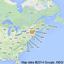
Used as Moretown Member of Missisquoi Formation following usage of Hepburn and others (1984). New U-Pb zircon data indicate the age of provenance(s) of sediments as Early to Middle Proterozoic (1.0 to 1.7 Ga), but actual date of Moretown could not be determined. [No official age change in GNC records resulting from this report.]
Source: GNU records (USGS DDS-6; Reston GNULEX).
- Usage in publication:
-
- Moretown Formation*
- Modifications:
-
- Areal extent
- AAPG geologic province:
-
- New England province
Summary:
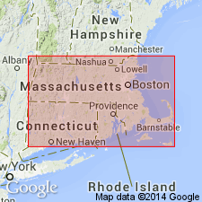
In Glens Falls quad, rocks of eastern Green Mountain terrane, east of Richardson Memorial Contact (an eastward-facing unconformity or possibly a tectonic contact) include the Hoosac, Pinney Hollow, Ottauquechee, and Stowe Formations (of probable Cambrian through Early Ordovician age), Moretown Formation (probably Ordovician), and Barnard Volcanic Member of Missisquoi Formation [unclear as to its stratigraphic position or age here]. West of Richardson Memorial Contact, rocks include conglomeratic units such as Tyson Formation as used by Doll and others (1961) [no age provided, but presumably Cambrian].
Source: GNU records (USGS DDS-6; Reston GNULEX).
- Usage in publication:
-
- Moretown Formation
- Modifications:
-
- Age modified
- AAPG geologic province:
-
- New England province
Summary:
Hallockville Pond Gneiss intrudes the Moretown Formation in the Plainfield, MA, 7.5-min quad. Multiple deformation fabrics are clearly visible in the gneiss and authors suggest that the intrusion took place before or during Taconian deformation. Early Ordovician age from zircons (479+/-8 Ma) constrains the age of the previously undated Moretown Formation to Early Ordovician or older. Moretown had been interpreted as Middle Ordovician based on correlations with the Beauceville Formation of southern Quebec and the Missisquoi Formation of VT. The Hallockville Pond is here compared to the tonalitic Collinsville Formation exposed in the Shelburne Falls and Goshen Domes in western MA and also recently dated as Early Ordovician using the same evaporation and U-Pb methods on zircons.
Source: GNU records (USGS DDS-6; Reston GNULEX).
- Usage in publication:
-
- Moretown Formation*
- Modifications:
-
- Revised
- Age modified
- AAPG geologic province:
-
- New England province
Summary:
Age modified to Ordovician(?) based on presumed stratigraphic contacts with overlying Cram Hill Formation elsewhere in VT. Recent study of Moretown-Cram Hill contact by T. Armstrong (unpub. data) shows Moretown is in fault contact with Cram Hill and associated volcanic rocks, and it appears to be isolated by top and bottom thrust faults. Ordovician age and relation to enclosing strata is quite uncertain. Lower age limit for Moretown is not constrained and it may be as old as Cambrian, but an Ordovician(?) age is assigned in this report.
Source: GNU records (USGS DDS-6; Reston GNULEX).
For more information, please contact Nancy Stamm, Geologic Names Committee Secretary.
Asterisk (*) indicates published by U.S. Geological Survey authors.
"No current usage" (†) implies that a name has been abandoned or has fallen into disuse. Former usage and, if known, replacement name given in parentheses ( ).
Slash (/) indicates name conflicts with nomenclatural guidelines (CSN, 1933; ACSN, 1961, 1970; NACSN, 1983, 2005, 2021). May be explained within brackets ([ ]).

