

- Usage in publication:
-
- Moat volcanics
- Modifications:
-
- Original reference
- Dominant lithology:
-
- Breccia
- Tuff
- Porphyry
- AAPG geologic province:
-
- New England province
Summary:
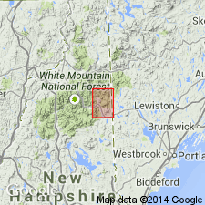
Pg. 89+. Moat volcanics. In North Conway quadrangle two large areas of volcanics are exposed, the type locality on Moat Mountain and a second large area on Mount Kearsarge (Mount Pequawket). These are composed of siliceous flow rocks and interbedded tuffs and breccias. I propose name Moat volcanics to include the Pequawket breccia and "quartz porphyry" of Hitchcock. (The "quartz porphyry" is = South Moat flows of this paper.) Thickness 8,300 to 11,800+ feet. Rest unconformably on Intervale clay slates. Are intruded by Albany and Conway granites. Type locality on South Moat Mountain, North Conway quadrangle, where excellent section is exposed from elevation 1,100 feet upwards on South Moat trail to Red Ridge.
Source: US geologic names lexicon (USGS Bull. 896, p. 1391).

- Usage in publication:
-
- Moat volcanics
- Modifications:
-
- Areal extent
- Age modified
- Overview
- Dominant lithology:
-
- Rhyolite
- Andesite
- Basalt
- Tuff
- AAPG geologic province:
-
- New England province
Summary:
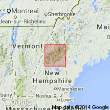
Moat volcanics present on Moat Mountain, on Mount Pequawket, in the Ossipee Mountains, in the southern Belknap Mountains, on Mount Hale, on North Twin Mountain, and 3 mi southeast of Mount Lafayette summit. Consists of rhyolite, andesite, basalt, flows, tuffs, breccias. Rhyolite flows are light-gray, blue-gray, and red porphyries with quartz and feldspar phenocrysts. Age is Mississippian based on stratigraphic position and is part of White Mountain plutonic-volcanic series which is younger than Early Devonian Littleton Formation. Moat is probably same age as Quincy granite and related rocks in MA which are pre-Pennsylvanian. Recent radioactive age determinations support this age.
Source: GNU records (USGS DDS-6; Reston GNULEX).
- Usage in publication:
-
- Moat Volcanics*
- Modifications:
-
- Age modified
- AAPG geologic province:
-
- New England province
Summary:
Although ages as old as Late Triassic have been reported from rocks of the White Mountain Plutonic-Volcanic Suite in southwestern ME, no ages other than Early Jurassic have been reported from this map area.
Source: GNU records (USGS DDS-6; Reston GNULEX).

- Usage in publication:
-
- Moat Volcanics*
- Modifications:
-
- Age modified
- AAPG geologic province:
-
- New England province
Summary:
The White Mountain batholith and outlying bodies, including the Moat Volcanics, are Jurassic in age.
Source: GNU records (USGS DDS-6; Reston GNULEX).
- Usage in publication:
-
- Moat volcanics
- Modifications:
-
- Geochronologic dating
- AAPG geologic province:
-
- New England province
Summary:
Lower part of Moat volcanics dated at 173.1+/-1.5 Ma using Rb/Sr whole-rock methods. Upper part of Moat dated at 168.2+/-1.2 Ma using Rb/Sr whole-rock methods. Trachyte of Moat volcanics dated at 169+/-4 Ma and 162+/-4 Ma using K-Ar whole rock methods.
Source: GNU records (USGS DDS-6; Reston GNULEX).

- Usage in publication:
-
- Moat Volcanics*
- Modifications:
-
- Geochronologic dating
- Age modified
- Areal extent
- AAPG geologic province:
-
- New England province
Summary:
Shown mapped on North and South Moat Mountains, Kearsarge North [a mountain], Mount Lowell, southeast slopes of Mount Hancock, and Mount Tom. Age is Jurassic based on radiometric dates reported in Eby and others (1992) (173.1+/-1.5 Ma Rb/Sr whole-rock isochron on lower part of Moat, 168.2+/-1.2 Ma Rb/Sr whole-rock isochron on upper part of Moat, and 169+/-4 Ma and 162+/-4 Ma K-Ar whole-rock isochron on trachyte from Moat), and using time scale of Harland and others (1989). Report includes geologic map, cross sections, and correlation chart.
Source: GNU records (USGS DDS-6; Reston GNULEX).

- Usage in publication:
-
- Moat Volcanics*
- Modifications:
-
- Overview
- Age modified
- Geochronologic dating
- AAPG geologic province:
-
- New England province
Summary:
Used as Moat Volcanics of White Mountain Plutonic-Volcanic Suite. Consists of bedded and ignimbritic tuffs, flows, and breccias; includes porphyritic rhyolite, with minor trachyte. Age changed from Early Jurassic to Middle Jurassic(?) based on the following isotope ages: lower part dated at 173+/-2 Ma using Rb/Sr methods (Eby and others, in press), upper part dated at 168+/-1 Ma using Rb/Sr methods (Eby and others, 1992), and trachyte dated at 169+/-4 and 162+/-4 Ma using K-Ar methods (Eby and others, 1992). Report includes geologic map and correlation chart, and 1:500,000-scale map of plutons and sample localities for age dating.
Source: GNU records (USGS DDS-6; Reston GNULEX).
For more information, please contact Nancy Stamm, Geologic Names Committee Secretary.
Asterisk (*) indicates published by U.S. Geological Survey authors.
"No current usage" (†) implies that a name has been abandoned or has fallen into disuse. Former usage and, if known, replacement name given in parentheses ( ).
Slash (/) indicates name conflicts with nomenclatural guidelines (CSN, 1933; ACSN, 1961, 1970; NACSN, 1983, 2005, 2021). May be explained within brackets ([ ]).