

- Usage in publication:
-
- McNairy sand member*
- Modifications:
-
- Named
- Dominant lithology:
-
- Sand
- AAPG geologic province:
-
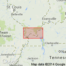
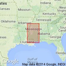
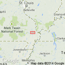
- Upper Mississippi embayment
Summary:
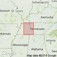
McNairy sand member of Ripley formation named in McNairy Co., western TN. In vicinity of southern TN State line and northward in TN, all but basal beds of Ripley formation appear to merge along the strike into shallow-water equivalents consisting of irregularly bedded, largely nonglauconitic sands and subordinate clays, probably in part marine, in part estuarine, and in part fresh water. Since time of Safford, these beds have been correlated with Ripley formation. Their lithologic dissimilarity to typical Ripley material seems to justify use of a member name to designate them. Type section is designated west of Cypress Station, where railroad passes through a ridge known as "Big Hill." Maximum thickness probably 400 to 500 ft. Unconformably overlain by Eocene strata. Age is Late Cretaceous. [As defined here, included Owl Creek formation at top and as mapped included at base the ferruginous clays, 100 ft thick, of Wades' 1917 report.]
Source: GNU records (USGS DDS-6; Reston GNULEX).
- Usage in publication:
-
- McNairy sand member*
- Modifications:
-
- Revised
- AAPG geologic province:
-
- Upper Mississippi embayment
Summary:
Ripley formation of southwestern TN divided into (ascending) Coon Creek horizon, 30 ft; ferruginous clay horizon, 100 ft; McNairy sand member [restricted]; and Owl Creek horizon.
Source: GNU records (USGS DDS-6; Reston GNULEX).
- Usage in publication:
-
- McNairy sand member*
- Modifications:
-
- Revised
- AAPG geologic province:
-
- Upper Mississippi embayment
Summary:
Ripley formation of TN divided into (ascending) Coon Creek horizon, including at top the 100 ft of ferruginous clay described in 1917 report; McNairy sand member; and Owl Creek tongue.
Source: GNU records (USGS DDS-6; Reston GNULEX).

- Usage in publication:
-
- McNairy sand member
- Modifications:
-
- Areal extent
- AAPG geologic province:
-
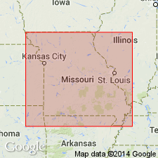
- Illinois basin
Summary:
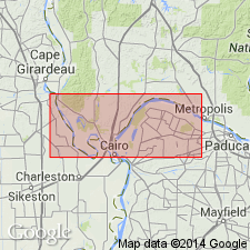
According to L.W. Stephenson, 1930 (oral commun., July 17, 1936), the McNairy sand member is present in Pulaski Co., southwestern IL, and in Massac Co., southeastern IL. The Owl Creek is now treated as a distinct formation by the U.S. Geological Survey.
Source: GNU records (USGS DDS-6; Reston GNULEX).
- Usage in publication:
-
- McNairy formation
- Modifications:
-
- Revised
- AAPG geologic province:
-
- Upper Mississippi embayment
Summary:
McNairy formation, in Ardeola Hill section consists of (ascending) fine, white sand--10 ft; Zadoc member (new)--about 29 ft; white sand--11 ft; brown micaceous clay with sand lenses--11 ft. Underlies Owl Creek formation.
Source: GNU records (USGS DDS-6; Reston GNULEX).
- Usage in publication:
-
- McNairy formation
- Modifications:
-
- Overview
- AAPG geologic province:
-
- Illinois basin
Summary:
McNairy formation probably attains thickness of about 300 ft in southern IL although maximum exposed thickness at any one place is 70 ft. Consists mainly of gray sand, which is commonly oxidized in exposures to various shades of brown, but may include pink or white bands. Underlies Clayton formation (sand).
Source: GNU records (USGS DDS-6; Reston GNULEX).
- Usage in publication:
-
- McNairy sand member
- Modifications:
-
- Mapped
- AAPG geologic province:
-
- Upper Mississippi embayment
Summary:
McNairy sand member of Ripley formation. Mapped as sand member of Ripley formation. [Age is Late Cretaceous.]
Source: US geologic names lexicon (USGS Bull. 1200, p. 2310).
- Usage in publication:
-
- McNairy formation
- Modifications:
-
- Areal extent
- AAPG geologic province:
-
- Upper Mississippi embayment
Summary:
Referred to as formation in MO. In outcrop area, essentially a series of nonmarine micaceous sand, quartzite, sandy clay, and clay. Underlies Owl Creek formation.
Source: GNU records (USGS DDS-6; Reston GNULEX).
- Usage in publication:
-
- McNairy sand*
- Modifications:
-
- Revised
- AAPG geologic province:
-
- Upper Mississippi embayment
- Illinois basin
Summary:
Unit referred to as McNairy sand in Stoddard and Scott Cos., MO, and Pulaski Co., IL. Thickness 173 ft in Stoddard Co. where it unconformably underlies Owl Creek formation. In Pulaski Co., unconformably underlies Clayton formation.
Source: GNU records (USGS DDS-6; Reston GNULEX).
- Usage in publication:
-
- McNairy Formation
- Modifications:
-
- Revised
- AAPG geologic province:
-
- Illinois basin
Summary:
Levings Member named in Pulaski Co., IL, and assigned to upper part of McNairy Formation. Member is composed of up to 70 ft of lignitic silt and clay.
Source: GNU records (USGS DDS-6; Reston GNULEX).
- Usage in publication:
-
- McNairy Sand*
- Modifications:
-
- Revised
- AAPG geologic province:
-
- Upper Mississippi embayment
Summary:
McNairy Sand Member of Ripley Formation raised in rank to McNairy Sand in the Mississippi embayment part of western TN according to the usage of the Tennessee Division of Geology, the cooperators of the map. Thickness ranges from 91 to 122 m. Age is Late Cretaceous. [Personal communication between W.S. Parks and GNU staff member (2/6/78) confirmed that the Ripley is restricted from the surface only in western TN where the McNairy is a fluvial deltaic unit of formational rank. In the subsurface downdip to southwest in Memphis area, it becomes a glauconitic marine facies which cannot be distinguished from underlying Coon Creek Formation. Therefore Ripley Formation is still used in the subsurface of western TN and is equivalent to Coon Creek and McNairy on surface.]
Source: GNU records (USGS DDS-6; Reston GNULEX).
- Usage in publication:
-
- McNairy Formation
- Modifications:
-
- Overview
- AAPG geologic province:
-
- Upper Mississippi embayment
Summary:
In southern IL, unit is gray to black clay with silt and lignite. Includes Levings Member, which reaches a maximum thickness of 120 ft. McNairy is 450 ft thick. Overlies Tuscaloosa Formation or Little Bear Soil (Late Cretaceous) and underlies Mounds Gravel (Pliocene and Pleistocene). Age is Late Cretaceous (Gulfian).
Source: GNU records (USGS DDS-6; Reston GNULEX).

- Usage in publication:
-
- McNairy Sand*
- Modifications:
-
- Overview
- AAPG geologic province:
-
- Upper Mississippi embayment
- Illinois basin
Summary:
McNairy Sand mapped undivided in MO and IL with Owl Creek Formation, Coffee Sand, and Little Bear Formation. Consists of sand, sandstone, clay, and interbedded lignitic silt and clay. Informal Commerce quartzite occurs near base of McNairy. Clay occurs as either thin layers interbedded with sand or as massive body. Massive clay is informally known a Zadoc clay in MO and is roughly correlative to Levings Member of Pryor (1960) and Pryor and Ross (1962) of McNairy in IL.
Source: GNU records (USGS DDS-6; Reston GNULEX).
For more information, please contact Nancy Stamm, Geologic Names Committee Secretary.
Asterisk (*) indicates published by U.S. Geological Survey authors.
"No current usage" (†) implies that a name has been abandoned or has fallen into disuse. Former usage and, if known, replacement name given in parentheses ( ).
Slash (/) indicates name conflicts with nomenclatural guidelines (CSN, 1933; ACSN, 1961, 1970; NACSN, 1983, 2005, 2021). May be explained within brackets ([ ]).