

- Usage in publication:
-
- Magothy formation*
- Modifications:
-
- Named
- Dominant lithology:
-
- Sand
- Sandstone
- Gravel
- AAPG geologic province:
-
- Atlantic Coast basin
Summary:
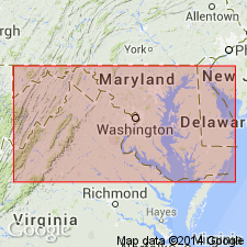
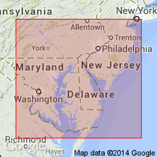
Magothy formation, here named for excellent exposures along the Magothy River in Anne Arundel Co., MD, is composed mainly of white and buff sands with local beds of brown sandstone and limonitic streaking in plates and discolorations. To the southwest it becomes gravelly for some distance, and some portions are locally lithified into loose conglomerate or more or less pebbly brown sandstones. Author formerly interpreted these beds to be a local upper member of the Potomac formation, but now finds they are separated from the Potomac by a continuous erosion plane and that they constitute a distinct formation 0 to 30 ft thick in upper Chesapeake Bay region. Unit unconformably underlies Severn Formation. Age is Late Cretaceous.
Source: GNU records (USGS DDS-6; Reston GNULEX).
- Usage in publication:
-
- Magothy formation
- Modifications:
-
- Overview
- AAPG geologic province:
-
- Atlantic Coast basin
Summary:
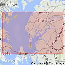
Magothy formation described along Chesapeake and Delaware Canal. Lowermost member is fine yellow iron-stained to buff micaceous compact sand containing variable proportions of clay of same color, plus additional small patches or lenses of black sticky clay. Composes more than half the thickness of formation. Middle member consists of white sand and clay. Upper member is black clay. Maximum thickness about 34 ft. Overlies Raritan formation; underlies Crosswicks clay of Matawan group.
Source: GNU records (USGS DDS-6; Reston GNULEX).
- Usage in publication:
-
- Magothy formation
- Modifications:
-
- Overview
- Areal extent
- AAPG geologic province:
-
- Atlantic Coast basin
Summary:
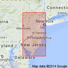
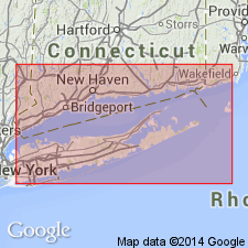
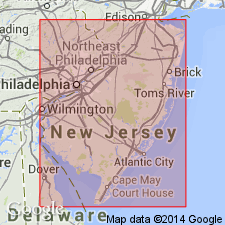
Magothy formation unconformably overlies Raritan formation in NJ. In outcrop reaches thickness of 150 ft at Raritan Bay and thins southwest where, in southern part of state, it is 25 ft thick. Maximum width in outcrop is 4 mi. Underlies Merchantville member of Matawan formation. Southernmost exposures are near DC. Well exposed along Severn River in MD and along Chesapeake and Delaware Canal in DE. Thickness varies from about 25 ft along Delaware River to 15 ft in Prince Georges Co., MD. Rests disconformably on Raritan formation at this location.
Source: GNU records (USGS DDS-6; Reston GNULEX).
- Usage in publication:
-
- Magothy Formation*
- Modifications:
-
- Revised
- AAPG geologic province:
-
- Atlantic Coast basin
Summary:
Unnamed unit at top of Raritan [Amboy stoneware clay of Kummel and Knapp, 1904] removed from Raritan and added to Magothy.
Source: GNU records (USGS DDS-6; Reston GNULEX).
- Usage in publication:
-
- Magothy Formation*
- Modifications:
-
- Revised
- AAPG geologic province:
-
- Atlantic Coast basin
Summary:
Old Bridge Sand Member removed from Raritan Formation and made basal member of Magothy Formation.
Source: GNU records (USGS DDS-6; Reston GNULEX).
- Usage in publication:
-
- Magothy Formation*
- Modifications:
-
- Revised
- AAPG geologic province:
-
- Atlantic Coast basin
Summary:
Amboy Stoneware Clay of Kummel and Knapp (1904) adopted as Amboy Stoneware Clay Member of Magothy Formation in northeastern NJ only. Overlies Old Bridge Sand member of Magothy; underlies Morgan beds (informal name) of Magothy. Age is Late Cretaceous (Santonian).
Source: GNU records (USGS DDS-6; Reston GNULEX).
- Usage in publication:
-
- Magothy Formation*
- Modifications:
-
- Areal extent
- AAPG geologic province:
-
- Atlantic Coast basin
Summary:
The Amboy and Old Bridge Members of the Magothy, and the South Amboy Member of the Raritan of northeastern NJ are geographically restricted from Long Island, NY.
Source: GNU records (USGS DDS-6; Reston GNULEX).
- Usage in publication:
-
- Magothy Formation
- Modifications:
-
- Overview
- AAPG geologic province:
-
- Atlantic Coast basin
Summary:
Magothy Formation in Ken-Bf 180 is notable because it contains no sandy facies. Unit is a waxy, gray to blackish clay with common occurrences of lignitic wood and pyrite. In this core, the Magothy is represented by 19 ft of marsh or back-bay sediments. Samples contain normapollen types considered to be Santonian to early Campanian. Overlies Elk Neck beds of Patapsco or Raritan(?) Formation; underlies Upper Cretaceous Matawan Group (undivided).
Source: GNU records (USGS DDS-6; Reston GNULEX).
- Usage in publication:
-
- Magothy Formation*
- Modifications:
-
- Revised
- AAPG geologic province:
-
- Atlantic Coast basin
Summary:
Revised the Magothy Formation to include the South Amboy Fire Clay Member as the lowest member (formerly assigned to Raritan Formation). The Magothy consists of light-colored, loose sand interbedded with thin-to-thick, dark-gray, very lignitic clay and silt. Unit includes (ascending) the Cliffwood beds (informal), Morgan beds (informal), Amboy Stoneware Clay Member, Old Bridge Sand Member, and South Amboy Fire Clay Member. Overlies Raritan Formation and underlies the Cheesequake Formation. The Magothy is of Late Cretaceous (Santonian) age.
Source: GNU records (USGS DDS-6; Reston GNULEX).
For more information, please contact Nancy Stamm, Geologic Names Committee Secretary.
Asterisk (*) indicates published by U.S. Geological Survey authors.
"No current usage" (†) implies that a name has been abandoned or has fallen into disuse. Former usage and, if known, replacement name given in parentheses ( ).
Slash (/) indicates name conflicts with nomenclatural guidelines (CSN, 1933; ACSN, 1961, 1970; NACSN, 1983, 2005, 2021). May be explained within brackets ([ ]).