

- Usage in publication:
-
- Larrabee member
- Modifications:
-
- Original reference
- Dominant lithology:
-
- Limestone
- AAPG geologic province:
-
- New England province
Summary:
Pg. 262-263. Larrabee member of Glens Falls formation. Constitutes lower part of Glens Falls formation that is of Hull age, the upper Glens Falls being lowest Sherman Fall. At type section, member is composed of about 20 feet of bedded relatively pure limesones above Isle la Motte limestone; underlies CRYPTOLITHUS-bearing upper Glens Falls, the Shoreham member (new) of lowest Sherman Fall age. Larrabee varies in lithology and thickness; in lower Mohawk Valley [eastern New York], composed of thin-bedded limestones with coarse-textured ledges in upper part; thickness 15 to 25 feet between Patterson and Fultonville; lies on Lowville to west and on Amsterdam toward east. [Age is Middle Ordovician (Mohawkian).]
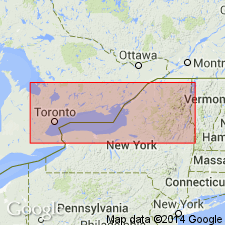
Type section: [along eastern shore of Lake Champlain] in quarry 0.25 mi south of Larrabee [Larrabees] Point, [Ticonderoga 15-min quadrangle, 1902 ed.], Addison Co., westernmost VT.
[Typographical error (USGS Bull. 1200, p. 2109): Publication date of 1947 is listed; should be 1937.]
Source: Publication; US geologic names lexicon (USGS Bull. 1200, p. 2109).
For more information, please contact Nancy Stamm, Geologic Names Committee Secretary.
Asterisk (*) indicates published by U.S. Geological Survey authors.
"No current usage" (†) implies that a name has been abandoned or has fallen into disuse. Former usage and, if known, replacement name given in parentheses ( ).
Slash (/) indicates name conflicts with nomenclatural guidelines (CSN, 1933; ACSN, 1961, 1970; NACSN, 1983, 2005, 2021). May be explained within brackets ([ ]).