- Usage in publication:
-
- John Day lake basin
- Modifications:
-
- Original reference
- AAPG geologic province:
-
- Eastern Columbia basin
Summary:
Miocene lake, of which the Blue Mountains formed east and south shores, but its other limits are difficult to ascertain, as the whole country has since been deeply buried by successive outflows of volcanic rocks. It is only where latter have been washed away that the lake deposits can be examined. The typical localities of this Miocene basin are along John Day River, and this name may very properly be used to designate the lake basin. The strata of the basin are more or less inclined and of great thickness. One section near John Day River seems to indicate thickness of not less than 5,000 feet. The upper beds alone of this series correspond to deposits of White River basin. The lower part also is clearly Miocene, as shown by its vertebrate fauna, which differs in many respects from that above. Overlain by Pliocene beds in a few places and underlain by Eocene beds, which are more highly inclined than the Miocene beds.
Source: US geologic names lexicon (USGS Bull. 896, p. 1048).
- Usage in publication:
-
- Johnday formation
- Modifications:
-
- Overview
- AAPG geologic province:
-
- Eastern Columbia basin
Summary:
Pg. 290-292. Johnday formation. Is 4,000 to 5,000 feet thick according to Marsh. It occupies a considerable tract on upper part of course of John Day River in Oregon.
Source: US geologic names lexicon (USGS Bull. 896, p. 1048).
- Usage in publication:
-
- John Day formation
- Modifications:
-
- Revised
- Biostratigraphic dating
- AAPG geologic province:
-
- Eastern Columbia basin
Summary:
Pg. 496-497, and Jour. Geol., v. 9, p. 71-72. John Day formation, of John Day basin, is unconformably overlain by Columbia [River] lava and rests (probably unconformably) on Clarno formation. The upper or buff beds correspond to MERYCOCHOERUS beds of Wortman, but as MERYCOCHOERUS does not occur in the John Day, the upper beds will be called PARACOTYLOPS beds. They overlap the middle division of the John Day and older formations. The middle John Day consists of blue-green beds, very fossiliferous, and corresponds to DICERATHERIUM beds of Wortman. The lower John Day beds are usually of deep-red color, considerably contorted in places, and rarely contain fossils.
[When referring to the John Day series of Merriam (1901), please use informally. The practice of employing "Series" for lithostratigraphic or lithodemic nomenclature is now regarded as improper (see ACSN, 1961, 1970; NACSN, 1983, 2005, 2021). The term "Series" is applied formally only to chronostratigraphic units.]
Source: US geologic names lexicon (USGS Bull. 896, p. 1048).
- Usage in publication:
-
- John Day series
- Modifications:
-
- Revised
- AAPG geologic province:
-
- Eastern Columbia basin
Summary:
Pg. 278-314. Gave thickness of upper division of John Day series as 300 to 400 feet, of middle division as 500 to 1,000 feet, and of lower division as 250 to 300+ feet, and described it as unconformably overlain by Columbia [River] lava and underlain, probably unconformably, by Clarno formation. [Merriam included the beds at Bridge Creek in Clarno formation and assigned them to upper Eocene.]
[Merriam is cited as sole author in USGS Bull. 896, p. 1048.]
Source: US geologic names lexicon (USGS Bull. 896, p. 1048).
- Usage in publication:
-
- John Day series
- Modifications:
-
- Overview
- Dominant lithology:
-
- Tuff
- Gravel
- Sand
- AAPG geologic province:
-
- Eastern Columbia basin
Summary:
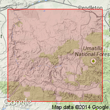
Pg. 111-172. The principal material in all three divisions of John Day series is fine-grained tuff. A few thin flows of lava are intercalated in various sections, and waterworn gravels and sands occur near upper limit of the series.
Source: US geologic names lexicon (USGS Bull. 896, p. 1048).
- Usage in publication:
-
- upper John Day [series]
- middle John Day [series]
- lower John Day [series]
- Modifications:
-
- Revised
- Age modified
- Dominant lithology:
-
- Tuff
- Shale
- Gravel
- Sand
- AAPG geologic province:
-
- Eastern Columbia basin
Summary:
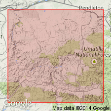
Pg. 173. Upper John Day is mainly buff-tinted tuffs, with sands and gravels near top. Middle John Day is drab and bluish green tuffs. Lower John Day is red, white, and green tuffaceous shale. Rests unconformably on Clarno formation and is unconformably overlain by Columbia [River] lava. [Their table shows upper part of upper John Day is Miocene and rest of formation Oligocene.]
Source: US geologic names lexicon (USGS Bull. 896, p. 1048).

- Usage in publication:
-
- John Day formation*
- Modifications:
-
- Overview
- AAPG geologic province:
-
- Eastern Columbia basin
Summary:
H.F. Osborn, 1909 (USGS Bull. 361, p. 65), and 1919 (Amer. Mus. Nat. Hist. Mem., n.s., v. 2, pt. 1, p. 8, 9, 12), assigned John Day formation to lowermost Miocene, upper Oligocene, and uppermost middle Oligocene. Some later reports, by other authors, assign it all to Miocene and others all to Oligocene. The USGS classifies it as lower Miocene and upper and middle Oligocene.
Source: US geologic names lexicon (USGS Bull. 896, p. 1048).
- Usage in publication:
-
- John Day formation
- Modifications:
-
- Overview
- AAPG geologic province:
-
- Eastern Columbia basin
Summary:
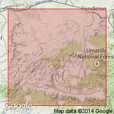
Since 1902, formation has been considered divisible into three parts: lower reddish trachytic tuffs, middle blue-green, and upper buff andesitic tuffs. Early studies indicated that a rhyolitic flow separates middle and upper beds. Plant remains from lower beds have been determined as upper Oligocene in character, and mammal remains in middle and upper divisions as lower Miocene. Recent studies indicate that the rhyolite is welded tuff, ignimbrite, and this grades into andesitic tuff of upper division. Since characteristics for middle and upper beds are the same, separated only by local extrusive variant, it seems evident that any division is artificial.
Source: US geologic names lexicon (USGS Bull. 1200, p. 1928-1929).
For more information, please contact Nancy Stamm, Geologic Names Committee Secretary.
Asterisk (*) indicates published by U.S. Geological Survey authors.
"No current usage" (†) implies that a name has been abandoned or has fallen into disuse. Former usage and, if known, replacement name given in parentheses ( ).
Slash (/) indicates name conflicts with nomenclatural guidelines (CSN, 1933; ACSN, 1961, 1970; NACSN, 1983, 2005, 2021). May be explained within brackets ([ ]).

