

- Usage in publication:
-
- Hurricane Formation*
- Modifications:
-
- First used
- AAPG geologic province:
-
- New England province
Summary:
Informal designation and first noted use of the name Hurricane Formation [later called Hurricane Mountain Formation]. Pre-Silurian in age; older than the overlying Dead River Formation. No further nomenclatural information.
Source: GNU records (USGS DDS-6; Reston GNULEX).
- Usage in publication:
-
- Hurricane Mountain Formation
- Modifications:
-
- First used
- AAPG geologic province:
-
- New England province
Summary:
First known publication of the present name Hurricane Mountain Formation. Geographic name changed from Hurricane Formation of previous report. Considered Cambrian(?) based on its apparent unconformable contact with overlying fossiliferous Lower to Middle Ordovician strata.
Source: GNU records (USGS DDS-6; Reston GNULEX).
- Usage in publication:
-
- Hurricane Mountain Formation
- Modifications:
-
- Named
- Dominant lithology:
-
- Siltstone
- Slate
- Phyllite
- Quartzite
- AAPG geologic province:
-
- New England province
Summary:
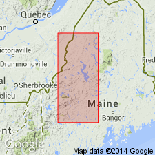
Name and type area for the Hurricane Mountain Formation, selected informally during early stages of mapping in the Lobster Mountain anticlinorium, are here retained as they are stratigraphically suitable. At the type locality in Pierce Pond quad, matrix is predominantly metasiltstone and metapelite. Locally contains light gray, thickly bedded quartzite of exotic origin. Metasiltstone and subordinate slate and phyllite are sulfidic to nonsulfidic and generally low in graphitic content. At the reference section at Indian Pond, metasedimentary and meta-igneous (metabasite) clasts range in length to 1.4 km. Unit is identified as an ancient accretionary complex, a suture zone between the Boundary Mountains terrane to the northwest and the Gander terrane to the southeast. Exposed continuously for 160 km along the Lobster Mountain anticlinorium, from the ME-NH border northeastward to the Chesuncook dome. Overlies Jim Pond Formation and underlies Dead River Formation in the type area. Elsewhere unconformably underlies the Kennebec Formation and the Lobster Mountain Volcanic Complex. Age probably ranges from Middle Cambrian to Early Ordovician (Tremadocian?). Isotopic age of 540 Ma on amphibolite megaclast at Indian Pond sets maximum age for melange accumulation. Isotopic age of 485 Ma on metagabbro intrusion indicates minimum age of melange and Penobscottian metamorphic event. Structural thickness averages 1200 m.
Source: GNU records (USGS DDS-6; Reston GNULEX).
- Usage in publication:
-
- Hurricane Mountain Formation*
- Modifications:
-
- Age modified
- Overview
- AAPG geologic province:
-
- New England province
Summary:
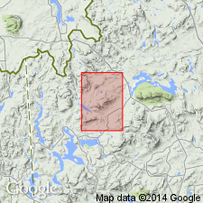
Type area identified. Age considered to be Tremadocian(?) (Early Ordovician(?)) or older. Considered to be a melange. The formation is named for Hurricane Mountain in the south-central part of the Pierce Pond 15-minute quadrangle in west-central Maine, where good outcrops exist. It is no more than 1500 meters thick, actually a tectonic thickness. The thickness is that of a composite section which includes Hurricane Mountain, the Brassua Lake lowland to the northeast, and Grand Falls of the Dead River to the southwest of Hurricane Mountain.
Source: GNU records (USGS DDS-6; Reston GNULEX).

- Usage in publication:
-
- Hurricane Mountain Formation*
- Modifications:
-
- Age modified
- Biostratigraphic dating
- Areal extent
- AAPG geologic province:
-
- New England province
Summary:
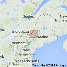
Hurricane Mountain Formation is mapped in Bronson Hill-Boundary Mountains anticlinorium and is geographically extended from western ME into NH in an area between Prospect Mountain and Bosebuck Mountain southwest to Diamond Ridge in Second Connecticut Lake 15-min quad, NH. An age of Cambrian(?) is assigned based on primitive sponges PROTOSPONGIA, sp., or DIAGONIELLA, sp. found in black slate by Harwood (1973) in the Cupsuptic, ME 15-min quad. R.M. Finks (oral commun., 1983) examined the fossils and determined a probable Cambrian(?) age, but he also noted that an Ordovician age is not completely ruled out. Contact with underlying Jim Pond Formation is generally sheared with parts of the Jim Pond incorporated in melange of Hurricane Mountain.
Source: GNU records (USGS DDS-6; Reston GNULEX).

- Usage in publication:
-
- Hurricane Mountain Formation*
- Modifications:
-
- Overview
- AAPG geologic province:
-
- New England province
Summary:
Used as Late Cambrian(?) Hurricane Mountain Formation. Consists of dark, rusty-weathering, siliceous, scaly slate or schist, with flaser structure and polymict fragments ranging in size from a few millimeters up to (in ME) several hundred meters. Considered a melange consisting of metasedimentary, felsic and mafic metavolcanic, and ultramafic rocks. Report includes geologic map, cross sections, correlation chart, and four 1:500,000-scale derivative maps.
Source: GNU records (USGS DDS-6; Reston GNULEX).
For more information, please contact Nancy Stamm, Geologic Names Committee Secretary.
Asterisk (*) indicates published by U.S. Geological Survey authors.
"No current usage" (†) implies that a name has been abandoned or has fallen into disuse. Former usage and, if known, replacement name given in parentheses ( ).
Slash (/) indicates name conflicts with nomenclatural guidelines (CSN, 1933; ACSN, 1961, 1970; NACSN, 1983, 2005, 2021). May be explained within brackets ([ ]).