

- Usage in publication:
-
- Hunting Hill Greenstone*
- Modifications:
-
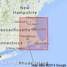
- Areal extent
- AAPG geologic province:
-
- New England province
Summary:
Blackstone Group and its four members, Sneech Pond Schist, Quinnville Quartzite, Mussey Brook Schist, and Hunting Hill Greenstone, are extended into eastern MA. A definite Proterozoic Z age is assigned because units are intruded by Proterozoic Z plutonic rocks and are more metamorphosed than nearby Cambrian Hoppin Formation.
Source: GNU records (USGS DDS-6; Reston GNULEX).

- Usage in publication:
-
- Hunting Hill Greenstone*
- Modifications:
-
- Overview
- AAPG geologic province:
-
- New England province
Summary:
Hunting Hill Greenstone included in unnamed amphibolite and greenstone unit within Blackstone Group of Proterozoic Z age.
Source: GNU records (USGS DDS-6; Reston GNULEX).
- Usage in publication:
-
- Hunting Hill Greenstone*
- Modifications:
-
- Overview
- AAPG geologic province:
-
- New England province
Summary:
Greenstone and amphibolite unit within Blackstone Group on State bedrock geologic map (Zen and others, 1983) was originally meant to include not only Hunting Hill Greenstone of Blackstone Group, but also amphibolite and other metavolcanic or metavolcaniclastic rocks of middle to high metamorphic grade in areas west and northwest of Blackstone type area. However, amphibolites in these areas could not be readily separated out from rest of Blackstone at scale 1:250,000, so they were included in the undivided Blackstone unit. Middlesex Fells Volcanic Complex and Hunting Hill Greenstone have similar lithologic descriptions and occupy similar stratigraphic positions and are therefore correlatives. Report includes geologic maps and correlation charts. [Chapters A-J in U.S. Geological Survey Professional Paper 1366 are intended as explanations and (or) revisions to 1:250,000-scale MA State bedrock geologic map of Zen and others (1983).]
Source: GNU records (USGS DDS-6; Reston GNULEX).
For more information, please contact Nancy Stamm, Geologic Names Committee Secretary.
Asterisk (*) indicates published by U.S. Geological Survey authors.
"No current usage" (†) implies that a name has been abandoned or has fallen into disuse. Former usage and, if known, replacement name given in parentheses ( ).
Slash (/) indicates name conflicts with nomenclatural guidelines (CSN, 1933; ACSN, 1961, 1970; NACSN, 1983, 2005, 2021). May be explained within brackets ([ ]).