

- Usage in publication:
-
- Hoosac schist*
- Modifications:
-
- Original reference
- Dominant lithology:
-
- Schist
- Gneiss
- AAPG geologic province:
-
- New England province
Summary:
Hoosac schist. Feldspathic mica schist or thin-bedded gneiss. Underlies Rowe schist and overlies Dalton phyllite in Green Mountains region, Massachusetts, and Becket gneiss in Hawley quadrangle, Massachusetts.
Source: US geologic names lexicon (USGS Bull. 896, p. 978-979).
- Usage in publication:
-
- Hoosac schist*
- Modifications:
-
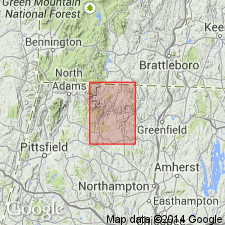
- Areal extent
- AAPG geologic province:
-
- New England province
Summary:
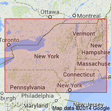
Geographically extended to VT from top of Hoosac Mountain, MA, for several miles into VT. Consists of albite schist. Underlies Rowe schist. In contact with Stockbridge limestone and Vermont formation in northwest MA. Age is Cambrian and Ordovician.
Source: GNU records (USGS DDS-6; Reston GNULEX).
- Usage in publication:
-
- Hoosac schist*
- Modifications:
-
- Areal extent
- AAPG geologic province:
-
- New England province
Summary:
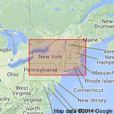
Geographically extended into CT.
Source: GNU records (USGS DDS-6; Reston GNULEX).
- Usage in publication:
-
- Hoosac schist*
- Modifications:
-
- Age modified
- AAPG geologic province:
-
- New England province
Summary:
Age changed to Early Cambrian(?) because authors, who have studied and mapped the formation, consider it to be [Early] Cambrian or older.
Source: US geologic names lexicon (USGS Bull. 896, p. 978-979).
- Usage in publication:
-
- Hoosac formation
- Modifications:
-
- Revised
- Age modified
- AAPG geologic province:
-
- New England province
Summary:
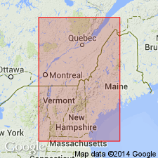
Hoosac is subdivided in southeast VT into Bull Hill member near its base, and Turkey Mountain and Plymouth members in its upper part. Age is Cambrian or Early Ordovician.
Source: GNU records (USGS DDS-6; Reston GNULEX).
- Usage in publication:
-
- Hoosac schist*
- Modifications:
-
- Age modified
- AAPG geologic province:
-
- New England province
Summary:
Hoosac age changed from Early Cambrian(?) to Early Cambrian because it more definitely correlates with other rocks of Early Cambrian age.
Source: GNU records (USGS DDS-6; Reston GNULEX).
- Usage in publication:
-
- Hoosac Formation*
- Modifications:
-
- Age modified
- AAPG geologic province:
-
- New England province
Summary:
Plate 2 of report shows Hoosac Formation as Cambrian(?).
Source: GNU records (USGS DDS-6; Reston GNULEX).
- Usage in publication:
-
- Hoosac Formation*
- Modifications:
-
- Age modified
- AAPG geologic province:
-
- New England province
Summary:
Age given as Early(?) Cambrian.
Source: GNU records (USGS DDS-6; Reston GNULEX).
- Usage in publication:
-
- Hoosac Formation*
- Modifications:
-
- Age modified
- AAPG geologic province:
-
- New England province
Summary:
Age given as Early Cambrian or older.
Source: GNU records (USGS DDS-6; Reston GNULEX).
- Usage in publication:
-
- Hoosac Formation*
- Modifications:
-
- Age modified
- AAPG geologic province:
-
- New England province
Summary:
Sherman Marble occurrences interbedded with albite schist outside the Sherman type locality (as shown by Skehan, 1961) are probably Proterozoic Z or Early Cambrian and may be regarded as correlatives of the Plymouth Member of the Hoosac Formation. This implies a change the in the overall age of the Hoosac.
Source: GNU records (USGS DDS-6; Reston GNULEX).

- Usage in publication:
-
- Hoosac Formation*
- Modifications:
-
- Overview
- AAPG geologic province:
-
- New England province
Summary:
Used as Hoosac Formation of Proterozoic Z and Early Cambrian age. Consists of one undivided unit and seven unnamed subdivisions, based on lithologic differences.
Source: GNU records (USGS DDS-6; Reston GNULEX).
- Usage in publication:
-
- Hoosac Schist*
- Modifications:
-
- Age modified
- AAPG geologic province:
-
- New England province
Summary:
Used as Hoosac Schist of Cambrian(?) age. [No explanation for age change given].
Source: GNU records (USGS DDS-6; Reston GNULEX).

- Usage in publication:
-
- Hoosac Formation*
- Modifications:
-
- Areal extent
- AAPG geologic province:
-
- New England province
Summary:
In Glens falls quad, rocks of eastern Green Mountain terrane, east of Richardson Memorial Contact (an eastward-facing unconformity or possibly a tectonic contact) include the Hoosac, Pinney Hollow, Ottauquechee, and Stowe Formations (of probable Cambrian through Early Ordovician age), Moretown Formation (probably Ordovician), and Barnard Volcanic Member of Missisquoi Formation [unclear as to its stratigraphic position or age here]. West of Richardson Memorial Contact, rocks include conglomeratic units such as Tyson Formation as used by Doll and others (1961) [no age provided, but presumably Cambrian].
Source: GNU records (USGS DDS-6; Reston GNULEX).
- Usage in publication:
-
- Hoosac Formation*
- Modifications:
-
- Age modified
- AAPG geologic province:
-
- New England province
Summary:
Age changed to Late Proterozoic and Early Cambrian.
Source: GNU records (USGS DDS-6; Reston GNULEX).
- Usage in publication:
-
- Hoosac Formation*
- Modifications:
-
- Revised
- AAPG geologic province:
-
- New England province
Summary:
Hoosac Formation includes informal Turkey Mountain metabasalt member, which occurs as discontinuous lenses in different stratigraphic positions over a stratigraphic distance of approximately 100 to 400 m above base of Hoosac. Upper contact with unnamed granofels member of Hoosac is marked by 0.5 to 5 m of quartzite or conglomerate; lower contact is with unnamed rusty muscovite-albite-biotite schist. Age of Hoosac is Late Proterozoic and Early Cambrian.
Source: GNU records (USGS DDS-6; Reston GNULEX).
- Usage in publication:
-
- Hoosac Formation*
- Modifications:
-
- Overview
- AAPG geologic province:
-
- New England province
Summary:
The Hoosac Formation in VT laterally replaces the Tyson Formation from north to south. Albitic schists and granofels of the Hoosac replace the dolostone and vitreous quartzite of the Tyson. In the transition area near the southern border of the Plymouth quadrangle, the Hoosac overlies the Tyson.
Source: GNU records (USGS DDS-6; Reston GNULEX).
- Usage in publication:
-
- Hoosac Formation*
- Modifications:
-
- Revised
- AAPG geologic province:
-
- New England province
Summary:
First revision is restriction of Tyson Formation and its replacement by Hoosac Formation in this quad. Cover rocks overlying basement of West River antiformal sheath fold (in hanging-wall of Ball Mountain thrust) consist of albitic schist locally containing pods of white dolomite and discontinuous basal beds of vitreous quartzite and interbedded dolomite as much as 15 m thick. These rocks were previously mapped as Tyson Formation by Doll and others (1961, State geologic map) and Karabinos (1984) and are now mapped as Hoosac Formation in this quad because of the presence of quartzite and dolomite locally contained within rusty albitic schist and granofels rocks typical of Hoosac. Similarly, cover rocks of Jamaica antiformal sheath fold consist of a 10-m-thick basal and quite continuous belt of dolomite marble that contains thin beds of vitreous quartzite. This unit was also mapped as Tyson by Doll and others (1961) and by Karabinos (1984) and is now mapped as Hoosac. Second revision is that Turkey Mountain Member is formalized as a member of Hoosac Formation to include all metabasalts within the formation. Exposed for a distance of 3 km northwest of Townshend. Consists of a collection of massive black amphibolite layers, 1 to 2 m thick, interlayered with epidotitic and quartz-rich, laminated greenstones. Total thickness of interbedded amphibolite and associated metasedimentary rock on Turkey Mountain is as much as 200 m. Termination of Turkey Mountain Member northward appears to result from thinning to the north although fault truncation along its lower contact cannot be ruled out. To the south, Turkey Mountain Member also appears to thin by interbedding with enclosing metasedimentary rocks, and pinches out north of Townshend. Where several layers in a limited region can be separately mapped, they are each referred to informally by use of subscripts in the letter symbol; this, however, does not imply correlation of numbered layers between different areas of the map.
Source: GNU records (USGS DDS-6; Reston GNULEX).
For more information, please contact Nancy Stamm, Geologic Names Committee Secretary.
Asterisk (*) indicates published by U.S. Geological Survey authors.
"No current usage" (†) implies that a name has been abandoned or has fallen into disuse. Former usage and, if known, replacement name given in parentheses ( ).
Slash (/) indicates name conflicts with nomenclatural guidelines (CSN, 1933; ACSN, 1961, 1970; NACSN, 1983, 2005, 2021). May be explained within brackets ([ ]).