

- Usage in publication:
-
- Hillsdale limestone [member]
- Modifications:
-
- Named
- Dominant lithology:
-
- Limestone
- Chert
- AAPG geologic province:
-
- Appalachian basin
Summary:
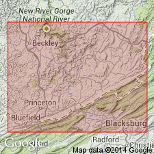
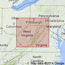
Named the Hillsdale limestone [member] of the Greenbrier limestone in southeastern WV and southwestern VA for Hillsdale, Monroe Co., WV. Consists of blue, hard limestone with marine fossils and black nodular chert. Basal part contains streaks of sandy shale and upper part is massive. Thickness is 50 to 150 feet. Overlies the Maccrady formation and underlies the Sinks Grove limestone [member] of the Greenbrier limestone. Unit is lowest member of Greenbrier. It was observed in Greenbrier and Mercer Cos. WV, and northward to Marlinton, Pocahontas Co., WV; also in Giles Co. The Hillsdale is of Mississippian age.
Source: GNU records (USGS DDS-6; Reston GNULEX).
- Usage in publication:
-
- Hillsdale Limestone
- Modifications:
-
- Revised
- AAPG geologic province:
-
- Appalachian basin
Summary:
Revised the Hillsdale to the Hillsdale Limestone of the Greenbrier Group in WV. On correlation chart it overlies the Maccrady Formation and underlies the Denmar Formation of the Greenbrier Group.
Source: GNU records (USGS DDS-6; Reston GNULEX).

- Usage in publication:
-
- Hillsdale Member
- Modifications:
-
- Overview
- AAPG geologic province:
-
- Appalachian basin
Summary:
In this report, Greenbrier Limestone divided into (ascending) Little Valley Limestone Member, St. Louis Limestone Member (Hillsdale Member of Reger, 1926), the "St. Genevieve" Limestone Member, and the Gasper Limestone Member. The St. Louis (or Hillsdale) consists of dark-gray to grayish-black cherty limestone. The chert is black, pale red, or gray and occurs as stringers or nodules. Contains fossils considered to be diagnostic of the Meramecian St. Louis Limestone of MO.
Source: GNU records (USGS DDS-6; Reston GNULEX).
For more information, please contact Nancy Stamm, Geologic Names Committee Secretary.
Asterisk (*) indicates published by U.S. Geological Survey authors.
"No current usage" (†) implies that a name has been abandoned or has fallen into disuse. Former usage and, if known, replacement name given in parentheses ( ).
Slash (/) indicates name conflicts with nomenclatural guidelines (CSN, 1933; ACSN, 1961, 1970; NACSN, 1983, 2005, 2021). May be explained within brackets ([ ]).